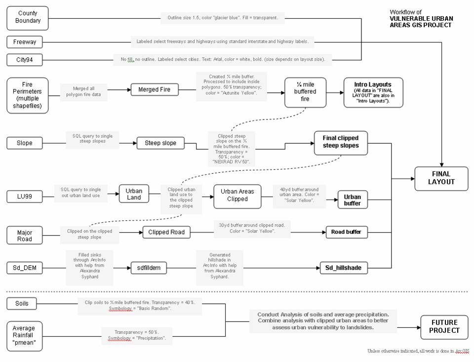
The following flow chart illustrates the GIS operation process for generating this landslide analysis.
Home | Research | Static Maps | Interactive Maps | GIS | Mobile GIS | About | Links
Last Updated: August 7, 2004
*Any media or persons are welcome to reproduce or redistribute these maps and information by acknowledging the map producers and the Department of Geography, San Diego State University.
Click to download the related PDF files:
The following flow chart illustrates the GIS operation process for generating this landslide analysis.