Unit 4.1
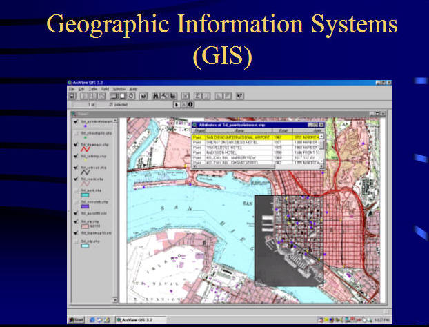
GIS Software.
Three key parts of GIS software systems:
- User Interface,
- Tools (Functions),
- Data Manager (Databases).
(Textbook: Ch 7, 8)
User Interface.
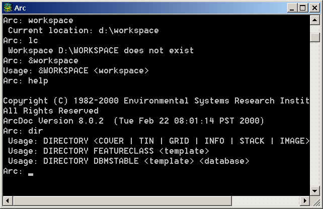
Command Lines
Command Mode: (ARC/INFO workstation)
Graphic User Interface (GUIs)
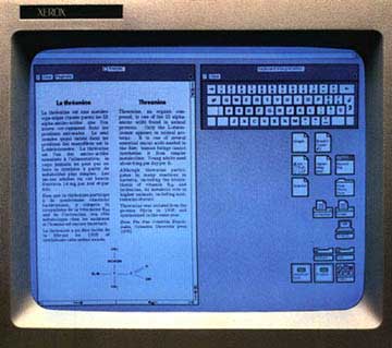
A Rich Neighbor Named Xerox:
http://www.folklore.org/StoryView.py?story=A_Rich_Neighbor_Named_Xerox.txt
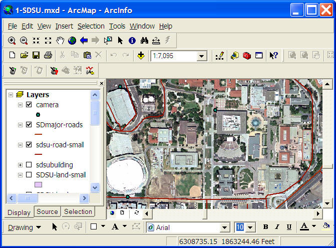
(ArcGIS 9.1 ArcMap Example)
Innovative Mapping User Interfaces
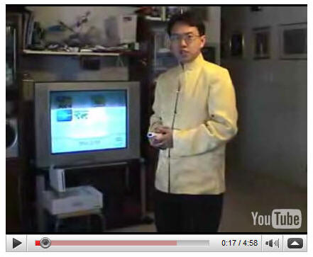
Wii Virtual Globe Demo
A virtual Globe demo in Nintendo Wii by Dr. Ming-Hsiang Tsou.
YouTube: http://youtube.com/watch?v=nzRVcCLJOxc
Click here to download this video!
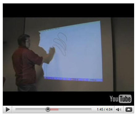
Wiimote Whiteboard project
This project/application was created by Johnny Chung Lee when he was a Ph.D. student in Carnegie Mellon University.
http://www.cs.cmu.edu/~johnny/projects/wii/
http://www.youtube.com/watch?v=5s5EvhHy7eQ&eurl
How to create an IR Pen?
http://www.kenmooredesign.com/2008/11/how-to-make-infrared-led-light-pen-for.html
Revised whiteboard program for Vista 64 platform: Smoothboard:
http://www.boonjin.com/wp/2008/08/14/wiimote-smoothboard-045-beta
(Excellent revision of the original program. Perfect for Google Earth application)
A very good painting tool: ArtRage (free starter edition): http://www.artrage.com/
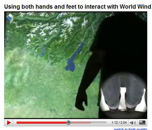
Wii Fit and NASA Wolrd Wind
(using Wii FIT scale).http://www.youtube.com/user/SchoeningJohannes
XBox Kinect
http://www.youtube.com/watch?v=dc13yY6m3J4
http://www.youtube.com/watch?v=9i8-Cg2Ny2o
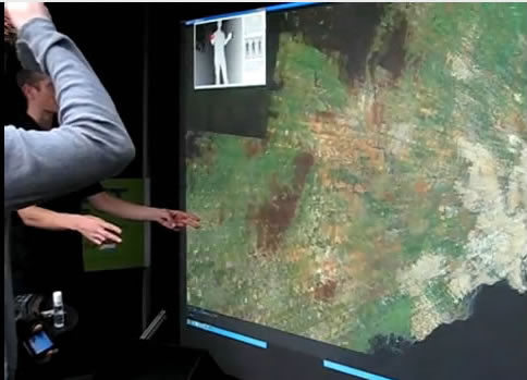
Direct Manipulation User Interface. (Touch table)
http://www.youtube.com/watch?v=X2pPeW4cUgU
http://www.youtube.com/watch?v=W3dz2xpCJVU&feature=related
(Show the 2004 ESRI conference move and the 2005 3D Terrain Mapping Table movie)
UI from Minority Report?
http://www.youtube.com/watch?v=jtt2Xe2y0FI

Question: Have you ever used any computer software? Please tell us your experiences in using these software. (Microsoft Word? Powerpoint? Windows Live Messenger? Google Talk?)
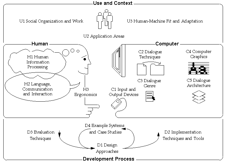
Human Computer Interaction (HCI) and
User Interface Design
![]()
What is Human Computer Interaction (HCI)?
Human-computer interaction is a discipline concerned with the design, evaluation and implementation of interactive computing systems for human use and with the study of major phenomena surrounding them.
(source: Curricula for Human-Computer Interaction (ACM SIG CHI) http://www.acm.org/sigchi/cdg/cdg2.html#2_1 )
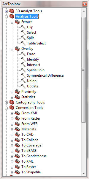
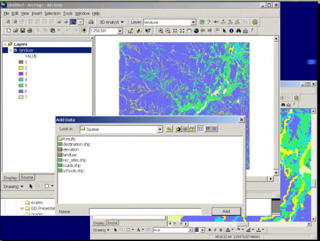
Tools (functions).
ArcGIS 10 Desktop Toolbox: Data Analysis, Data Conversion, Data Interoperability, Data Management, Editing, Geocoding, Geostatistical Analysis, 3D Analysis, Linear Referencing, Multidimension, Network Analysis, Parcel Fabric, Schematics, Spatial Analysis, Spatial Statistics, and Tracking Analysis.
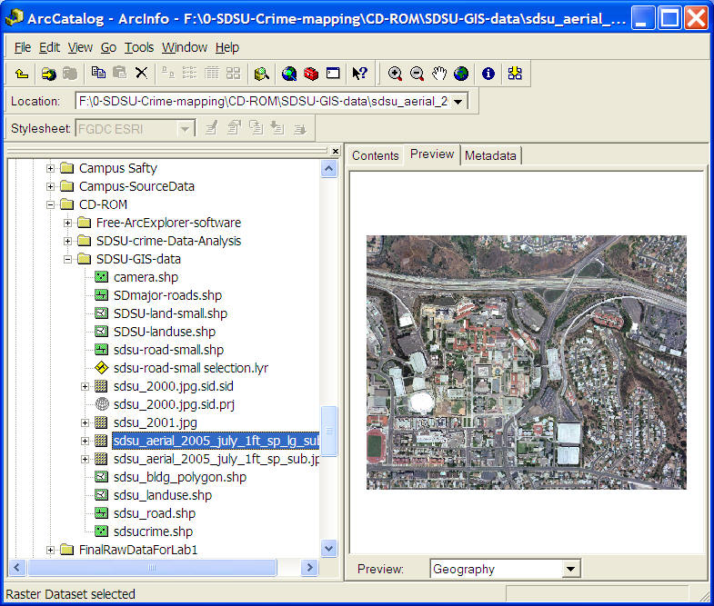
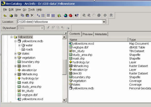
The Data Manager (Databases).
(ArcGIS 9.1-- ArcCatalog).
Major functions of GIS software:
collecting, storing, managing, querying, analyzing and presenting geographic information (textbook p.158).
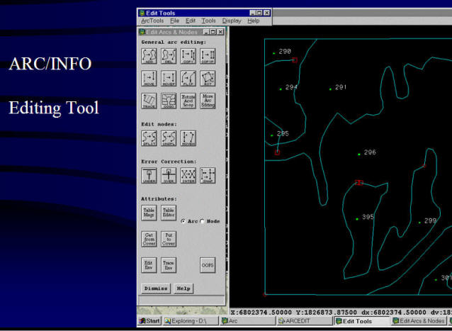
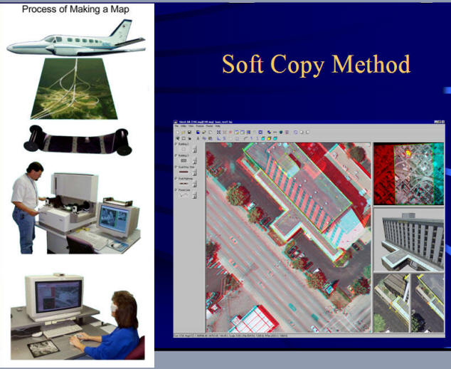
Collecting data: Digitizing, scanning, and editing Data.
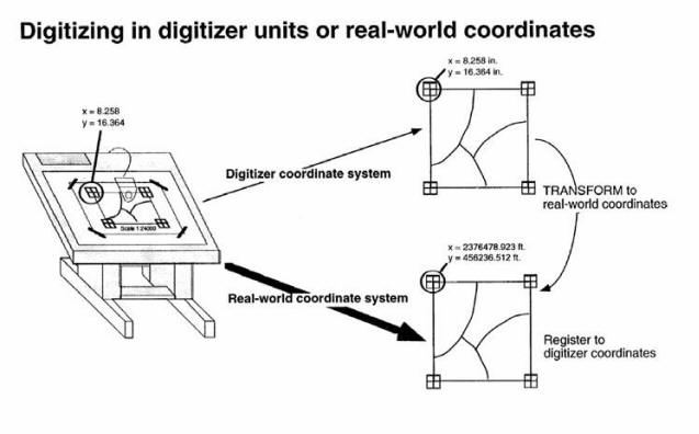
(Image source: ESRI lecture notes).
Editing in ArcGIS 10 http://www.youtube.com/watch?v=g8WqYpJUG2k&feature=related
Example of Softcopy
OpenStreetMap is built by GPS tracing and Softwcopy.
Geospatial Revolution Episode 1 & Chapter 4: http://www.youtube.com/watch?v=gxCEb5Cv4Nk&feature=player_embedded
Storing data: create a data file or a database (e.g. Shapefile, Geodatabase, ArcSDE)
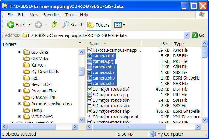
e.g., ESRI Shapfiles: http://en.wikipedia.org/wiki/Shapefile
Shapefile (!!!!) is comprised of .dbf, .prj, .sbn. .sbx .shp .shx
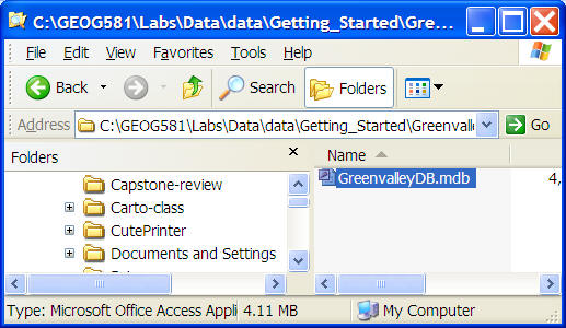
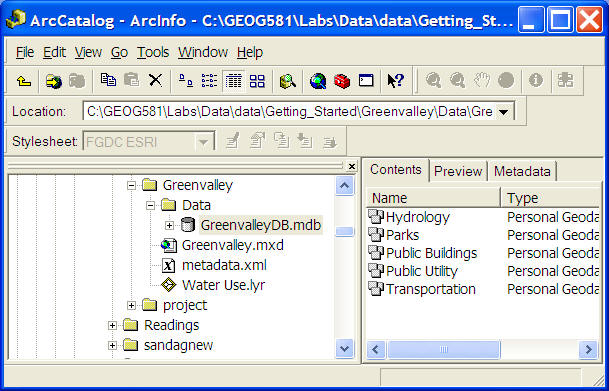
Personal Geodatabase: Microsoft Access
(MDB file -- One database --> one file --> multiple data sets)
Database: an integrated set of data on a particular subject
Geographic (Spatial) Database: Database containing geographic data of a particular subject for a particular area (geospatial features)
http://www.youtube.com/watch?v=uDwLb3aIG7E
http://en.wikipedia.org/wiki/Geodatabase
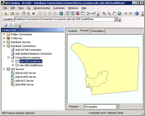
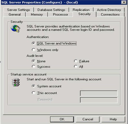
ArcSDE: Middleware to link between GIS software and Traditional Database Management Systems (MS SQL server, IBM DB2, Oracle Database, etc.)
http://en.wikipedia.org/wiki/ArcSDE
Database Management System (DBMS): Software applicatoin designed to create, maintain and access databases (efficient storage and access).
Oracle Commercial: http://www.youtube.com/watch?v=4qzFFBff34g
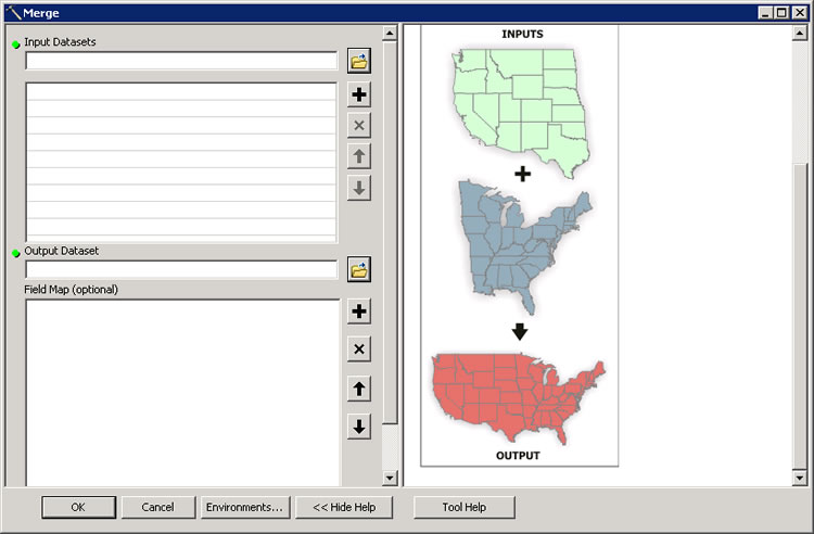
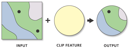
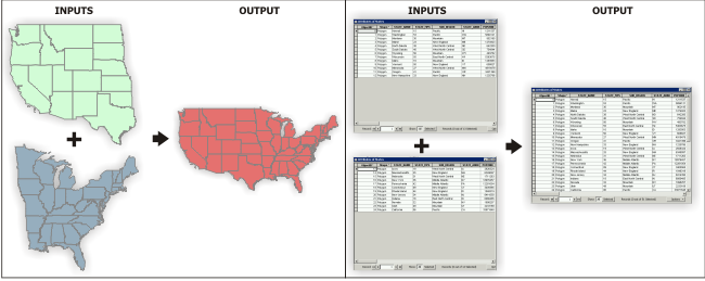
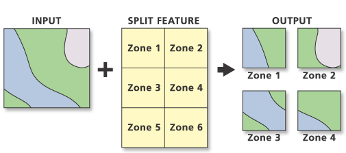
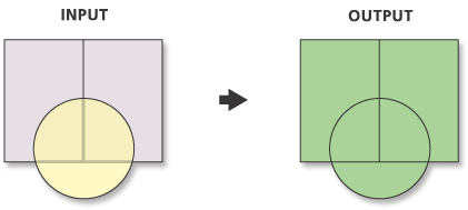
Managing spatial data: update, convert, merge data
Merge Polygons ArcGIS: http://www.youtube.com/watch?v=kymtYPNv2gU
Clip: http://help.arcgis.com/en/arcgisdesktop/10.0/help/index.html#
//000800000004000000.htm
Merge: http://help.arcgis.com/en/arcgisdesktop/10.0/help/index.html#//001700000055000000
Split: http://help.arcgis.com/en/arcgisdesktop/10.0/help/index.html#//000800000006000000.htm
Union: http://help.arcgis.com/en/arcgisdesktop/10.0/help/index.html#//00080000000s000000.htm
Query data:
Spatial query and Attribute query
Querying Data in ArcGIS Desktop: http://www.youtube.com/watch?v=xiR7bn9KfrE
SQL (Structured Query Language): a programming language designe for managing data (http://en.wikipedia.org/wiki/Sql)
Attribute Query:
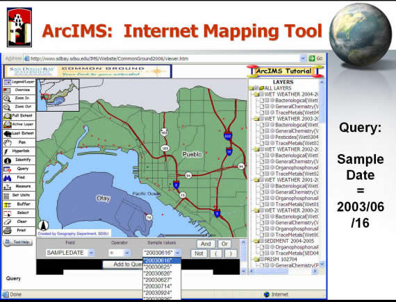
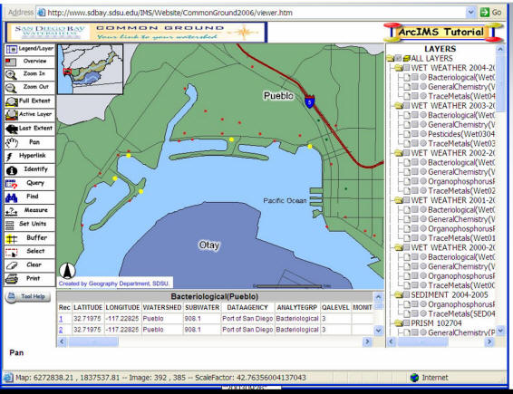
Spatial Query:
- Which hospital is located in suburban areas of the San Diego County?
- Which elementary school is located in La Mesa?
- Which coffee shops are located within 1 mile from SDSU campus?
Analyze data and Presenting data: maps or graphics.
Analysis in ArcGIS 10 http://www.youtube.com/watch?v=Hd13H0XO0LU&feature=related
GIS Software distribution types:
- COTS: Commercial-off-the-shelf software.
- Shareware: Intended for sale after a trial period.
- Liteware: shareware with some capabilites disabled
- Freeware: Free software but with copyright restiriction
- Public domain software: Free with no restrictions
- Open source software: the source code is provided and users agree not to limit the distribution of improvements
Commercial products
- ESRI: http://www.esri.com (ArcView, ArcGIS)
- Intergraph Inc.: http://www.intergraph.com (GeoMedia, MicroStation)
- Autodesk Inc. : http://www.autodesk.com (AutoCAD, MapGuide)
- GE Energy (SmallWorld): http://www.gepower.com/prod_serv/index.htm (SmallWorld)
- MapInfo: http://www.mapinfo.com/ (MapInfo).
Shareware (http://en.wikipedia.org/wiki/Shareware)
- Examples: http://www.agismap.com/
- ESRI student evaluation version of ArcGIS: Trial for 1 year for student.
Freeware
Open source software
- QGIS: http://www.qgis.org/
- GRASS http://grass.itc.it/index.php
- Resource: http://opensourcegis.org/
- GeoServer: http://geoserver.org/
History of GIS
Geospatial Revolution Episode 1 Ch. 3: http://geospatialrevolution.psu.edu/episode1/chapter3
SYMAP: https://www.youtube.com/watch?v=5oJIBEvut38&t=262s
Roger Tomlinson: http://www.esri.com/esri-news/arcnews/spring14articles/roger-tomlinson-geographer (The Father of GIS).
https://www.youtube.com/watch?v=eAFG6aQTwPk&list=PLA8EDA53CDAE79FA6&index=4&t=0s
Decades |
Features |
Milestones |
The 1960s |
Operational GIS with loosely coupled computer routines |
The Canadian Geographic Information System (CGIS) (Roger Tomlinson) The Harvard Laboratory for Computer Graphics and Spatial Analysis, 1965. SYMAP (Synagraphic Mapping System 1966), The establishment of ESRI by Jack Dangermond, 1969 |
The 1970s |
GIS with standard user interface and the development of commercial products |
SYMAP POLYVRT and ODYSSEY implemented (computer mapping and analysis packages) |
The 1980s |
Development of commercial GIS software; Command line user interactions |
The release of Arc/Info, 1981 MapInfo, founded in 1986 |
The 1990s |
Growing GIS markets with several dominating vendors; Graphic User Interfaces; GIS software for specific applications; Customizable software development based on object-oriented programming; Spatial database |
A series of ESRI products (ArcSDE), MapInfo, Intergraph MGE |
The 2000s |
Internet GIS with distributed Web Services; GIServices; Interoperability issue; Open source GIS |
Geography network by ESRI; Open GIS Consortium standards widely adopted |
Making Maps with a Typewriter
http://makingmaps.wordpress.com/2007/09/12/making-maps-with-a-typewriter/
The Architecture of GIS:
Three Tier Architecture
- Presentation (user interface),
- Logic (tools - middleware)
- Data server (data management)
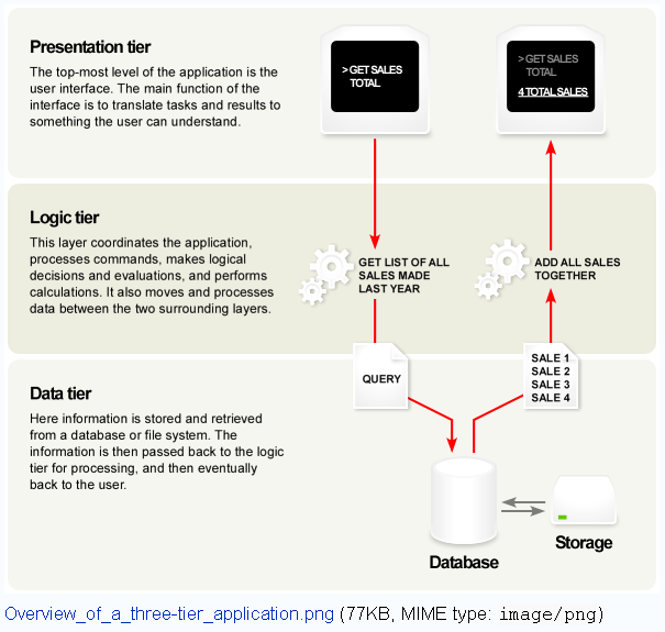
( http://en.wikipedia.org/wiki/Image:Overview_of_a_three-tier_application.png )
(Image from Peng and Tsou, 2003, Internet GIS).
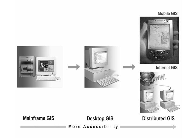
Main Frame GIS: 1970s, 1980s
Desktop GIS: 1990s.
Internet GIS: 2000s
Mobile GIS: 2000s
Why 2000s?
GIS Software Customization.
Standard programming languages are adopted (Java, C++, Visual Basic, and python).
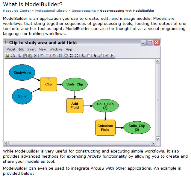
ArcGIS Model Builder (Visual Programming / Modeling Tool)
ModelBuilder is an application you use to create, edit, and manage models (workflows).
http://help.arcgis.com/en/arcgisdesktop/10.0/help/index.html#//002w00000001000000
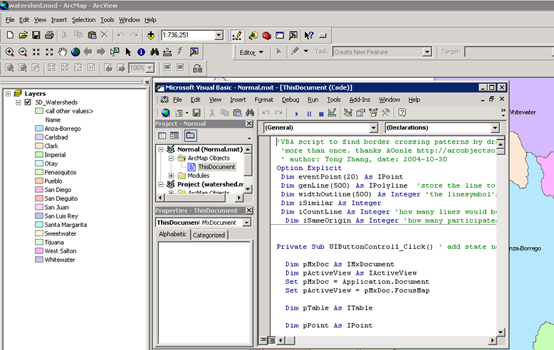
ArcGIS (VBA: Visual Basic for Applications)
Java: Integrated Development Environments (IDEs)
API: Application Programming Interfaces. --> ArcGIS Server API and Google API
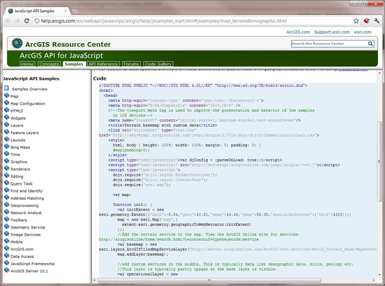
ArcGIS API for Javascript ( http://help.arcgis.com/en/webapi/javascript/arcgis/)
Python !!!!!!!
ArcGIS Python http://www.esri.com/news/arcuser/0405/files/python.pdf
ArcPy: http://help.arcgis.com/en/arcgisdesktop/10.0/help/index.html#//000v00000001000000
Strategies of Building GISystems
Commercial products vs. open source tools .
Geotools: http://geotools.codehaus.org/ http://en.wikipedia.org/wiki/GeoTools
GeoTools is an open source Java code library which provides standards compliant methods for the manipulation of geospatial data.
PostGIS: http://postgis.refractions.net/
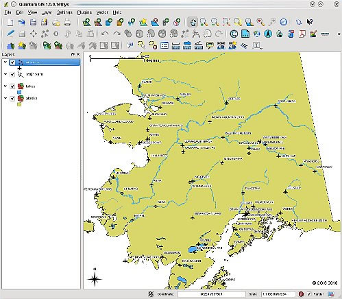
Quantum GIS: http://www.qgis.org/
Video for Introduction to QGIS: http://www.youtube.com/watch?v=K2iJFeyHnvA
More OpenSource GIS tools: http://opensourcegis.org/
Discuss:
Which types of GIS platforms you prefer? Discuss with costs, training, administration, reliability, scalability, robustness and availability between commercial GIS vs. opensource GIS.
GIS Software Types:
- Desktop GIS (ArcView, ArcInfo)
- Server GIS (ArcGIS Server, ArcIMS -- Internet Map Server)
- Developer GIS (GeoTools, ArcObjects, MapObjects, ArcGIS Engine)
- Hand-held GIS (ArcPAD)
- GIS Database Middleware and Extensions (ArcSDE, PostGIS)
Unit 4.2
Geographic Data Modeling
Data model:
"A data model is a set of constructs for describing and representing parts of the real world in a digital computer system." (textbook, p. 177).
Why data model is important? Different data model --> different spatial analysis capabilities.
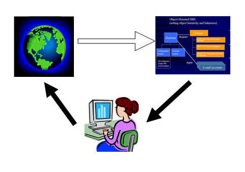
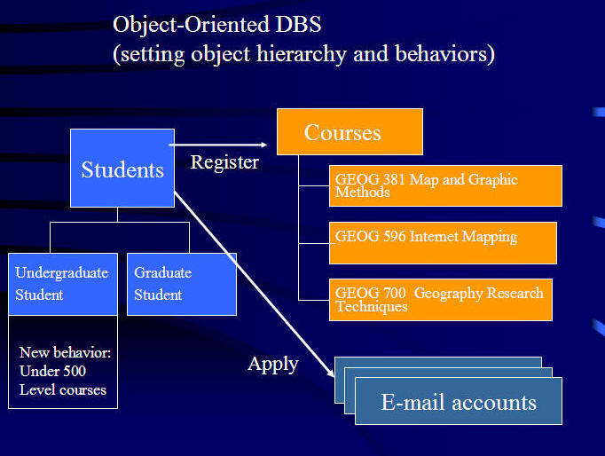
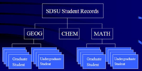
Example of Data model: SDSU Student Information.
Object-Oriented Model:
http://en.wikipedia.org/wiki/Object-oriented_programming
http://www.apl.jhu.edu/~jcstaff/oodev/oointro/models/sld010.htm
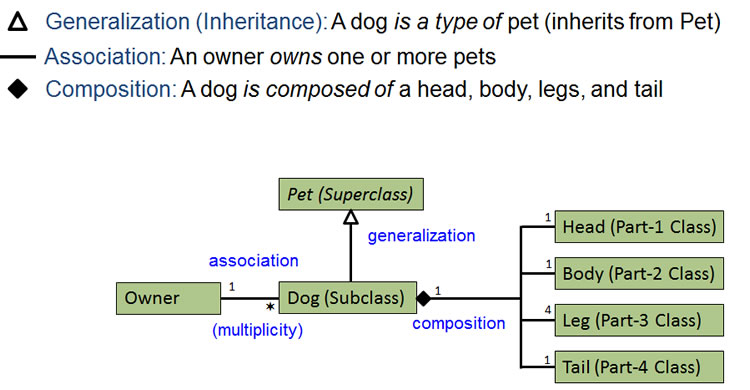
UML and the design of diagrams.
http://en.wikipedia.org/wiki/Unified_Modeling_Language
http://en.wikipedia.org/wiki/Class_diagram
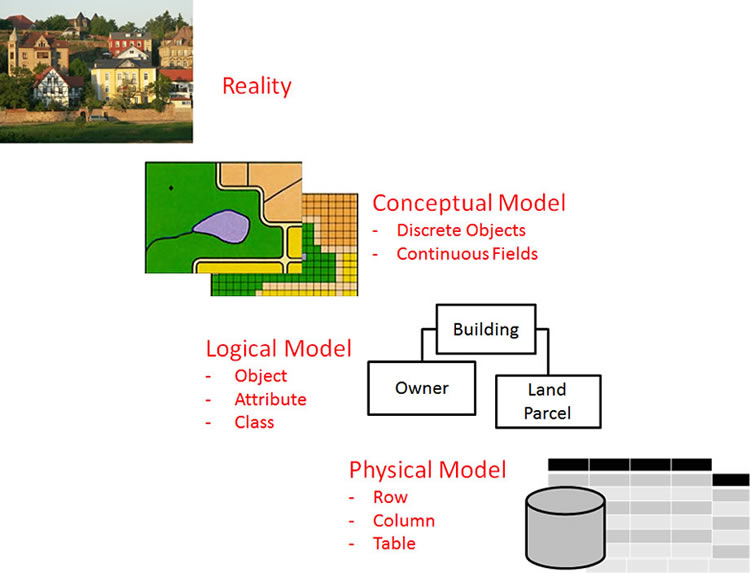
Four Levels of Data Model Abstraction :
Reality – Conceptual model – Logical model – Physical model.
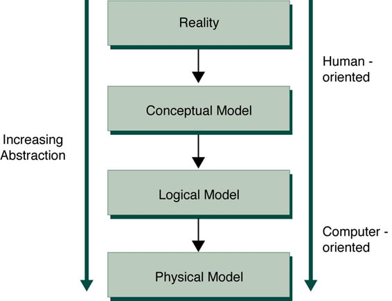
Conceptual Model: Define objects, types of objects. Discrete object vs. Continuous fields?
Logical Model: Create Diagrams and list desribing the properties of objects, their behavior, the type of relationships.
Physical Model: Define database schema
(Zeiler, 1999, Modeling Our World, p.17)
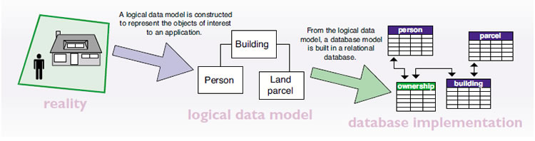
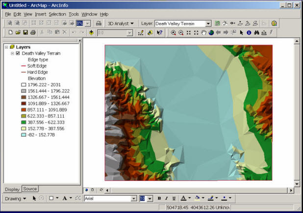
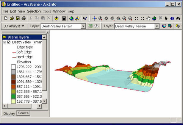
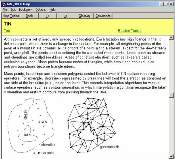
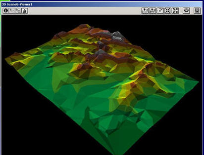
Example: Modeling Terrain
Real World:
Conceptual Model: Continuous Field
Digital Elevation Model (DEM)
Logical Model:
TIN

Physical Model: Data Schema.
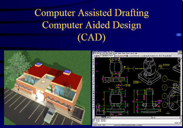
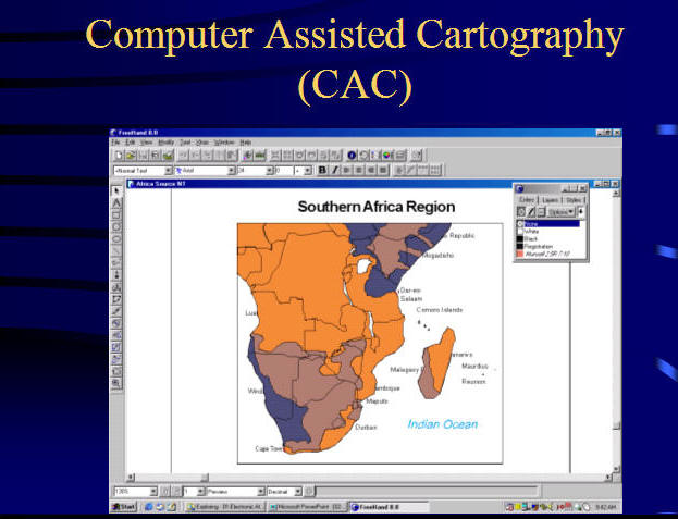
The Comparison between CAD, Graphical, and GIS Data Models:
Traditional CAD
(Computerized Aided Design or Computer Assisted Drafting) Data Model.
- No Topological relationship.
- Fast drawing.
- Good 3D functions
GIS and CAD overlap in highly accurate mapping tasks like surveying and civil engineering
Graphic Design Tools
(Freehand, Canvas, Painter). (No Databases or Attributes for graphic elements (points, lines, polygons). Purely presentation purpose. No query functions.
GIS Data Model
Connecting Attributes and Graphic elements, include topology relationships. Very large size of data and very complicated drawing procedures (multiple map layers).
Discussion: Why CAD (Computer-aided Design) is not suited for describing geographic information ?
(Coordinates, identification, no topology, Spatial Analysis Function)
[E-Business with GIS] Movie
GIS Data Format More Concepts:
Review: What are two types of GIS Data Formats?
A. Raster Data Model
File Compression
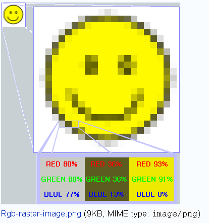
(http://en.wikipedia.org/wiki/Image:Rgb-raster-image.png)
Encoding Method:
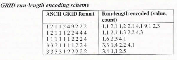
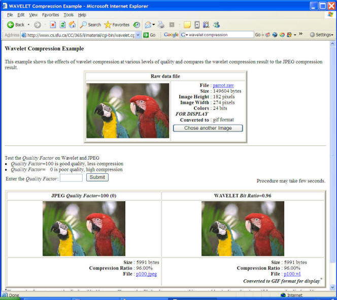
Use compression technologies; wavelet compression techniques (MrSID, ECW)
http://en.wikipedia.org/wiki/Wavelet_compression .
http://www.cs.sfu.ca/CC/365/li/material/misc/wavelet.html
Size of Images
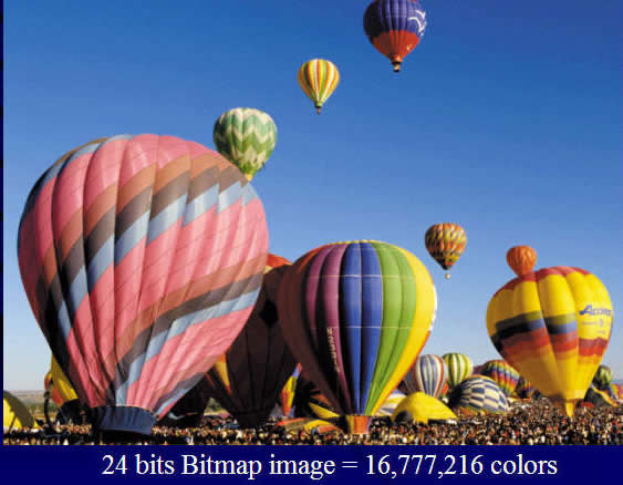
How many bands (Layers)? What's the storage size for each pixel? (2 bits?, 8 bits (One byte)? 24 bits (3 bytes)?
(Four Bands -- First-Blue, Second-Green, Three (not used), Four-RED).
The size of each pixel
Images size: 24MB
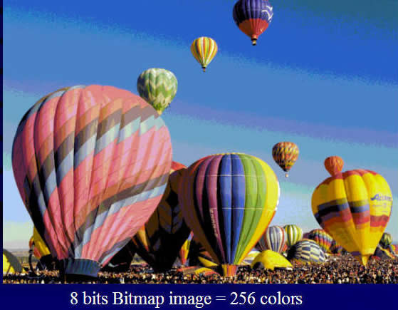
Image size: 8MB
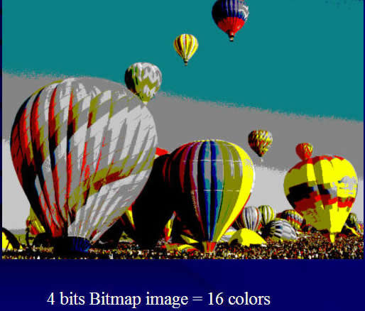
Image size: 4MB
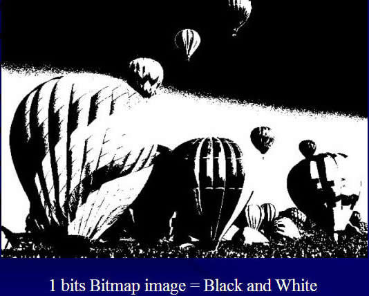
Image size: 1MB
Discussions: What are the advantages and disadvantages of raster data models?
B. Vector Data Model
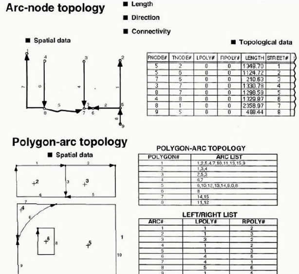
Topology:
Vector model = simple features + topological relations.
Features are vector objects of type point, polyline, or polygon. (p. 184),
Topology is the science and mathematics of relationships used to validate the geometry of vector entities, and for operations such as network tracing and tests of polygon adjacency. (p. 184)
Discussion: Why do we need topology?
ESRI ARC/INFO Topology
Topology: Science and mathmatics of geometric relationships
(Image from ESRI lecture notes)
(http://www.sli.unimelb.edu.au/gisweb/GISModule/GIST_Vector.htm)
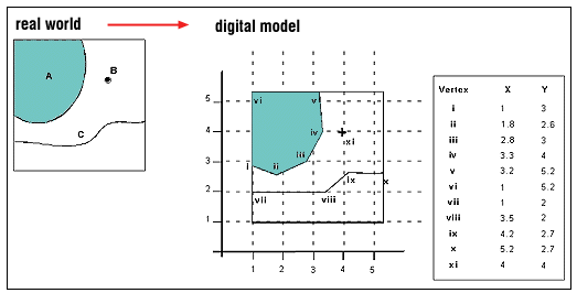
Vertex: any point on the polygon where two sides (line segments) meet or connect.
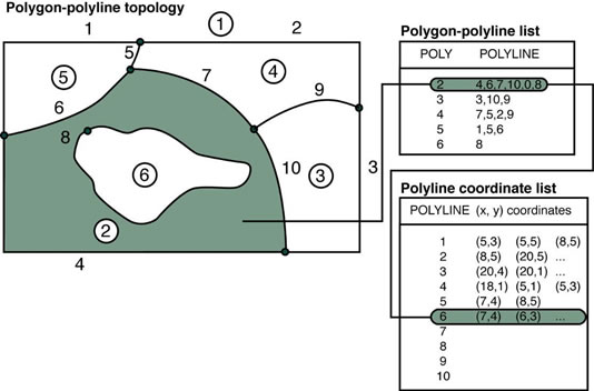
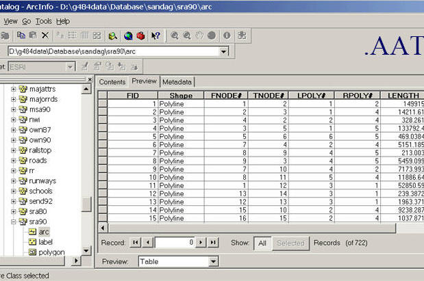
###.AAT (Arc Attribute Table)
Examples of Vector Data Models:
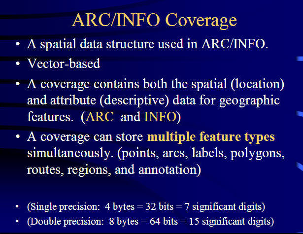
Arc/INFO Coverage Data Model
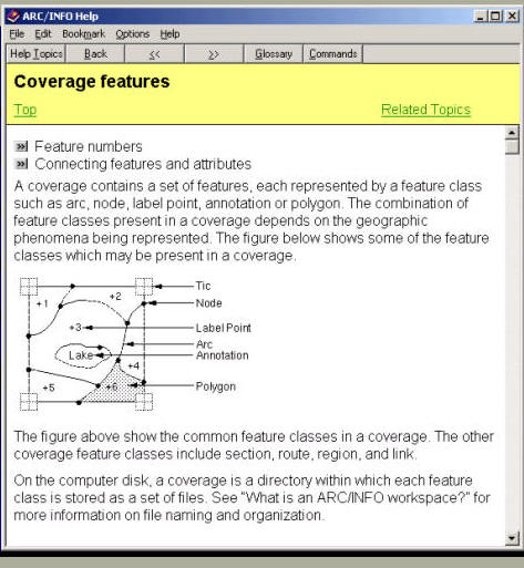
http://help.arcgis.com/en/arcgisdesktop/10.0/help/index.html#
/Topology_basics/006200000002000000/
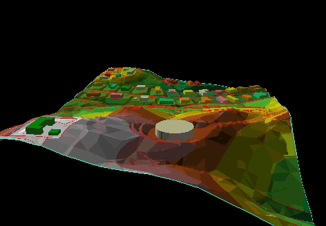
TIN Data Model
Triangulated Irregular Networks (TINs)
- TIN is used to create, store, analyze and display surface information.
- Points are connected with their two nearest neighbor points
- Comprised of points with x,y,z values
- Series of edges that join the points to form triangles.
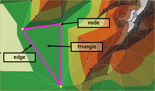
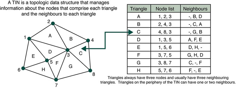
Images from ESRI ARC/INFO help file.
TIN Data Model Advantages:
- Compact Data format (save disk space).
- Consisting of irregular nodes and lines;
- Accurately describing the relief;
- Topological vector structure;
- Flexible and efficient in terms of storage space;
More information about TINs:
http://www.ian-ko.com/resources/triangulated_irregular_network.htm
Object Oriented Data Model (!!!!):
Shapefile vs. Coverage (Topology) vs. Geodatabase (OODM)
Try to mimic and simiplify the real world
- Define a class
- Define attributes of a class
- Define behaviors(also called as methods and functions) of a class
- Define Relationships
- Create Instances
Important concepts of OODM
- Classification & Hierarchy
- Inheritance
- Encapsulation (Information hiding)
- Polymorphism
Class: A template to create "Instance" of itself.
Instance: A copy of a class (also called as an Object).
Creating an object is also known as instantiation.

cookie cutter vs. cookies
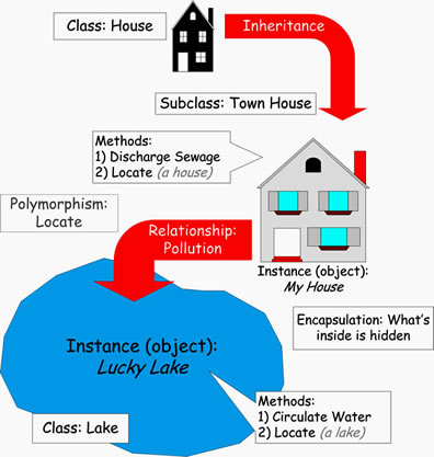
e.g. Water Distribution System
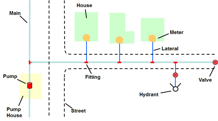
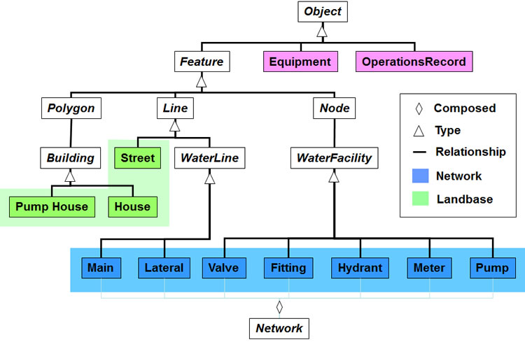
source: textbook
More resource:
!!! Youtube Video: http://www.youtube.com/watch?v=hX1Q9wQ5QMk !!!
http://java.sun.com/docs/books/tutorial/java/concepts/object.html
UML: Unified Modeling Language.
http://www.smartdraw.com/resources/tutorials/uml-diagrams/
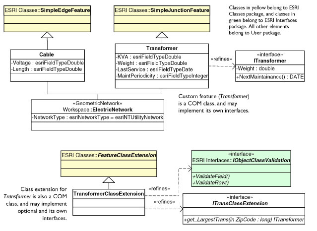
Source: http://edndoc.esri.com/arcobjects/9.1/ExtendingArcObjects/Appendices/UMLAndCASE.htm
Discussion:
Give ONE examples of objects and their attributes.
What are the advantages of object model?
What is a “class” and what is a “rule”?
(Attribute rules, connectivity rules, relationship rules and geographic rules)
Relational Database?
Object-Oriented GIS data model ? (Not really. Most of current GIS databases are still [Relational Database]. Shapefile vs. Geodatabase
Hybrid GIS Data Model (Relational + OO)
Unit 4: In-Class Discussion
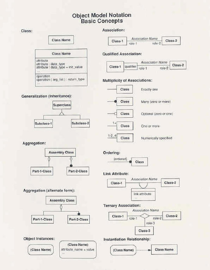
Please create and define THREE "related" Data Objects by following the rules of Object-Oriented Modeling and explain the three Objects' attributes, behaviors, and their relationships. (All three objects must be related to each other). Draw a diagram of the three objects by following the [Object Model Notation]. Use the following file: OODM_2012.pptx
