Unit 3.1
The Network of Geospatial Information
Spatial Webs (or Geospatial Cyberinfrastructure):
What is Spatial Webs? Spatial webs are geographically dispersed
information communities actively sharing geospatial data. (NCGIA, Specialist Meeting report: http://www.ncgia.ucsb.edu/projects/nga/docs/final_report.pdf )
The topics of spatial webs include data and service interoperability, distributed data sources, distributed services, data integration, spatial support, etc.
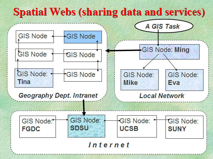
Internet has dramatically changed GIS.
Internet can provide new data (Data warehouses, data clearning houses, data archive centers, data portals, etc.).
Internet can provide new services for different users (Web services, on-line mapping tools, on-line analytical tools, etc.).
Internet can provide new media (Web pages, Messenger, Blogs, etc.) for the dissemination of Geographic Information and GIS project managements.
Internet can provide a new cyberinfrastructure for the next generation of GIS.
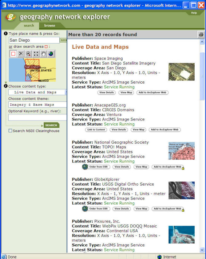
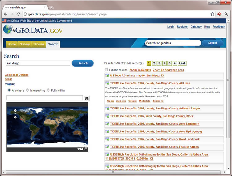
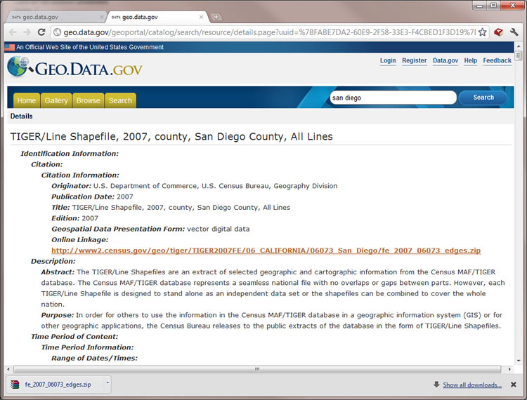
GeoData Network:
ESRI Geography Network (Retired): http://www.geographynetwork.com/
U.S. Federal Government GIS data portal (http://geo.data.gov/geoportal/)
GIS Service Network:
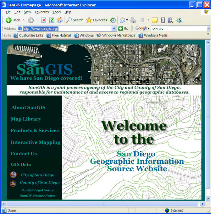
SANGIS http://www.sangis.org/
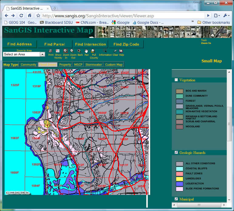
SanGIS Internactive Map ( http://files.sangis.org/interactive/viewer/viewer.asp )
Buying a house in San Diego? Make sure to check if the house location is within any potential natural hazard zones.
Media for Geographic Information.
What kinds of new media are available on the Internet today?
- Web Blogs (http://www.blogger.com/start, http://bigthink.com/blogs/strange-maps)
- YouTube (http://www.youtube.com/,
http://www.youtube.com/watch?feature=player_embedded&v=GXnBy3Iz1u4
http://www.youtube.com/watch?feature=player_detailpage&v=LiWu5A3Ca0Q
http://www.youtube.com/watch?v=6XYPU5_KVl4&feature=related
http://www.youtube.com/watch?v=euEUKlj0fmI&mode=related&search=)
- Podcasting (http://en.wikipedia.org/wiki/Podcasting,
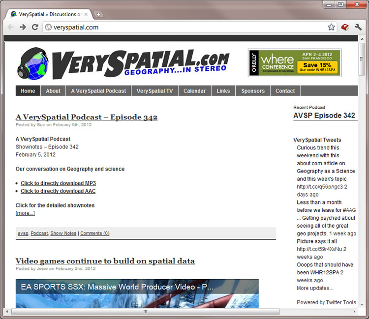
http://veryspatial.com/ ) - Social Networking (Facebook and Twitter) (http://www.facebook.com/home.php?
http://www.facebook.com/about/location
Examples:
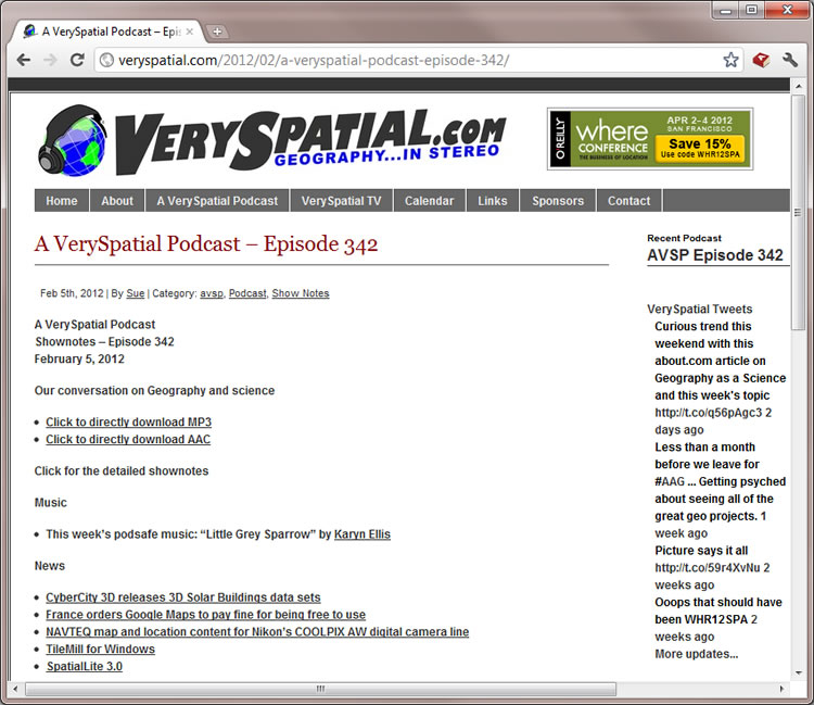
Very Spatial Website (PodCast and Blog):
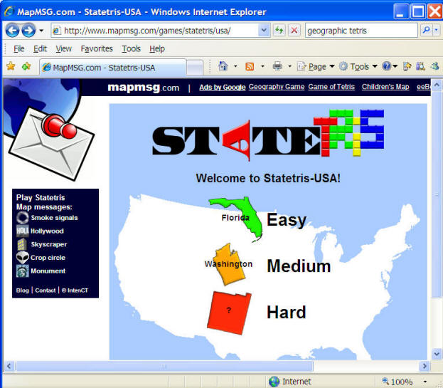
MAPMSG.com StateTRIS Game.
http://www.mapmsg.com/games/statetris/usa/
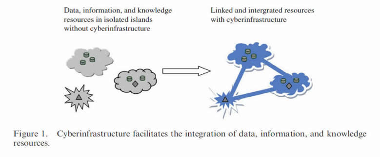
Cyber-infrastructure.
What is the term, "cyber-infrastructure"? http://en.wikipedia.org/wiki/Cyberinfrastructure
The term describes the new research environments that support advanced data acquisition, data storage, data management, data integration, data mining, data visualization and other computing and information processing services over the Internet. (definition from the Wikipedia).
Cyberinfrastructure is the coordinated aggregate of software, hardware and other technologies, as well as human expertise, required to support current and future discoveries in science and engineering. (Fran Berman, San Diego Supercomputer Center and UC San Diego, 2005. http://vis.sdsc.edu/sbe/ )
Geospatial cyberinfrastructure is a combination of distributed geographic information processing technology, high-performance computing (HPC) resources, interoperable Web services, and sharable geographic knowledge to facilitate the advancement of geographic information science (GIScience), geospatial technology, and geographic education.
(Zhang, Tong and Tsou, Ming-Hsiang(2009)'Developing a grid-enabled spatial Web portal for Internet GIServices and geospatial cyberinfrastructure',International Journal of Geographical Information Science,23:5,605 — 630).
What is the term, "Mash-up"?
What is a Mash-up Web applications?
http://en.wikipedia.org/wiki/Mashup_(web_application_hybrid)
In web development, a mashup is a web application that combines data from more than one source into a single integrated tool; an example is the use of cartographic data from Google Maps to add location information to real-estate data, thereby creating a new and distinct web service that was not originally provided by either source. (source: http://en.wikipedia.org/wiki/Mashup_(web_application_hybrid) ).
Mash-up is a key concept for Web 2.0. (What is Web 2.0?)
For more information about Internet GIS
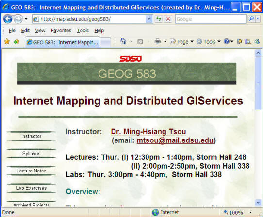
"Internet GIS" Book Web site: Http://map.sdsu.edu/gisbook
Link to GEOG 583 Internet Mapping and Distributed GIServices (every Spring semester).
Internet GIS Applications.
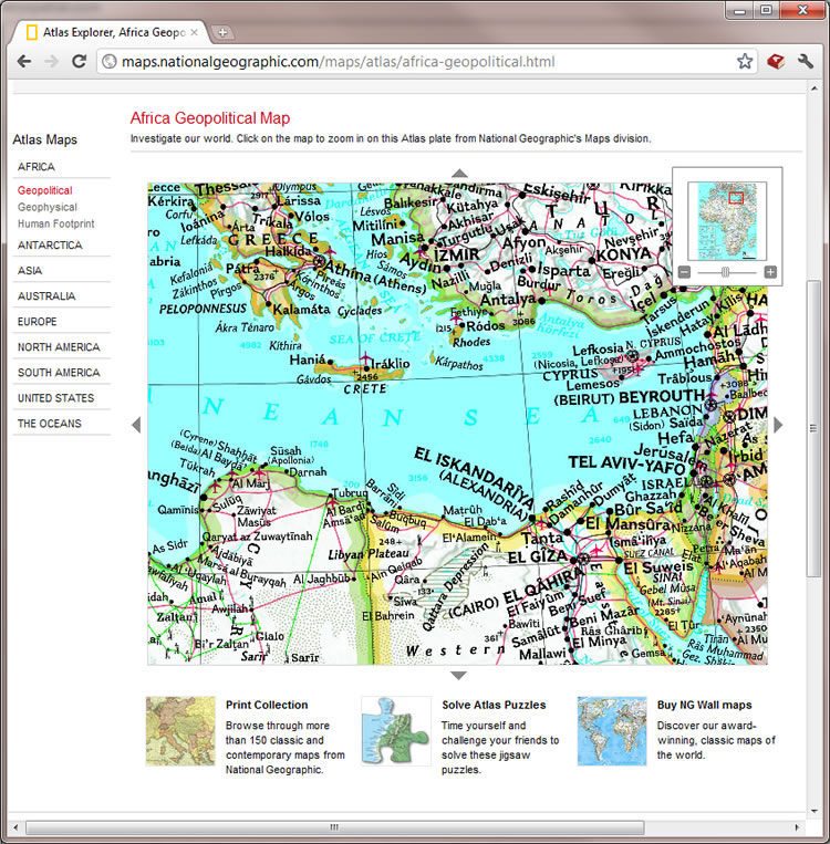
National Geographic Map (http://www.nationalgeographic.com/maps/)
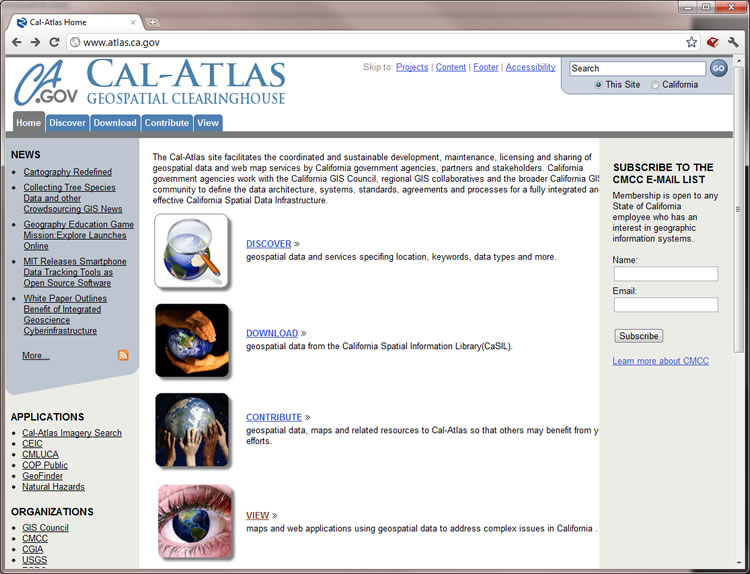
CAL-Atlas (http://www.atlas.ca.gov/)
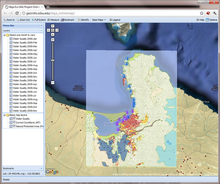
Baja Eco Info project: The GeoMashup Web Mapping Tool (http://geoinfo.sdsu.edu/baja/)
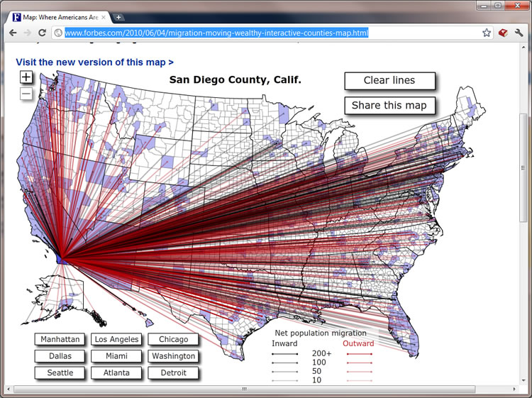
Forbes migration interactive map: ( http://www.forbes.com/2010/06/04/migration-moving-wealthy-interactive-counties-map.html)
Unit 3.2
Georeference and Map Projection
What is Georeferencing ?
Georeferencing is the process of specifying locations of objects on the Earth's surface by one or multiple reference methods. (This definition is modified from the textbook). Georeference, geolocate, and geocode are commonly used to describe the act of assigning locations of infomration.
(example: locating your position now in this classroom. rows, columns)
Keywords: Locations, Objects, Reference methods.
- Location information is very unique.
- Objects refers to the natural or human phenomena.
- Reference methods refer to a systematic framework of connecting two different systems (real world systems vs. mapping systems)
The Requirements of a GOOD Geoferencing System
- Unique
- Shared
- Persistent through time
- Unambiguous
Unique:
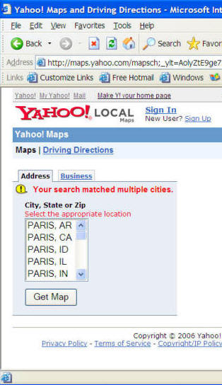
only one location associated with one given georeference. (example:.. Is [placename] a good georeference system? (WHY?). ... Try to type [Paris] in the Yahoo Maps. http://maps.yahoo.com/
Shared:
Different users understand the meaning of a georeference
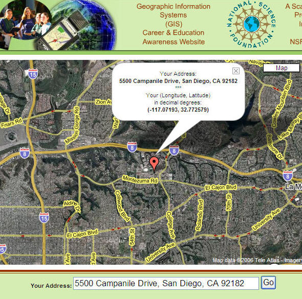
e.g. Mailing address.
Poway Unified School District Boundary might need to be changed ( http://powayusd.sdcoe.k12.ca.us/news/qabound.html )U.S. Mailing Address: 5500 Campanile Drive, San Diego, CA 92182-4493 (San Diego State University).
Chinese (Taiwan) Mailing Address: National Taiwan University. (Zip Code first, then City name, then Street name, then the numbers.)
(Taiwan).
(Korean)
Persistent through time:
Georeference should not be changed frequently
(School Districts, Zip Code, Telephone area code?)


Unambiguous:
Georeference should rely on specific measurement frameworks
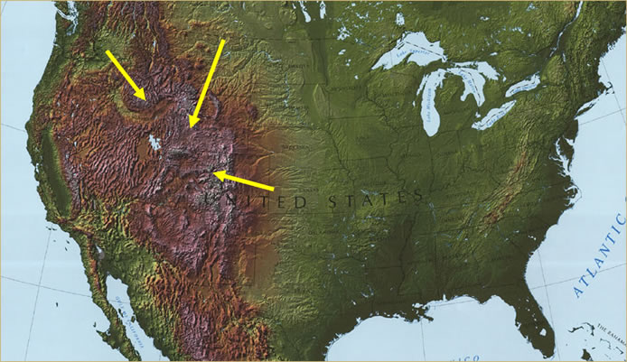
Where is Rocky mountains?
Examples of specific measurement frameworks
- Lat/Long: degrees, minutes, seconds
- UTM: meters
- Postal Addresses: street blocks, building numbers
The Latitude/Longitude coordinate system
(image source: IBM on-line documents: http://publib.boulder.ibm.com/infocenter/db2luw
/v8/index.jsp?topic=/com.ibm.db2.udb.doc/opt/csb3022a.htm)
Some georeference are metric (Universal Transverse Mercator): Precise, and allow for calculations.
Different Georeferencing Systems
Placenames (fuzzy concepts)?
- The earliest form of georeferencing (the most commonly used in everyday activities)
- Many names of geographic features are universally recognized (others may be understood by locals)
- Names work at many different scales (from contient to small villages and neighborhoods
- Names may pass out of use in time (where was Camelot?)
Discussion: How can you tell a new friend where you live? Where is your home town?
Are Placenames good georeferencing system? Why?
The postal system (more precise than “Placenames” system)
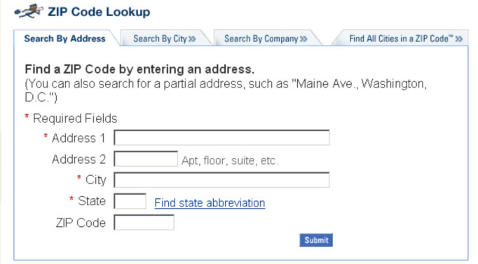
USPS ZIP Code Lookup (http://zip4.usps.com/zip4/welcome.jsp)
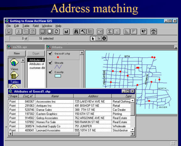
Linear referencing systems (used in the Address Matching functions)
Street names: Line features. How can we know the location of the address?
e.g. AAA (American Automobile Association) maps with street numbers marked in the intersections.
Additional Info for Address Matching: http://www.uiowa.edu/~geog/health/address/locate.html (from the Geography Department, University of Iowa).
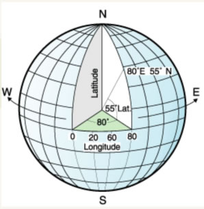
Latitude and Longitude
Several concepts for Lat/Long
- North/South pole
- Equator
- Prime Meridian
- Latitude and Longitude
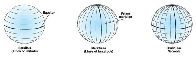
(image source: ESRI Documentation, Understanding Map Projections page 8.)
http://store.esri.com/esri/showdetl.cfm?SID=2&Product_ID=99&Category_ID=28
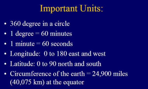
Decimal Degree:
latitude and longitude represented as decimal fractions
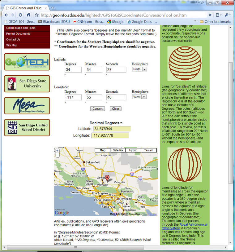
How to convert from a degree/minutes/second (DMS) format to a decimal degree (DD) format?
130° 42' 30 '' W (West). = - 130.70833.
- 1 second = 1/60 minute
- 1 minute = 1/60 degree
1. Convert the [seconds] to minutes: 30'' (seconds) = 30 / 60 = 0.5' (minute)
2. Add the value (0.5) back to the minutes (42). 42 + 0.5 = 42.5 (minutes)
3. Convert the [minutes] to [degree]: 42.5' (minutes) = 42.5 / 60 = 0.70833 (degree).
4. Add the result (0.70833) to the degree number (130): 130 + 0.70833 = 130.70833 (degree).
5. Since the longitude is West. The value of the decimal degree will be negative -->
130° 42' 30 '' W (West). = - 130.70833
Latitude: N (+), S (-), Longitude: E (+), W (-)
http://geoinfo.sdsu.edu/hightech/GPSToGISCoordinatesConversionTool_on.htm
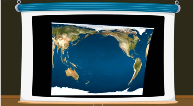
Map Projection
http://www.youtube.com/watch?v=2LcyMemJ3dE
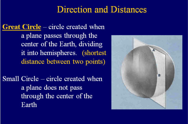
Map projection is the systematic transformation of the curved, three-dimensional surface of the planet into flat, two-dimensional plane. Projections are often developed using the intersection of some geometric form such as a plane, cylinder or cone with some reference globe.
Distortions: Any projectoin distorts the Earth in some way
- Conformal: Shapes of small features are preserved, but areas are distorted.
- Equal Area: Features have the correct area, but shapes are distorted.
More map projection info can be found from the following link: http://www.colorado.edu/geography/gcraft/notes/mapproj/mapproj_f.html from the Geographer's Craft Project, Department of Geography, The University of Colorado at Boulder
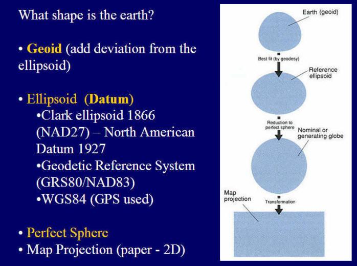
Geoid: the mean ocean surface http://en.wikipedia.org/wiki/Geoid http://www.youtube.com/watch?v=bDTF6UtO0mg&feature=related
Ellipsoid (Datum): http://en.wikipedia.org/wiki/Datum_(geodesy)
Geoid vs. Ellipsoid
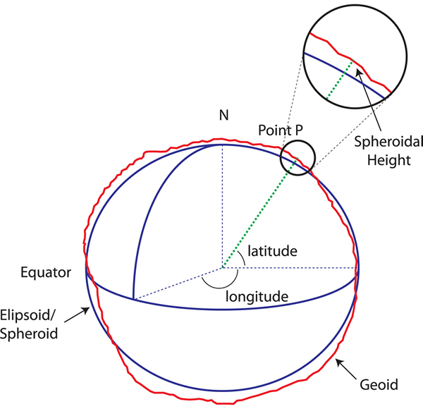
Source: http://www.icsm.gov.au/mapping/datums2.html
GPS devices are using WGS84 (World Geodetic System 1984) for the reference datum (ellipsoid).
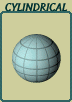
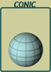
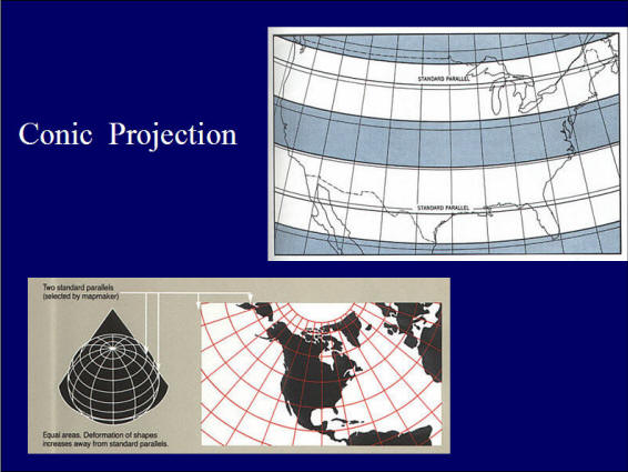
Three classes of projections in terms of the analogous physical models:
- Cylindrical Projections: conceptualized as the result of wrapping a cylinder of paper around the Earth
- Conic Projections: concetpualized as the result of wrapping a cone of paper around the Earth
- Azimuthal/Plannar Projections: conceptualized as the result of transforming points from Earth onto a plane

Examples of Projections
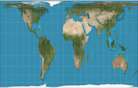
Mercator Projection (Cylindrical)
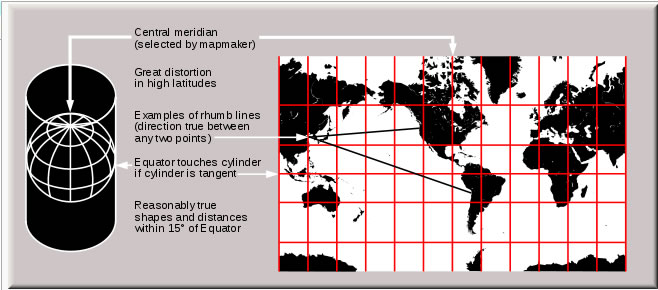
(source: http://en.wikipedia.org/wiki/Mercator_projection)
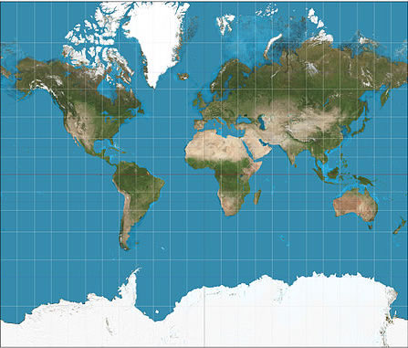
Discussion: Where are the least distorted areas in the map of the mercator projection?
Gall-Peters Projection (Cylindrical)
Political implication of map design? http://www.youtube.com/watch?v=vVX-PrBRtTY
(source: http://en.wikipedia.org/wiki/Gall%E2%80%93Peters_projection)
Robinson Projection (Pseudocylindrical)
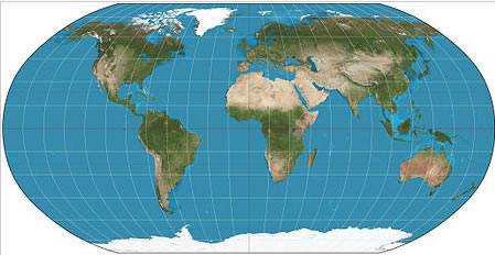
Source: http://en.wikipedia.org/wiki/Robinson_projection
Coordinate Systems
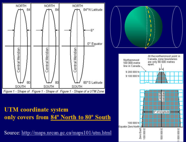
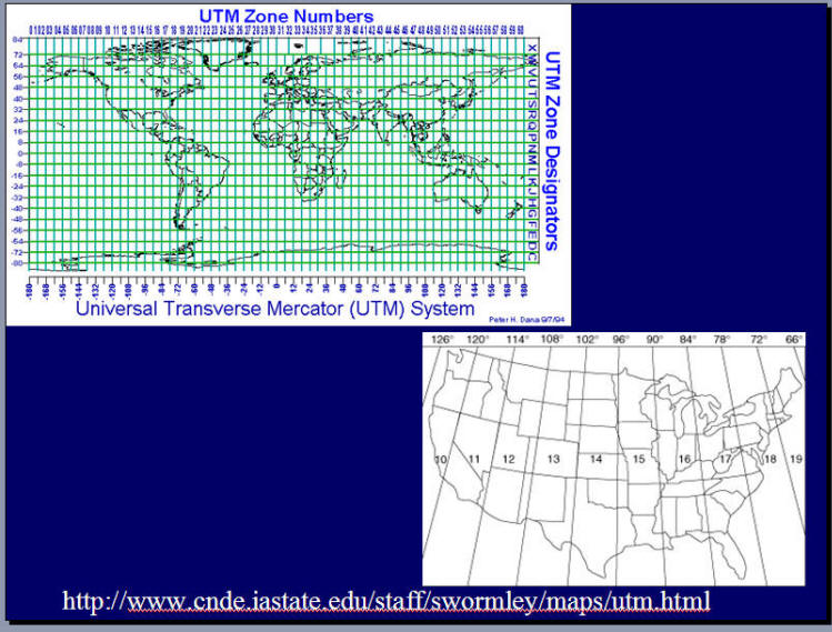
Universal Transverse Mercator Grid (UTM) Coordinate system.
UTM: http://www.uwgb.edu/dutchs/fieldmethods/utmsystem.htm
- A type of cylindrical projection
- Implemented as an internatially standard coordinate system (initially devised as a military standard).
- Used a system of 60 zones (360/6)http://upload.wikimedia.org/wikipedia/commons/e/ed/Utm-zones.jpg
- It is called transverse because the cylindar is wrapped around the Poles, not the Equator.
- a Global coordinate system (used by U.S. Army, Navy, and Air force).
- Unit: Meter
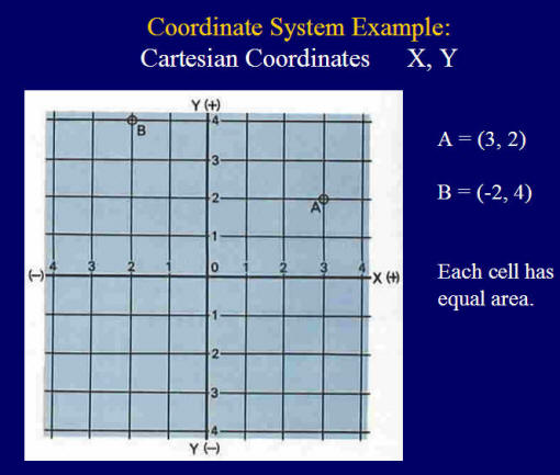
- Cartesian Coordinates: X, Y units are equal. Easy to calculate distances from Point A to Point B.
More information about the UTM Coordinate Systems.
http://en.wikipedia.org/wiki/Universal_Transverse_Mercator_coordinate_system
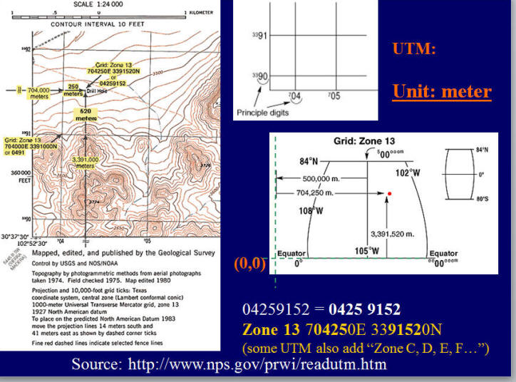
Calculate Distance on the UTM map.
What is the distance between Beach Town (N384240,E256940) and Sand City (N368640,E259200)? (Hint: Use Pythagorean Theorem http://en.wikipedia.org/wiki/Pythagorean_theorem)
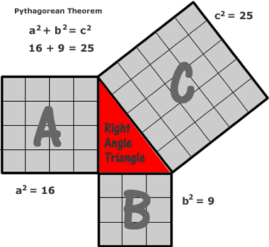
Image source:
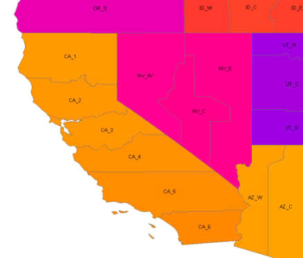
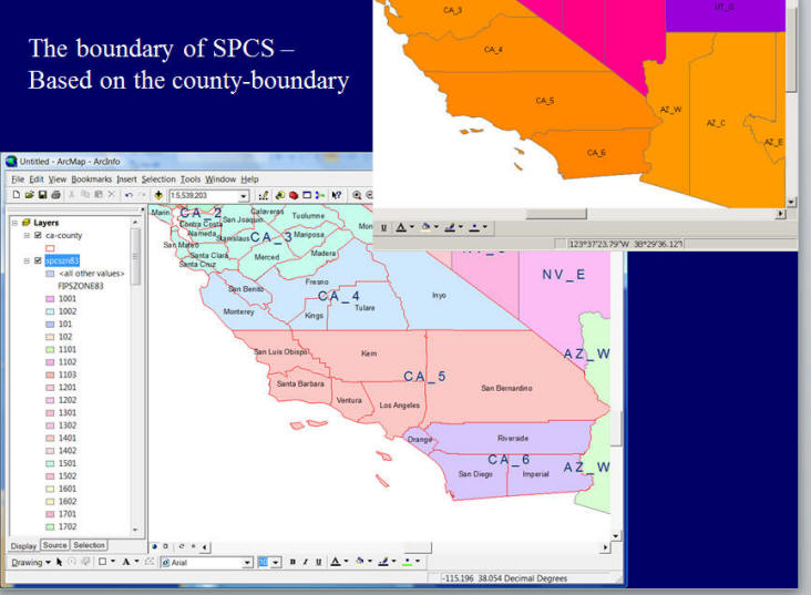
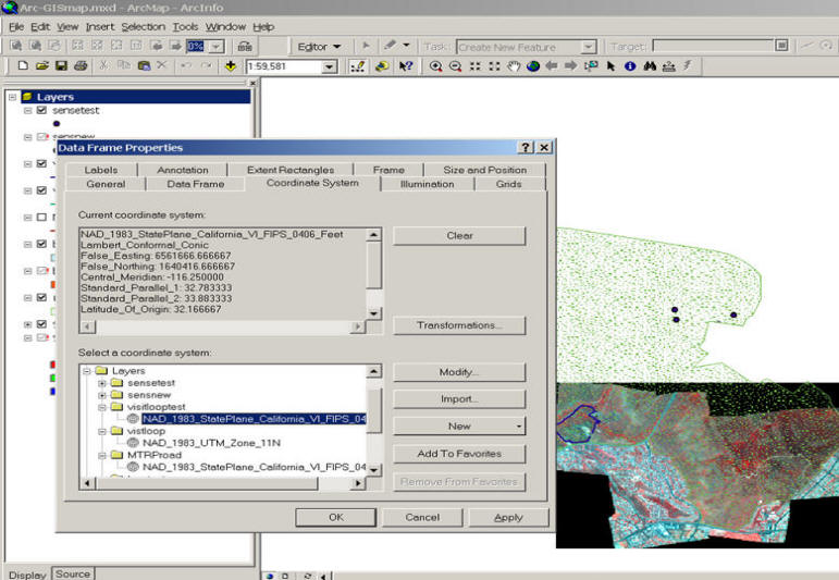
State Plane Coordinate System (SPCS).
A State-plane-coordinate-system implements the coordinate system commonly used by USGS in the 1:24000 and 1:48000 quadrangle series of map sheets. Depending on the location (U.S. States), this coordinate system uses either Universal Transverse Mercator or lambert-conformal-conic, although in some regions another coordinate system is used. Coordinates are specified in terms of x, y, and z, where z is the altitude above the surface of the reference ellipsoid (or sphere).
"This coordinate system that divides all fifty states of the United States, Puerto Rico and the U.S. Virgin Islands into over 120 numbered zones. Each zone has an assigned code number that defines the projection parameters for the region." (source: http://gislounge.com/features/aa032700.shtml)
More information regarding the State Plane Coordinate System:
http://en.wikipedia.org/wiki/State_Plane_Coordinate_System
WhyU Topology: http://www.youtube.com/watch?v=p2ofJPh2yMw (10:30 ~)
Converting Georeference systems.
Coordinate systems conversion:
Geocoding: From your local street address to Latitude/Longitude:
http://geoinfo.sdsu.edu/hightech/Address_ed/
Converting Georeferences are standard functions in GIS packages.
Projection transformation;
A Java Applet Tool: http://www.btinternet.com/~se16/js/mapproj.htm
Unit 3: Additional Information
Please choose ONE map projection from the following websites or other resources, and then explain the characteristics of your selected projection (equal area? conformal? or equal distance).
http://webhelp.esri.com/arcgisdesktop/9.2/index.cfm?TopicName=List_of_supported
_map_projections
http://www.mapthematics.com/Projections.html

/pythagoreantheorem-56a6021e5f9b58b7d0df6f16.gif)