Unit 5.1
Global Positioning Systems (GPS).
(Acknowledgement: some images used in this unit is from the Global Position System unit page from The Geographer's Craft Project, Dr. Kenneth E. Foote at k.foote@colorado.edu.Department of Geography, The University of Colorado at Boulder. http://www.colorado.edu/geography/gcraft/notes/gps/gps_f.html)
The author of some GPS images are from Peter Dana. http://www.pdana.com/ )
What is GPS?
Geospatial Revolution Ep. 1 Ch. 2: http://geospatialrevolution.psu.edu/episode1/chapter2
Satellite Global Positioning Systems are a part of Remote Sensing Domain.
It is an all-weather system offering centimeter positional accuracy.
Two original Satellite Positioning Systems in the 1990s
- GPS: Global Positioning Systems by U.S. (since 1978: Navigation System with Timing and Ranging (NAVSTAR) satellites, with the full orbital constellation of 24 statellites in 1993 )
- GLONASS: GLObal NAvigation Satellite System by Russia. Due to the budget shortage, the GLONASS project could not be accoplished by 2010 (the full orbital constellation of 24 statellites was restored in October 2011).
GPS vs. GLONASS http://www.youtube.com/watch?v=EQgy91qUMaw
Full Operational Capability (FOC) of GPS
24 satellites are needed for FOC with global coverage. The Full Operational Capability (FOC) of GPS was formally declared on April 27, 1995. The FOC of GPS has generated numerous business opportunities for civil applications. This profitable market encourages the similar efforts in other counties, such as recent Galieo positioning system by the European Union. The Galileo positioning system is proposed to have enhanced features over current GPS technologies such as higher precision, better reliability and coverage. The major impetus of launching this project is the concern of European countries of having independent satellite-based positioning systems.
Four Satellite Navigation Systems
GPS: Start testing in 1978. IOC was achieved in 1993 (24th satellite lauched), FOC in 1995.
GLONASS: Global Navigation Satellite System. Start from 1982. FOC was achieved in 2011
GALILEO: The European Union and European Space Agency. Firtus satellite lanuched in Dec. 2005. Initial service is expected around 2014 and completion by 2019.
Beidou: China. 10 satellites in 2011. Asia-Pacific region by 2012, and global system by 2020.
Galileo video: http://www.youtube.com/watch?v=HvniQs40lY4&feature=player_embedded
Now, GPS and GLONASS can provide complete positioning functions. GPS has more satellites than GLONASS.

Source: http://upload.wikimedia.org/wikipedia/commons/9/9c/ConstellationGPS.gif
GPS Constellation http://www.usno.navy.mil/USNO/time/gps/current-gps-constellation
- 32 Satellites in 6 Orbital Planes
- 4 Satellites in each plane (To calculate a location, 4 GPS signals are needed at least)
- 20,200 km (12,600 mi) altitude, 55 Degree Inclination
More Information about GPS Satellites:
- http://leonardo.jpl.nasa.gov/msl/Programs/gps.html
- http://tycho.usno.navy.mil/gpsinfo.html
- http://tycho.usno.navy.mil/gpscurr.html
- http://www.montana.edu/gps/understd.html
GPS was initiated by the U.S. Department of Defense (DOD). In its early development with the NAVSTAR (Navigation System with Timing And Ranging) program. GPS was originally developed for military use. However, there have been numerous civil users ever since 1995when the Full Operational Capability (FOC) was declared.
Common civil applications of GPS technologies can be categorized into two types: positioning and precise time & frequency dissemination.
- Positioning applications include navigation (aircraft, ships and vehicles), surveying, transportation and geophysics research.
- Time accuracy is critical in the telecommunication systems and electronic power grids. For these areas, some users may find it is useful to apply GPS to deliver precise time from the atomic clocks for the purpose of time synchronization
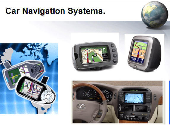
GPS has become a very powerful tool in field survey and geodesy. There are many different GPS receivers on the market now. Every type of GPS receivers has its specific purpose and functions, such as recreational GPS (hiking, biking, Navigation (cars), GIS and survey (professional), and military use.
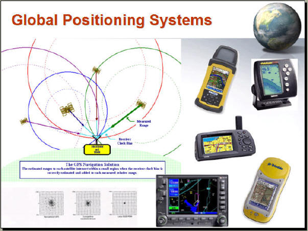
The GPS satellites keep sending signals to the Earth. With different time offsets in receiving the signals, both the three dimensional position and the GPS time can be obtained. Typically, a user can have five to eight GPS satellites “visible” at any time.
SA (Selective Availability)
Before year 2000, the data accuracy of GPS devices is not consistent because the Selective Availability (SA) signals which are imposed by the U. S. Air Force. ( Diggelen, 1994 ) The SA signals will reduce the accuracy of ground resolution to 100 meters ( civilian use ) instead of 10 meters ( military use) in 2000. Today with advanced GPS signal decoding methods, the accuracy of GPS is much better than a few years ago.
May 2000
U.S. President's Announcement:
- Discontinue SA (Selctive Availability), the signal encoding protected by D.O.D.
- Become 10 Times more accurate
- GPS Accuracy: 3 - 10 meters (civil use) (military use: 10-20 cm)
Difference between commercial GPS receiver and military GPS receiver: http://www.youtube.com/embed/fVxDVUsiejQ
The obstruction issue of GPS
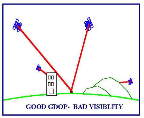
Another problem of GPS comes from the obstructions issue. When users go down to a deep valley or in a forest, or in the big city surrounding by the skyscrape, the receiving signals will have problems and thus reduce the accuracy of observation. Also, if the receiver can not lock enough satellites, the functions of GPS will become invalid.
Differential GPS (DGPS)
From the user perspective, the most used equipment is GPS receivers. A minimum of four satellites is required to calculate the position, velocity and the GPS time. GPS receivers can directly process the GPS signals to display the position, speed and time information for current locations. A Standard Positioning Service (SPS) is devised for civil use while there is another Precise Positional Service (PPS) for military use. Obviously, SPS provides less accuracy in terms of positioning and time. To achieve better precision, Differential GPS (DGPS) technology has been developed. DGPS computes the errors for users with respect to specific reference stations which are believed to have the same errors as the users nearby.
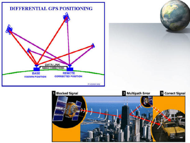
(Note: image source from Peter Dana http://www.colorado.edu/geography/gcraft/notes/gps/gps_f.html and Trimble GPS website http://www.trimble.com )
Location Based Services
Geospatial Revolution Ep. 2/Ch.2 http://geospatialrevolution.psu.edu/episode2/chapter2
GPS receivers can be embedded into mobile phones as well. The so-called GPS mobile phone has the features of global positioning. GPS is essential for location-based services. GPS-enable mobile phones have been widely used in personal navigation, roadside assistance, and tracking services.
http://client.ecityinteractive.com/sprint/family/demo.html
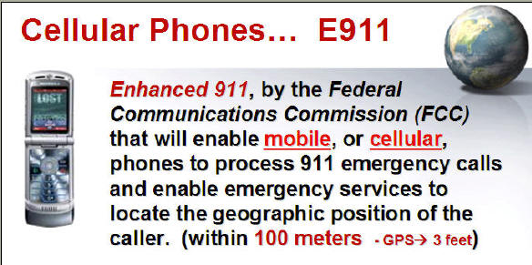
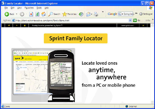
E911
The E911 (Enhanced 911) mandate has created huge demands for wireless location services. The trend of future wireless location solutions are towards more accurate, fast, reliable and less expensive and power consumption services.
NAVIZON
SnapTrack’s (http://www.snaptrack.com/) and NAVIZON (http://www.navizon.com/) hybrid positioning solutions represent such a trend. Simply using GPS may not meet the navigation demands of indoors or downtown areas. The combination of GPS, mobile telecommunication, and Wi-Fi technologies has been proven to be more cost-effective.
http://www.snaptrack.com/index.jsp
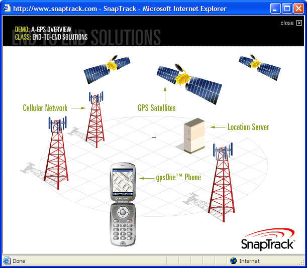
(image from http://www.snaptrack.com/index.jsp )
http://www.navizon.com/FullFeatures.htm
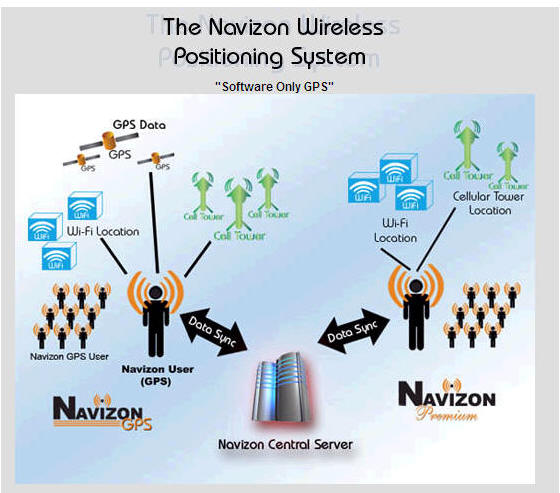
(image from http://www.navizon.com/FullFeatures.htm)
Foursquare
Gowalla (Facebook)
http://www.huffingtonpost.com/2011/12/05/facebook-gowalla_n_1129720.html
Yelp
Who owns GPS?
U.S. Government (U.S. Department of Defense)
A Web-based Satellite Tracking tool
Unit 5.2
Location-Based Services
Definition of LBS: from Wikipedia: http://en.wikipedia.org/wiki/Location-based_service
A location-based service (LBS) is an information and entertainment service, accessible with mobile devices through the mobile network and utilizing the ability to make use of the geographical position of the mobile device.[1][2][3] LBS services include services to identify a location of a person or object, such as discovering the nearest banking cash machine or the whereabouts of a friend or employee. LBS services include parcel tracking and vehicle tracking services. They include personalized weather services and even location-based games. They are an example of telecommunication convergence. (source: http://en.wikipedia.org/wiki/Location-based_service)
2005 SDSU Geo-Treasure Hunt Event.
As Part of our National GIS Day 2005 activities, SDSU's Geography Department is hosting a Fast, Fun, Easy, & Free Geo-Treasure Hunt Contest. This Website is intended to provide you with the most up-to-date and comprehensive information about the contest and other presentations and activities as part of National Geography Awareness Week.
Quick Contest Overview
DESCRIPTION: In a free contest designed with a variety of geospatial technologies such as GIS. This contest was conceived to highlight geospatial technologies such as GPSs and GIS. It is also part of the larger SDSU Geography Week Celebration.
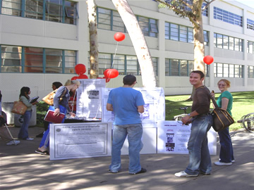
LOCATION: This contest and all other GIS Day and Geography Week activities and presentations take place in or near Storm Hall--- the SDSU Geography Department. The onsite registration and contest table will be in the area between Nasatir and Storm Halls next to West Commons.

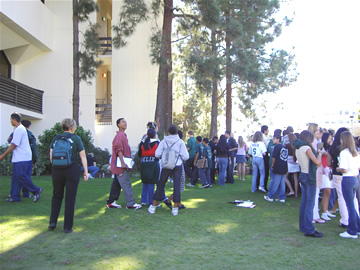
Students gathering for the beginning of the GPS treasure hunt.


Geography Department GPS treasure hunt and departmental information booth.
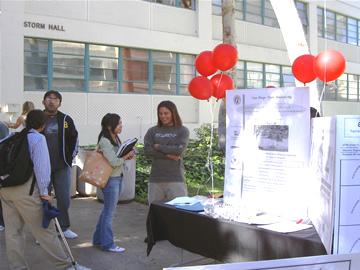
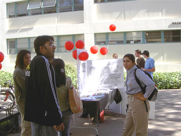
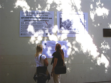
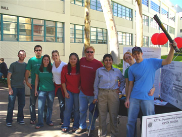
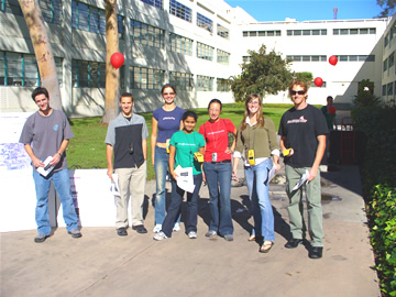
GeoTreasure Hunt Winning Team 1 (left) and Winning Team 2 (right)


Gathering of contestants after the GPS treasure hunt.

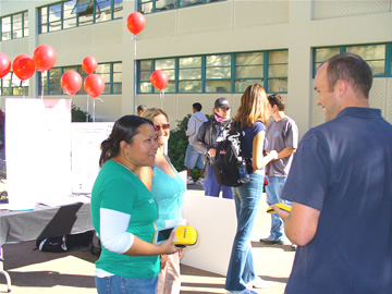
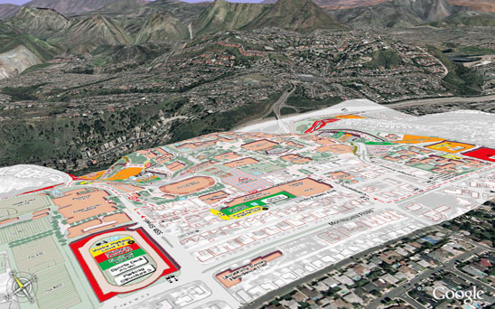
OpenStreetMap: GPS Tracking http://www.openstreetmap.org/
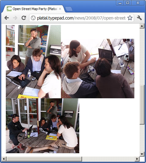
MAP PARTY by OpenStreetMap
http://platial.typepad.com/news/2008/07/open-street-map.html
WHY OpenStreet Maps? (Public Domain?)
Questions: If you are a restaurant owner, can you use the Google Map image to your advertizement flyer?
What is the "Term of Use" in Google MAP?
Terms of Service for Google Maps (cited from Google Map Website)
By using Google Maps and any data or information accessed from Google Maps, you agree to be bound by our Google Terms of Service as well as these additional terms and conditions. For individual users, Google Maps, including local search results, maps, and photographic imagery, is made available for your personal, non-commercial use only. For business users, Google Maps is made available for your internal use only and may not be commercially redistributed, except that map data may be accessed and displayed by using the Google Maps API pursuant to the API terms and conditions.
Google Maps Legal Notices http://maps.google.com/help/legalnotices_maps.html
Google Maps API Terms of Service (cited from Google Map Website)
http://code.google.com/apis/maps/terms.html
Thank you for using the Google Maps API! By using the Google Maps API (the "Service"), you ("You") accept and agree to be bound by the Google Terms of Service, theTerms of Service for Google Maps as well as these additional terms and conditions (the "Terms of Service"). It is important for You to read each of these three documents, as they form a legal agreement between You and Google regarding your use of the Service.
- Service.
1.1 Description of Service. The API allows You to display certain content, including map images and driving directions on your website, subject to the limitations and conditions described below. The informationaccessible through the Service, not limited to map information and photographic imagery, is referred to in this document as "theContent."
Subject to the limitations and conditions described in the terms of service, You may use the API to display the Content in conjunction with other information You provide to end users. You may not access, reproduce, or use the Content for any other purpose.
The API may be used only for services that are generally accessible to consumers without charge. Accordingly, You may not use the API for any service that requires a subscription or other restricted access, or for which a fee is charged.
In order to obtain the API, You must have a Google Account. After supplying Google with Your account information, the URL of your service, and agreeing to the Terms of Service, You will be issued an alphanumeric key assigned to You by Google that is uniquely associated with your Google Account and the URL of your service. Your service must import the Google Maps API using an HTML <script> tag that contains this key, as described in the Maps API documentation, and Google will block requests with an invalid key or invalid URL. Google shall have sole and complete control over the map data and format. You may not obtain more than one key for use in the Service.
Discussion: How can Google Make money by providing almost "free" services to the public?
Google Maps API Premier http://www.google.com/enterprise/maps/
http://gmaps-samples.googlecode.com/svn/trunk/mapcoverage_filtered.html
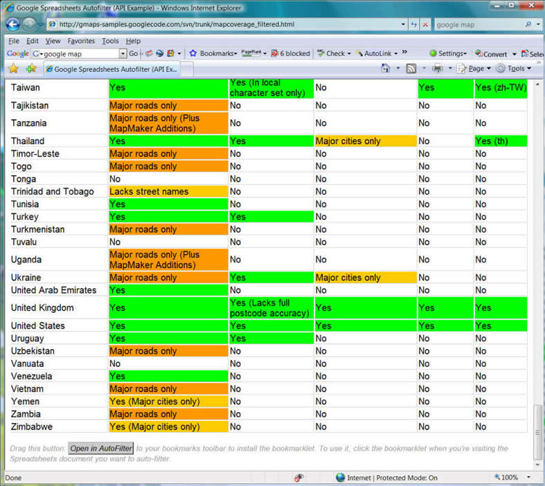
2012 Now
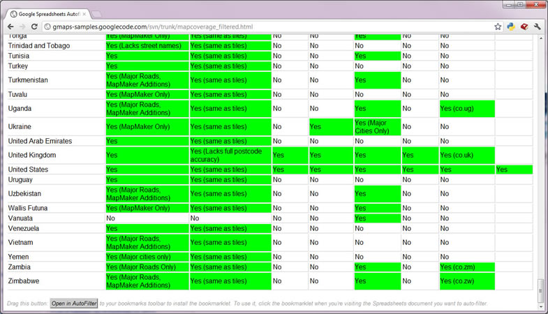
Unit 5: In-Class Exercise
Please describe what location-based services (LBS) are. What kind of applications will the LBS be applied in? What is the relationship between LBS and GPS?
