


PUBLICATION
See the full publication list in the updated C.V. HERE
Major Published Articles in 2015:
- Tsou, M. H. (2015). Research challenges and opportunities in mapping social media and Big Data. Cartography and Geographic Information Science, 42:sup1, 70-74. doi: 10.1080/15230406.2015.1059251.
- Dara E. Seidl, Piotr Jankowski & Ming-Hsiang Tsou (2015): Privacy and spatial pattern preservation in masked GPS trajectory data, International Journal of Geographical Information Science, DOI: 10.1080/13658816.2015.1101767.
- Jiang W, Wang Y, Tsou M-H, Fu X (2015). Using Social Media to Detect Outdoor Air Pollution and Monitor Air Quality Index (AQI): A Geo-Targeted Spatiotemporal Analysis Framework with Sina Weibo (Chinese Twitter). PLoS ONE 10(10): e0141185. doi:10.1371/journal.pone.0141185.
- Li, A., Tsou, M. H., Crook, S., Chun, Y., Spitzberg, B., Gawron, J. M., & Gupta, D. (2015). Space–time analysis: Concepts, quantitative methods, and future directions. Annals of the Association of American Geographers. doi: 10.1080/00045608.2015.1064510.
- Han, S. Y., Tsou, M. H., & Clarke, K. C. (2015). Do Global Cities Enable Global Views? Using Twitter to Quantify the Level of Geographical Awareness of US Cities. PloS one, 10(7), e0132464. URL:http://journals.plos.org/plosone/article?id=10.1371/journal.pone.0132464.
As a featured story in the Atlantic CITY LAB online magazine
- Tsou, M. H., Jung, C. T., Allen, C., Yang, J. A., Gawron, J. M., Spitzberg, B. H., & Han, S. (2015, July). Social media analytics and research test-bed (SMART dashboard). In Proceedings of the 2015 International Conference on Social Media & Society (p. 2). ACM. URL:http://dl.acm.org/citation.cfm?id=2789196.
(This paper received the Best Method Paper Award in the International Conference).
Scholarly Books
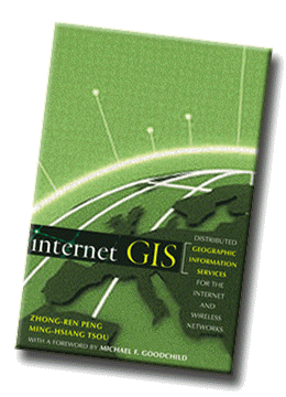
- Peng, Z.R. and Tsou, M. H. (2003). Internet GIS: distributed geographic information services for the Internet and wireless networks. (720 pages, publisher: John Wiley & Sons, Inc.). This is a co-authored book. My contribution of this book is 50% (around 360 pages). This scholarly book has been widely cited by many research papers and become one major literature in the research field of Internet GIS. The Google Scholar index (http://scholar.google.com/scholar?q=Internet+GIS&hl=en&btnG=Search&as_sdt=2001&as_sdtp=on)
Edited Special Issue in Refereed Journals
- Tsou, M. H. and Leitner, M. (guest editors) (March 2013 issue). Special Content Issue: “Mapping Cyberspace and Social Media”. Cartography and Geographic Information Science. 2013.
National Research Council Report (2007):
A Research Agenda for Geographic Information Science at the United States Geological Survey, The National Academies Press, Washington DC. Report by Committee on Research Priorities for the USGS Center of Excellence for Geospatial Information Science. Co-authors (committee members): R.Denaro, K. Beard‐Tisdale, C. Brewer, M. Domaratz, P.Gong, R. McMaster, M. Tsou, and J. Wilson. http://www.nap.edu/catalog.php?record_id=12004
Articles in Refereed Journals
- Saltenberger, J., Li, Y. W., Tsou, M. H., & Bahramzi, S. (2015). Web GIS as a useful tool for the health and social service sector. International Journal of Healthcare Technology and Management. 15, no. 1 (2015): 58-72. URL:http://www.inderscienceonline.com/doi/abs/10.1504/IJHTM.2015.070520.
- Kim, I. H., Tsou, M. H., & Feng, C. C. (2015) Design and implementation strategy of a parallel agent-based Schelling model. Computers, Environment and Urban Systems, 49, 30–41.
- Aslam AA, Tsou MH, Spitzberg BH, An Li, Gawron JM, Gupta DK, Peddecord KM, Nagel AC, Allen C, Yang JA, Lindsay S (In Press). The Reliability of Tweets as a Supplementary Method of Seasonal Influenza Surveillance. J Med Internet Res.
- Kim, Ick-Hoi, Tsou, Ming-Hsiang, & Feng, Chen-Chieh (2015) Design and implementation strategy of a parallel agent-based Schelling model. Computers, Environment and Urban Systems, 49, 30–41.
- Tsou, Ming-Hsiang, Jiue-An Yang , Daniel Lusher , Su Han , Brian Spitzberg , Jean Mark Gawron , Dipak Gupta & Li An (2013) Mapping social activities and concepts with social media (Twitter) and web search engines (Yahoo and Bing): a case study in 2012 US Presidential Election, Cartography and Geographic Information Science, 40:4, 337-348, DOI: 10.1080/15230406.2013.799738
- Tsou, M. H. and Leitner, M. (2013). Editorial: Visualization of Social Media: Seeing a Mirage or a Message? In Special Content Issue: “Mapping Cyberspace and Social Media”. Cartography and Geographic Information Science. 40(2), pp. 55-60. http://www.tandfonline.com/doi/abs/10.1080/15230406.2013.776754#.U_ICBvldW0I
- Tsou, Ming-Hsiang, Ick-Hoi Kim, Sarah Wandersee, Daniel Lusher , Li An, Brian Spitzberg, Dipak Gupta, Jean Gawron, Jennifer Smith , Jiue-An Yang, Su Yeon Han (2013). Mapping Ideas from Cyberspace to Realspace: Visualizing the Spatial Context of Keywords from Web Page Search Results. International Journal of Digital Earth, 2013.
- Ick-Hoi Kim and Ming-Hsiang Tsou (2013). Enabling Digital Earth simulation models using cloud computing or grid computing: two approaches supporting high-performance GIS simulation frameworks. International Journal of Digital Earth, 2013. 6:4, 383-403.
- Nagel AC, Tsou MH, Spitzberg BH, An Li, Gawron JM, Gupta DK, Yang JA, Han Su, Peddecord KM, Lindsay S, Sawyer MH, (2013). The Complex Relationship of Realspace Events and Messages in Cyberspace: Case Study of Influenza and Pertussis Using Tweets, J Med Internet Res 2013;15(10):e237.
- Brian H. Spitzberg, Ming-Hsiang Tsou, Dipak K. Gupta, Li An, Jean Mark Gawron, Daniel Lusher, (2013). The Map is Not Which Territory?: Speculating on the Geo-Spatial Diffusion of Ideas in the Arab Spring of 2011. Studies in Media and Communication. Vol 1(1). 2013, pp. 101-115.
- Tsou, M. H. (2011). Revisiting Web Cartography in the United States: the Rise of User-Centered Design. Cartography and Geographic Information Science, 38 (3), 249- 256. LINK (PDF)
- Tsou, M. H. and Yanow, K. (2010). Enhancing General Education with Geographic Information Science and Spatial Reasoning. Urban and Regional Information Systems Association (URISA) Journal, Special Issue on Geospatial Education and Training. 22(2), 45-54. LINK (PDF)
- Tsou, M.-H. and Kim, I. H. (2010). Increasing Spatial Awareness by Integrating Internet Geographic Information Services (GIServices) with Real Time Wireless Mobile GIS Applications. International Journal of Strategic Information Technology and Applications (IJSITA), 1(4), 42-54. LINK
- Kawabata, Mizuki, Thapa, Rajesh, Oguchi, Takashi, and Tsou, Ming-Hsiang (2010) Multidisciplinary Cooperation in GIS Education: A Case Study of US Colleges and Universities, The Journal of Geography in Higher Education. 34(4), 493- 509. LINK (PDF)
- Zhang, T., Tsou, M.-H., Qiao, Q., and Hu, B. (2010). Designing Integrated High Performance Web Portals for GIScience Research. Journal of Internet Technology. 11(6), 809-820.
- Zhang, T. and Tsou, M.-H. (2009). Developing a grid-enabled spatial Web portal for Internet GIServices and geospatial cyberinfrastructure, International Journal of Geographical Information Science. 23(5), pp.605-630. LINK (PDF)
- Jankowski, P., Tsou M.-H., and Wright, R.D. (2007). Applying Internet Geographic Information System for Water Quality Monitoring. Geography Compass 1/6 (2007): 1315–1337. LINK (PDF)
- Zhang, T. and Tsou, M.-H. (2005) The Integration of Grid-enabled Internet GIServices and Geographic Semantic Web Technologies. In Special Issue on Distributed GIS, Geographic Information Science (the former journal of Annals of GIS), 11 (1), pp. 15-23. LINK (PDF)
- Tsou, M.-H., Guo, L., and Howser, T. (2005). A Web-based Java Framework for Cross-Platform Mobile GIS and Remote Sensing Applications. GIScience & Remote Sensing. 31(3), pp. 153-165. LINK (PDF)
- Tsou, M.-H. (2004). Integrated Mobile GIS and Wireless Internet Map Servers for Environmental Monitoring and Management, (the Special Issue on Mobile Mapping and Geographic Information Systems) in Cartography and Geographic Information Science. 31(3), pp. 153-165. LINK (PDF).
- Tsou, M.-H. (2004). Integrating Web-based GIS and On-line Remote Sensing Facilities for Environmental Monitoring and Management. In special issue on the potential of Web-based GIS, the Journal of Geographical Systems. 6(2), pp. 155-174. LINK (PDF)
- Tsou, M.-H., Guo L., and Stow D. (2003). Web-based Remote Sensing Applications and Java Tools for Environmental Monitoring, Online Journal of Space Communication, No. 3, http://spacejournal.ohio.edu/issue3/abst_tsou.html
- Tsou, M. H. and Buttenfield, B. P. (2002). A Dynamic Architecture for Distributing Geographic Information Services. Transactions in GIS, 6(4), pp. 355-381. LINK (PDF)
Chapters in Refereed Books
- Dipak Gupta, Brian Spitzberg, Ming-Hsiang Tsou, Mark Gawron, An Li. (in Press). Chapter 3: Of Mining and Mine Fields: Revolution in Paradigms of Data Analysis and Interpretation. In L. Fenstermacher (ed) Countering Violent Extremism: A Multidisciplinary Perspective. Air University Press.
- Tsou, M. H. and Kim, I. H. (2011) Creating GIS simulation models on a TeraGrid-enabled Geospatial Web Portal: A Demonstration of Geospatial Cyberinfrastructure. In Advances in Web-based GIS, Mapping Services and Applications (Volume in ISPRS Book Series). Edited by Songnian Li, Suzana Dragicevic and Bert Veenendaal. LINK (PDF).
- Tsou, Ming-Hsiang (2009). Chapter 48: The Integration of Internet GIS and Wireless Mobile GIS. In Manual of Geographic Information Systems, edited by Marguerite Madden, published by the American Society for Photogrammetry and Remote Sensing (ASPRS), pp. 923-933. LINK (PDF)
- Chang, Kuo-Chen and Tsou, Ming-Hsiang (2008). Chapter 6. New Approaches for Integrating GIS layers and Remote Sensing Imagery for Online Mapping Services. In International Perspectives on Maps and the Internet. (edited by M. P Peterson). Berlin: Springer. pp. 91- 102. LINK (PDF)
- Tsou, Ming-Hsiang and Curran, Judd M. (2008). Chapter 20. User-Centered Design Approaches for Web Mapping Applications: A Case Study with USGS Hydrological Data in the United States. In International Perspectives on Maps and the Internet. (edited by M. P Peterson). Berlin: Springer., pp. 301-321. LINK (PDF)
- Tsou, Ming-Hsiang and Sun, Chin-Hong. (2007). Mobile GIServices Applications in Disaster Management, Book chapter in Dynamic and Mobile GIS: Investigating Change in Space and Time. (edited by Drummond, J, Billen, R., Forrest, D. and Joao, Ed. 2007. London: CRC Press (Taylor & Francis). (Innovations in GIS book series), pp. 213-236. LINK (PDF)
- Tsou, Ming-Hsiang. (2006). Bridging the Gap: Connecting Internet-based Spatial Decision Support Systems to the Field-based Personnel with Real time Wireless Mobile GIS applications. Book chapter in Collaborative Geographic Information Systems (Edited by Shivanand Balram and Suzana Dragicevic). Hershey, Pennsylvania: Idea Group, Inc., pp. 316-339. LINK (PDF)
- Tsou, Ming-Hsiang (2003). Chapter 14: An Intelligent Software Agent Architecture for Distributed Cartographic Knowledge Bases and Internet Mapping Services. In Maps and the Internet, M. Peterson (ed), Oxford: Elsevier Press, pp. 229-243. (published on behalf of the International Cartographic Association). LINK (PDF)
- Tsou, Ming-Hsiang (2002). An Operational Metadata Framework for Searching, Indexing, and Retrieving Distributed Geographic Information Services on the Internet. In Geographic Information Science - Second International Conference GIScience 2002, M. Egenhofer and D. Mark (eds.), Lecture Notes in Computer Science Vol. 2478, Berlin: Springer. pp. 312-333. LINK (PDF)
- Tsou, Ming-Hsiang and Buttenfield, Barbara P. (1997). A Direct Manipulation Interface for Geographical Information Processing. In: Kraak, M.J. and Melenaar, M. (eds.) Advances in GIS Research II. Taylor & Francis, London, U.K., pp. 905-915. LINK (PDF).
Encyclopedia Entries
- Tsou, M.H. (2008). Data Warehouse. In Karen Kemp (editor). Encyclopedia of Geographic Information Science. London: SAGE. (pp 94-95).
- Tsou, M.H. (2008). Distributed GIS. In Karen Kemp (editor). Encyclopedia of Geographic Information Science. London: SAGE. (pp 115-118).
- Tsou, M.H. (2008). Spatial Data Server. In Karen Kemp (editor). Encyclopedia of Geographic Information Science. London: SAGE. (pp 404-406).
- Tsou, M.H. (2008). Web Services. In Karen Kemp (editor). Encyclopedia of Geographic Information Science. London: SAGE. (pp 513-514).
- Tsou, M.H. (2010). Mobile GIS. In Barney Warf (editor). Encyclopedia of Geography. SAGE: Thousand Oaks. vol. 4, pages 1918‐1921.
- Tsou, M.H. (2010). Internet GIS. In Barney Warf (editor). Encyclopedia of Geography. SAGE: Thousand Oaks. vol. 3, pages 1620‐1623.
- Tsou, M.H. (2010). Distributed Computing. In Barney Warf (editor). Encyclopedia of Geography. SAGE: Thousand Oaks, vol. 2, pages 776‐778.
Articles in Refereed Proceedings
- Tsou, MH, Woodruff, SI, Spitzberg, B, Reed, M, Moran, M., Gawron, M, Allen, C., Yang, J. (2014). Using GIS and Geo-targeted Social Media (Twitter) to Track Illicit Drug Use Trends in Space and Over Time. GIScience 2014 Conference, Vienna, September 23-26. Extended Refereed Abstract.
- Ming-Hsiang Tsou, Brian H. Spitzberg, Chris Allen, Anoshé Aslam, and Anna Nagel, Geo-Targeted Social Media Analytics for Tracking Disease Outbreaks and Public Opinion at the Municipal Scale. 2014 National Conference on Health Communication, Marketing, and Media, Atlanta, Georgia. August 19-21, 2014. https://nphic.confex.com/cdc/nphic14/webprogram/Paper35448.html
- Jean Mark Gawron, Dipak Gupta, Kellen Stephens, Ming-Hsiang Tsou, Brian Spitzberg and Li An. (2012). Using Group Membership Markers for Group Identification, Proceedings of the Sixth International AAAI Conference on Weblogs and Social Media, p.467- 470.
- Tsou, Ming-Hsiang (2011). Mapping Cyberspace: Tracking the Spread of Ideas on the Internet. Refereed Proceedings of the 25th International Cartographic conference, July 3-8, 2011, Paris, France. PDF
- Tsou, Ming-Hsiang, Zhang, Tong, and Kaiser, John (2007) Internet GIServices for Homeland Security, Geoinformatics 2007 Conference (17–18 May 2007) http://gsa.confex.com/gsa/2007GE/finalprogram/abstract_122039.htm
- Tong Zhang, Ming-Hsiang Tsou, Qinghua Qiao, and Lin Xu (2006). Building an intelligent geospatial cyberinfrastructure: an analytical problem solving approach, Proc. SPIE, Vol. 6420, 64200A (2006); doi:10.1117/12.712656. Conference Title: Geoinformatics 2006: Geospatial Information Science.
- Tsou, M.H. and Buttenfield, B.P. (1998). Client/Server Components and Metadata Objects for Distributed Geographic Information Services. Proceedings, GIS/LIS '98, Fort Worth, TX, November, 1998: 590-599. LINK (PDF)
- Tsou, M.H. and Buttenfield, B.P. (1998). An Agent-based, Global User Interface for Distributed Geographic Information Services. Proceedings of the 8th International Symposium on Spatial Data Handling, Vancouver, British Columbia, July, 1998: 603-612. LINK (PDF)
White Papers
- Ming-Hsiang Tsou and Jennifer Smith (2011). Free and Open Source Software for GIS education , GeoTech Center. LINK (PDF)
Book Review
- Tsou, Ming-Hsiang (2014). Book Review: Big data: techniques and technologies in geoinformatics. Annals of GIS, 20(4), 295-296.
- Tsou, Ming-Hsiang (2008). Book Review: Map-based Mobile Services: Theories, Methods, and Implementations by Liqui Meng, Alexander Zipf, and Tumasch Reichenbacher (Eds.). Annals of GIS. 15(1), p. 73. (http://www.informaworld.com/smpp/content~db=all~content=a916953862~frm=titlelink)Invited Articles in Major GIS Professional Magazines and Newsletters
Invited Articles in Major GIS Professional Magazines and Newsletters
- Tsou, M.H., Stow, D., and J. Kaiser. (2006). Spatial Decision Support Services Enhance Homeland Security. GeosIntelligence, Mar/Apr 2006. pp. 18-23. LINK (PDF)
- Tsou, 2005. Recent Development of Internet GIS at GIS@development: http://www.gisdevelopment.net/technology/gis/techgis_002pf.htm
- Tsou, M. H. (2004). Present realities and the future of Internet GIS. GIS@Development Magazine. July 2004, vol. 8 (7). Pp. 29-32. (URL:http://www.gisdevelopment.net/magazine/years/2004/july/29.shtml)
- Tsou, M. H. (2004). Tracking the 2003 San Diego Wildfire. CSU Geospatial Review. Spring 2004, Vol. 2(1). Pp.1.