
GEOG 581: Cartography Design
![]()
![]()
![]()
![]()
![]()
![]()
Web-based Geographic Information Services (GIServices)
![]()
Group Project Progress Report
![]()
CartoGram Example: U.S. Presidential Election 2004
(Best, created by Dr. Sara Fabrikant at UCSB) http://www.geog.ucsb.edu/~sara/html/mapping/election/election04/election.html
http://www-personal.umich.edu/~mejn/election/
http://www.princeton.edu/~rvdb/JAVA/election2004/
![]()
Reading: Tsou, 2004, Present reality and the future of Internet GIS. at GIS@development, Vol. 8(7), pp. 29-32. http://www.gisdevelopment.net/magazine/years/2004/july/29.shtml
Traditional GISystems, designed as isolated islands, will become increasingly less attractive, maybe disappearing altogether.
The cost efficiencies and flexibility of reusable and interoperable open and distributed services interfaces will provide greater economies.
Web-based GIServices focus on open, distributed, task-centered services, which will broaden geographic information uses into an increasingly wide range of on-line geospatial applications These include digital libraries, digital governments, on-line mapping, data clearinghouses, real-time spatial decision support tools, distance learning modules, and so on.

Data Sharing Examples: (Raw Data)
| The USGS National Map Seamless Data Distribution System (http://seamless.usgs.gov/) | |
| The Federal Geographic Data Committee (FGDC)’s data clearinghouse ( http://clearinghouse3.fgdc.gov/ ). | |
| NASA The Earth Science Data Information Systems (ESDIS) Project http://spsosun.gsfc.nasa.gov/eosinfo/Welcome/index.html |
Information Sharing Example: ( data --> process --> information (maps))
| the U.S. Census Bureau American Factfinder (http://factfinder.census.gov/servlet/ReferenceMapFramesetServlet?_lang=en) | |
| Global Wildfire warning systems ( http://maps.geog.umd.edu ) |
Knowledge Sharing (the most difficult): (information --> analysis --> knowledge)
| on-line Java-based analysis toolbox for remotely sensed imagery (http://map.sdsu.edu/arc/Analytical_tools.htm). | |
| Sharing Hydrological model, software, and scripts. | |
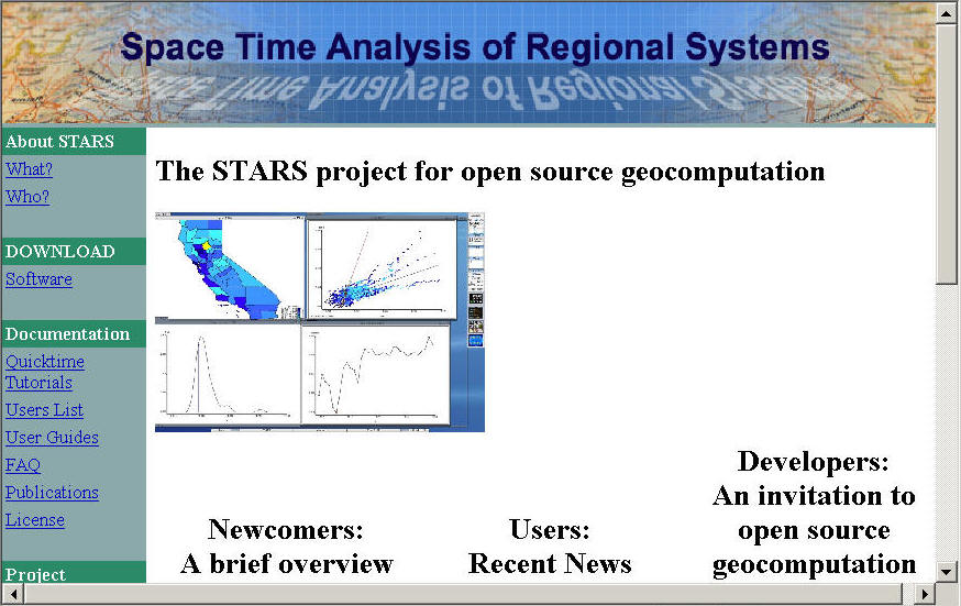
| Dr. Serge J. Rey http://stars-py.sourceforge.net/ |
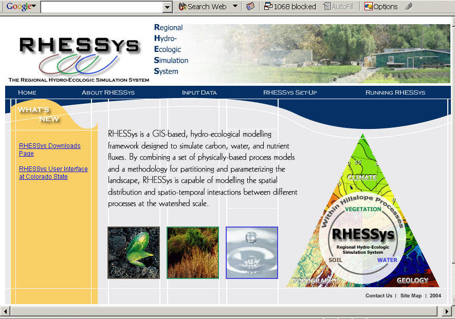
| Dr. Christina Tague http://geography.sdsu.edu/Research/Projects/RHESSYS/index.html |
![]()
Combined GIServices (including all data, maps, and knowledge sharing resources):
| ESRI the Geography Information Network ( http://www.geographynetwork.com) | |
| San Diego Emergency Response GIS data portal (under construction now) ( http://geoinfo.sdsu.edu/metadataexplorer ) |
![]()
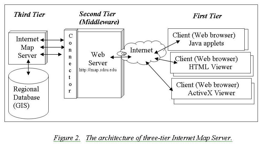
Most Internet map servers adopt a three-tier architecture for the system implementation (Figure 2).
|
The first tier is called “the client tier” which includes the user-side web browser and user-resident Java applets/HTML documents. The client tier is used by the user to make requests and to view maps and remote sensing data. | |
|
The second tier is the middleware tier that includes the Web Server and the Server Connectors (such as Servlet connectors or ASP connectors) to bridge the communication between clients and the map servers. The third tier is the data storage tier that includes the map server and the database server. | |
|
The three-tier software architecture of web-based GIS provides customizable functions for different mapping applications and scalable implementation for different hardware. |
![]()
Standards for Internet GIS
“Sharing” is the major concept of Internet GIS. To sharing data, information, and knowledge among the GIS community, a standardized communication protocol, standardized metadata contents, and interoperable programming interfaces are essential for the success of Internet GIS applications. With the comprehensive architecture for bridging heterogeneous GIServices, researchers and scientists can easily share their geospatial data, GIS models, and knowledge. There are three major groups that set standards for the development of Internet GIS now.
1. The Open GIS Consortium, Inc. (OGC) ( http://www.opengis.org ) (rename to Open Geospatial Consortium ( http://www.opengeospatial.org/ )
2. The Technical Committee tasked by the International Standards Organization (ISO/TC211). (http://www.isotc211.org)
3. NASA Earth Data System Working Group ( http://lennier.gsfc.nasa.gov/seeds/ )
The NASA Earth Science Enterprise (ESE) is faced with a new set of challenges to its data systems.
Among those challenges are:
| Enabling flexibility within data systems to adapt to new data stream(s) or to changes in current processing streams. | |
| Assuring products flowing from processing streams meet the needs of the focus area science teams - scientists working in conjunction with data systems experts, and in consultation with their communities. | |
| Identifying and creating interfaces that facilitate the flow of data to modeling efforts (e.g. carbon assimilation) - one size does not fit all. | |
| Enabling seamless hooks into data mining and high performance computing environments. | |
| Evolving from past instrument-focused processing systems to measurement oriented data systems within an interoperable framework that will help guide the flow of information and services; improve performance and access; be measurement focused; and be distributed geographically and logically. | |
| SPG subgroup (Standard Process Group) http://spg.gsfc.nasa.gov/ |

NASA has been active in the OGC and the ISO/TC 211. The goal of NASA activity has been to assure that NASA data and data services are compatible with emerging national and international standards. The Earth Science Data Information Systems (ESDIS) Project ( http://spsosun.gsfc.nasa.gov/eosinfo/Welcome/index.html )that is charged with implementing the major components of the Earth Observing System Data Information System (EOSDIS) and the Geospatial Interoperability Office (GIO) of the Earth Science Enterprise, charged with ensuring that NASA Earth science data can be employed in information, analysis and decision support applications have directed this activity.
![]()
The Future of Internet GIS: Services-oriented applications
This term, service-oriented, indicates that geographic information services are provided to help people accomplish their works and meet the needs of the public.
1. Internet GIServices are user-centered.
2. Internet GIServices focus on long-term, evolution-type operations.
3. Diversified GIServices are required.
In the future, integrated electronic services will be ubiquitous in our daily lives, transforming our experiences in transportation, financial management, shopping, and entertainment. GIS is the compass of e-services, providing directions and location functions for these multitude services. Internet GIS will also affect the way that Earth system scientists use, collect and share data.
New Direction: Semantic Web (Intelligent Web Services) http://www.w3.org/2001/sw/ with Intelligent Software Agents (Tsou's Ph.D. dissertation).


![]()
Discussion:
Will "Web-based GIServices" no longer need the help from Geography? (Some new GIS institutes are no in the Department of Geography)
New term emerging "Geospatial Information Technology" to replace "GIS" (Geographic Information Systems). WHY?
As a Cartographer, What are the major impacts for us to adopt the Web-based GIServices?
Spring 2004 GEOG583 (Internet Mapping and Distributed GIServices).
( http://map.sdsu.edu/geo596 )
![]()
Session TWO
![]()
Group Project Http://map.sdsu.edu/group2004Fall
Student Individual Webpage: Http://map.sdsu.edu/student581
|
Please use web search engine to find a new map animation example and introduce the application. Provide the URL, and define the type of animation (time series, re-expression, or fly-by) and visual variables (duration, rate of change, order, display date, frequency, and synchronization -- if applicable) adopted in your animation example. |
![]()
Web-powered by: MAP.SDSU.EDU