If you are looking for recent 2014 San Diego Wildfires information, please link to here.
http://www.sdcountyemergency.com/
(Official San Diego County Emergency Website)
For More Wildfire Mapping Information
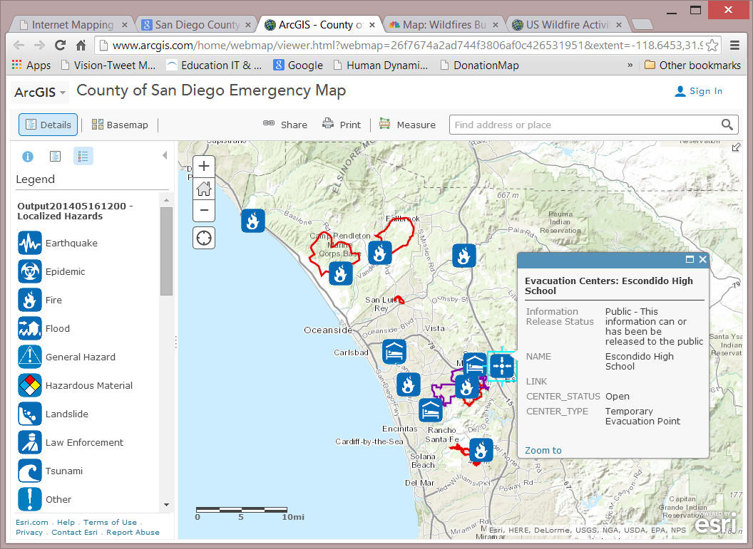
1. San Diego County Emergency Map (ArcGIS online): http://www.arcgis.com/home/webmap/viewer.html?webmap=26f7674a2ad744f3806af0c426531951&extent=-118.6453,31.9788,-114.7067,33.9125
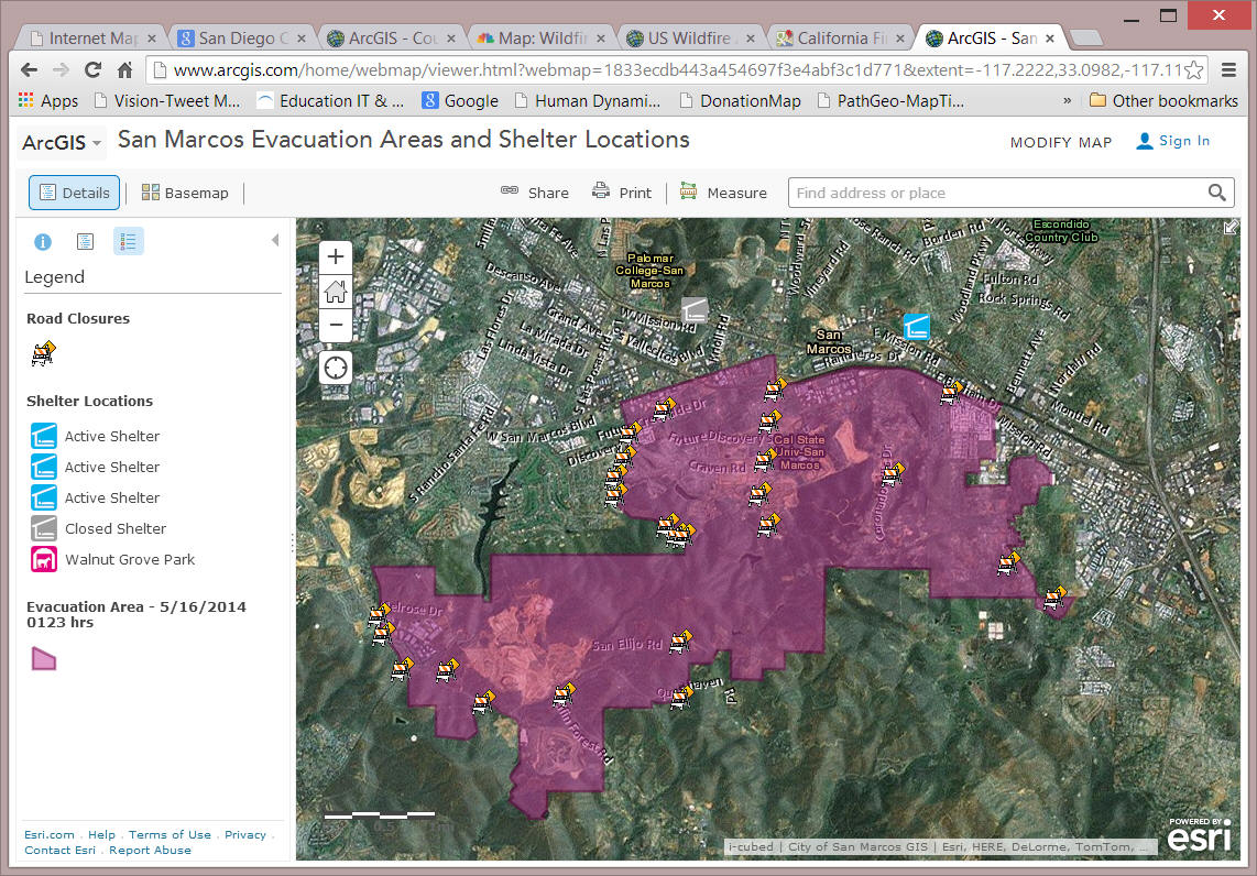
2. San Marcos Evacuation Areas and Shelter Locations (ArcGIS online): http://www.arcgis.com/home/webmap/viewer.html?webmap=1833ecdb443a454697f3e4abf3c1d771&extent=-117.2222,33.0982,-117.1147,33.1492
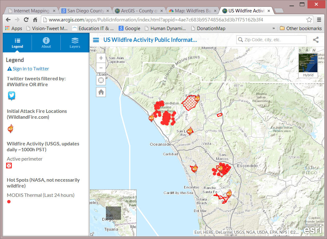
3. US Wildfire Activity Public Information Map (ArcGIS online): http://www.arcgis.com/apps/PublicInformation/index.html?appid=4ae7c683b9574856a3d3b7f75162b3f4
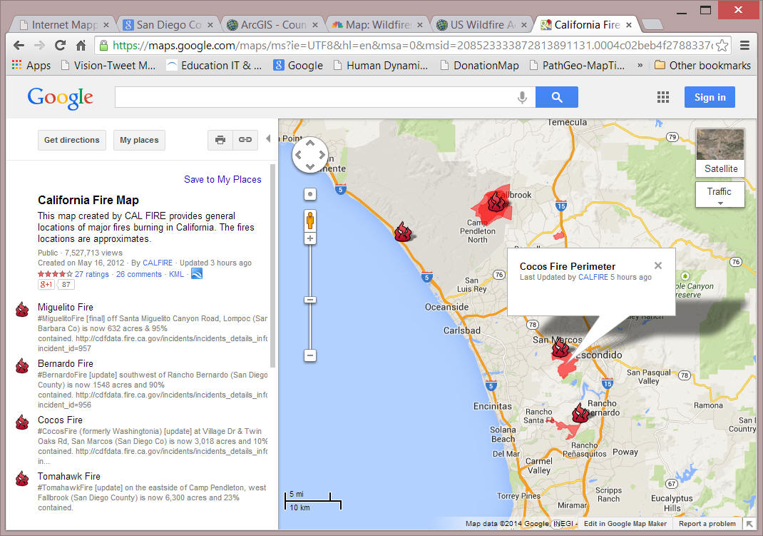
4. CAL FIRE: California Fire Map (Google Map): https://maps.google.com/maps/ms?ie=UTF8&hl=en&msa=0&msid=208523333872813891131.0004c02beb4f2788337d0&ll=37.055177,-120.454102&spn=17.505593,18.720703&z=5&source=embed&dg=feature&mid=1400275909
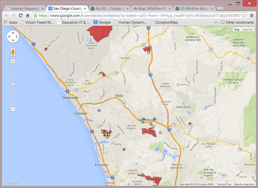
2. The San Diego Union-Tribune (5/14) (Google Map): https://www.google.com/fusiontables/embedviz?q=select+col2+from+1Prhyq_Gwal91q5VuW38beycxd71abyEDE0I0OnR1&viz=MAP&h=false&lat=33.194767&lng=-117.252143&t=1&z=10&l=col2&y=2&tmplt=2&hml=KML
Other Mapping Resources
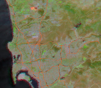
1. NASA MODIS Images: http://activefiremaps.fs.fed.us/imagery.php?op=fire&fireID=ca-south-000
2. NASA EOSDIS: https://firms.modaps.eosdis.nasa.gov/firemap/
Examples: (5/13) San Bernardo Fire
(5/13/2014 MODIS Satellite image (Aqua) overlay with streets).
Web Mapping Services for San Diego 2007 Wildfires
(Any media or persons are welcome to reproduce or redistribute these maps and information by acknowledging the map sources and the Department of Geography, San Diego State University.)
This website is maintained and updated by the San Diego GIS force group, a volunteer group of SDSU faculty and students. (Disclaimer: Since all GIS layers in these mapping services are derived from external sources, SDSU and the Department of Geography will do our best to provide useful information. However, we can not guarantee the accuracy of these data from external sources).
If you have any questions or suggestions
regarding this website, please contact Dr. Ming-Hsiang Tsou,
![]() at the Department of Geography, San Diego State University or
<gisforce@geography.sdsu.edu>.
at the Department of Geography, San Diego State University or
<gisforce@geography.sdsu.edu>.
Link to 2008 Volunteer Hazard Mapping Corps (VHMC) Workshop Documents
|
Aftermath and Damage Assessment (using GIS and Remote Sensing Technology):
|
The San Diego Fire Wiki ( http://sdfires.pbwiki.com/ ) This is a collaborative Wiki to organize Information on the San Diego 2007 Wildfires. You can contribute your own information to this on-line information portal or get the most updated information regarding the wildfires.
Evacuation Map Updates and GIS Maps. (the evacuation maps are updated ASAP once we get the maps from county Emergency Operations Centers (EOC). This web page includes major government websites (county and city) and GIS maps related to evacuation, traffic updates, power outages and related information. All evacuation orders have been lifted at 11:00am on Oct. 31, 2007 in San Diego County. Click Here to see the last fire perimeters update and evacuation map provided by the County's EOC.
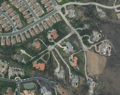
Damaged Areas Mapping. This page focuses on the damaged areas and buildings in San Diego. We will include geocoded addresses for the locations of damaged houses and other related information in this page.
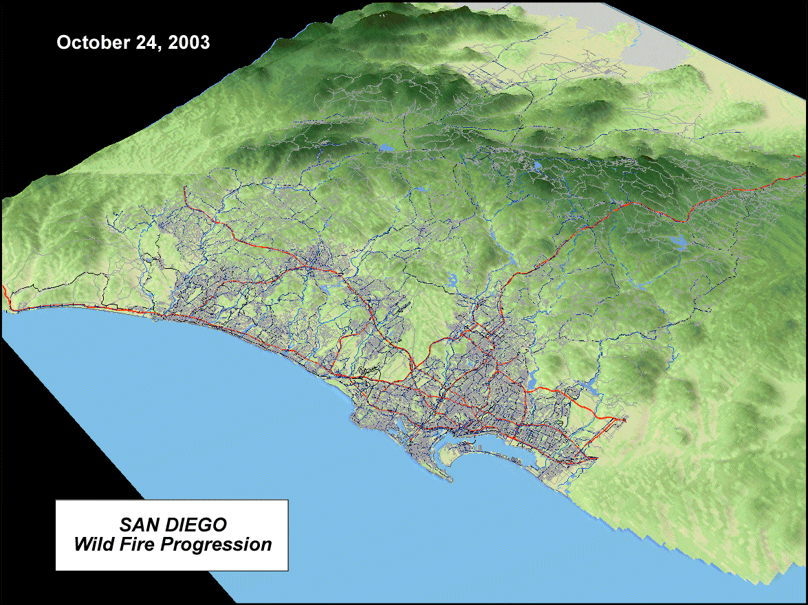
3D Visualization and Animation Maps. Display of 3D terrain and temporal changes of the wildfires. We will also compare the differences between the 2003 Cedar fire and the 2007 wildfires.
Satellite Images Overlay and Remote Sensing. This page collects all relevant satellite images and overlay them with GIS layers (streets, highways, rivers). We also compiled a satellite images resource list for all related remote sensing data.
Other On-line Mapping Resources This page will show a collective list of other on-line mapping resources related to the 2007 fires.
How GIS (Geographic Information Systems) can help us fight wildfires? One of the major differences between the 2003 and 2007 wildfire responses in San Diego is the great GIS team collaboration in the County's EOC in 2007. The San Diego EOC GIS team did an extraordinary job this time and provided very critical and valuable mapping information promptly to the public and related government agencies.
Map Highlights (gallery thumbnail images):
 Animation of NASA MODIS satellite images (true color, Oct. 21-29 (New) (by Ick Hoi Kim). More images HERE. |
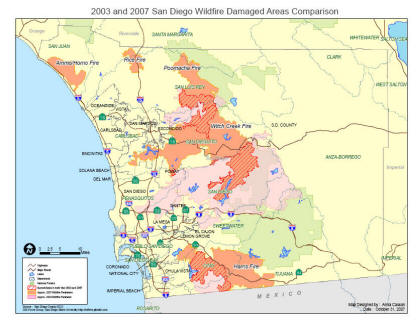 The damaged areas comparison map (2003 and 2007) (created by Anna Casson <acasson@jsanet.com>) |
|
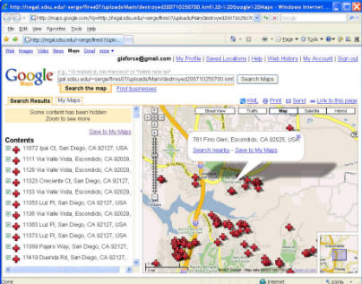
Damaged House Map in Google Map (by Serge Rey and Tong Zhang). See detailed description in http://toae.org/ |
3D Animation of the Fire 2003 (Orange color) and the
Fire 2007 (Red color) (By Aude Esperbe) See
detailed description in 3D Visualization
page. |
|
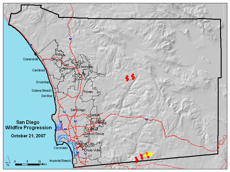
Animation of the Fire Oct 21-24 (By Andrew Gordon, Aude Esperbe, and Grant Fraley) |
 |
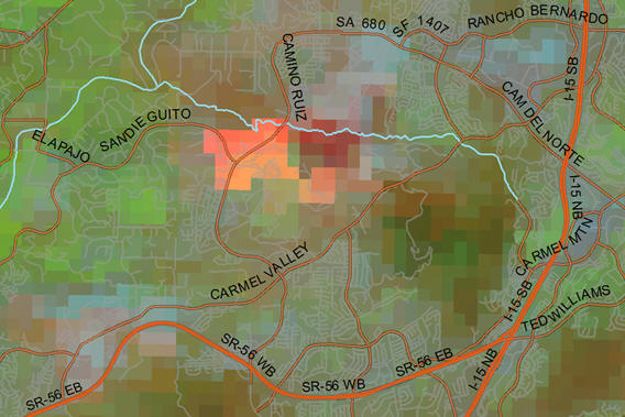
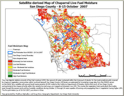 Fuel Moisture Map (created by Madhura Niphadkar and Doug Stow) derived from indices taken from MODIS surface reflectance data with fire perimeter overlay. |
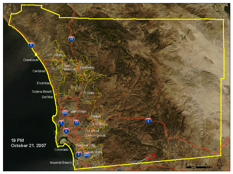
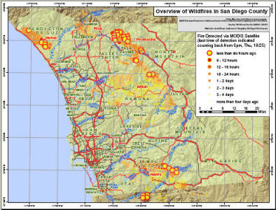 Overview of Wildfires in San Diego County (Printable PDF map) created by Andr'e Skupin. For more updated maps, visit http://sdfires.pbwiki.com/Maps |
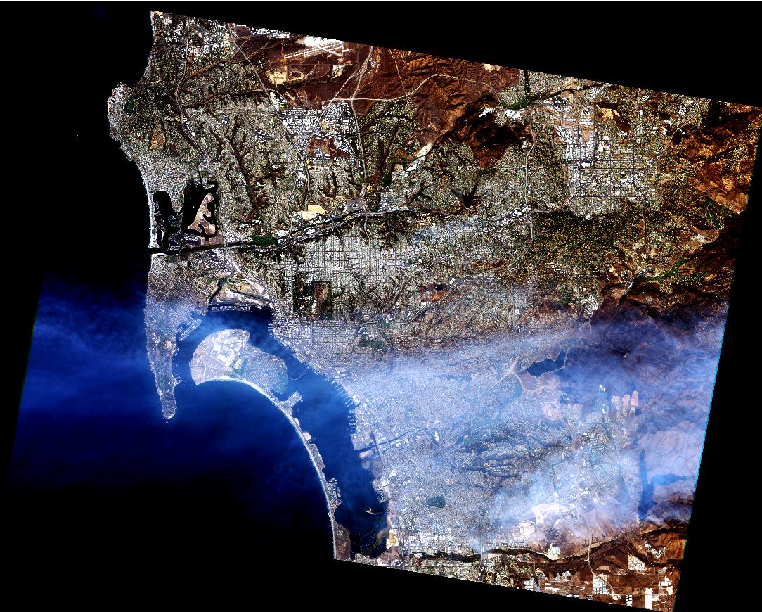
High Resolution Satellite Images from FORMOSAT-2 (Special thanks to the image providers, Taiwan's NSPO, Spot Image, and Remote Sensing & Spatial Knowledge Research Lab, Department of Geography, National Taiwan Normal University) - International research collaboration between SDSU and NTNU. (Click the thumbnail to see the high resolution image - taken on Oct. 24, 2007. 10:35:55am San Diego Time). (Click HERE to see more images)
New Discourse Maps (created by Gregg Verutes, Jochen Bercker, and Piotr Jankowski)
NEW Telascience San Diego Fires Map http://hypercube.telascience.org/fire/ (integrated images from multiple sources) created by John Graham.
Dr. Serge Rey's Blog http://toae.org/ (Preliminary Map of Destroyed Houses and KMZ files)
We apologize for the slow server performance in the first two days of the wildfires (Oct. 21 & 22) due to overloaded requests from Web users. Tuesday we were given access to major Intel computers at Calit2 at UCSD and special connectivity between SDSU and UCSD (OptIPuter) from which this page is now being served (special thanks to John Graham, Eric Frost, Larry Smarr, John DeNune, and Cristiano). It is super fast now. We will continue to update the wildfire maps and create some GIS maps / Recovery maps, as well as new imagery from NASA and other groups assisting in this massive effort. We also re-organized our website on Oct. 25 to provide a better layout of information for our community.
-- Department of Geography, San Diego State University, Oct. 25. 11:00am.
Link to the GIS data portal (2003) for San Diego Fire Recovery Network (SDFRN). SDSU Geography Department was collaborating with San Diego Fire Recovery Network (SDFRN) in 2003 to establish a GIS data center for San Diego Wildfire Recovery and Management. The GIS data center includes downloadable data (shapefiles and coverages and metadata) for San Diego 2003 Wildfires.
Link to SDSU Field Station's Wildfire Alert! Website: http://wildfirealert.sdsu.edu/
A link to a SDSUnivese article about this website.
http://www.sdsuniverse.info/story.asp?id=60047
The San Diego GIS Force Volunteer Group: Harry Johnson, Lloyd (Pete) Coulter, Ting-Hwan Lee, Christopher Lippitt, Aude Esperbe, Cristiano Giovando, Serge Rey, Andrew Gordon, Jennifer Larson, Ick-Hong Kim, Kimberly Dodson, Charlie Schmidt, Marcus Chiu, David McKinsey, Piotr Jankowski, Melissa Rosa, Boris Dev, Blake Brown, Tong Zhang, Charlie Adler, Arika Ligmann-Zielinska, Gagan Arora, David Folch, Gregg Verutes, Martin Lacayo-Emery, Andr'e Skupin, Madhura Niphadkar, Li An, Doug Stow, Grant Fraley, Ryan Burns, Xinyue Ye, Chung-Rui Lee, Raghuram Narasimhan, Anna Casson, Ming Tsou.
Special Thanks to the following persons and organizations for providing valuable information for this website: Dr. Harry Chang and Kevin Chen (National Taiwan Normal University), Mr. Sam Wang (Taiwan's NSPO), Rich McCreight (Near Earth Observation Systems), Drew Decker (USGS), Bill Clayton, Paul Hardwick and Tricia Toomey (San Diego County Emergency Operations Office), Jeffrey Johnson (Pict'Earth), Tony Howser, ESRI, SPOT Image, Richard Maher, Google and its Google Earth Team.
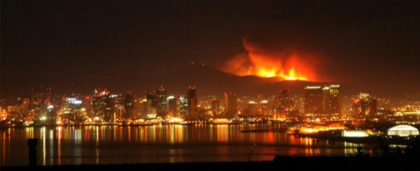
(This image is provided by Bill Clayton).
Contact person: Dr. Ming-Hsiang Tsou,
![]()
This Website is updated and maintained by the Department of Geography, San Diego State University.
(Click on the following icon to see the web logs analysis of this website.)
![]()
![]()