With the recent growth of mobile GIS technology, many companies now offer various services and equipment to perform different mobile GIS tasks. Though ESRI is a common choice, with its reputable name and excellent ArcPad software, there are now many other products and organizations to choose from. These include MapXtend software by MapInfo, GeoExplorer handhelds and mobile tracking devices by Trimble, ERMapper, and various GPS tracking solutions.
According to Mapping and Analysis for Public Safety (M.A.P.S.),
the leading GIS software companies are ESRI, MapInfo, and Intergraph. ESRI
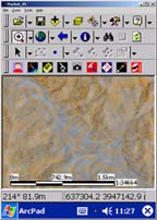
provides GIS software for the pocket PC (ArcPad) and tracking software for
the desktop computer (ArcIMS Tracking Server). MapInfo is a major alternative
to ESRI, offering GIS solutions for the desktop, mobile platforms, and server-based
products to serve GIS to the web. MapInfo MapX and MapBasic are tools for
developers to create custom GIS applications. Intergraph offers a mobile GIS
platform called IntelliWhere, which brings Intergraph GeoMedia’s GIS
capabilities to the mobile platform.
Mobile GIS has three components:
 |
 |
 |
|
Handheld Computer
|
GIS Software
|
Global Positioning System
|
Hardware:
- Field computers
- Field computers with integrated GPS: Trimble GeoExplorer series handhelds, the Mitac Mio 168, the Garmin iQue, etc.
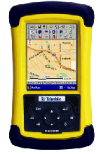
- Trimble GeoExplorer Rugged Handheld Series or the Trimble Recon Series for more rugged operations: GeoXT, GeoXM, the Recon GPS Card Edition, and the Recon GPS Pocket Edition.
- Fujitsu Stylistic tablet PC
- IBM ThinkPad-T20 laptop
- HP iPAQ pocket PC
Software:
- ArcView 9.0
- GeoMapper software
- Trimble software extension for ESRI ArcPad
- MapInfo: MapXtend, which is a developer tool for creating location-based wireless handheld applications; and MapX Mobile, which is a development tool for creating customized mapping applications for the Pocket PC.
Other Equipment:
- Trimble GPS Pathfinder Pocket, a compact GPS receiver
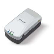
- Belkin Bluetooth add-on GPS
- Motorola 9505 satellite phone