Unit #1.1
Introduction to Geospatial Information Technology
and Geographic Information Science
1. Welcome and Introduction.
- Class Title
- Class Website
- Instructor
- TA
- GIS Certificate Program: http://geography.sdsu.edu/Programs/giscert.html
2. Course Syllabus
In this cousre, you will know
- What is GIS?
- How is it implemented?
- Why is it important?
- When is it applied
Requried Textbook: Geographic Information Systems and Science , 4th Edition Paul A. Longley, Michael F. Goodchild, David J. Maguire, David W. Rhind, Published by Wiley ( https://www.wiley.com/en-us/Geographic+Information+Science+and+Systems%2C+4th+Edition-p-9781118676950 )
3. Questionnaires.
(Please fill out the questionnaire and return ONLY the last page back to the instructor)
What is your major? (Undeclared, Geography, Journalism, Recreation and Tourism Management, Communications, Environmental Science, Business, Liberal Studies, Anthropology, Biology, etc)
Introduce the mappingideas project: multi-disciplinary project (http://mappingideas.sdsu.edu)
4. Use the Blackboad for the communication of this course:
Blackboard URL: https://blackboard.sdsu.edu/
5. Facebook "Page" for Geospatial Technology at SDSU:
http://www.facebook.com/video/video.php?v=10150257497405484
Facebook Check In
http://www.facebook.com/about/location
6. What is GIS?
Geospatial Revolution Movie: http://geospatialrevolution.psu.edu
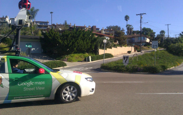
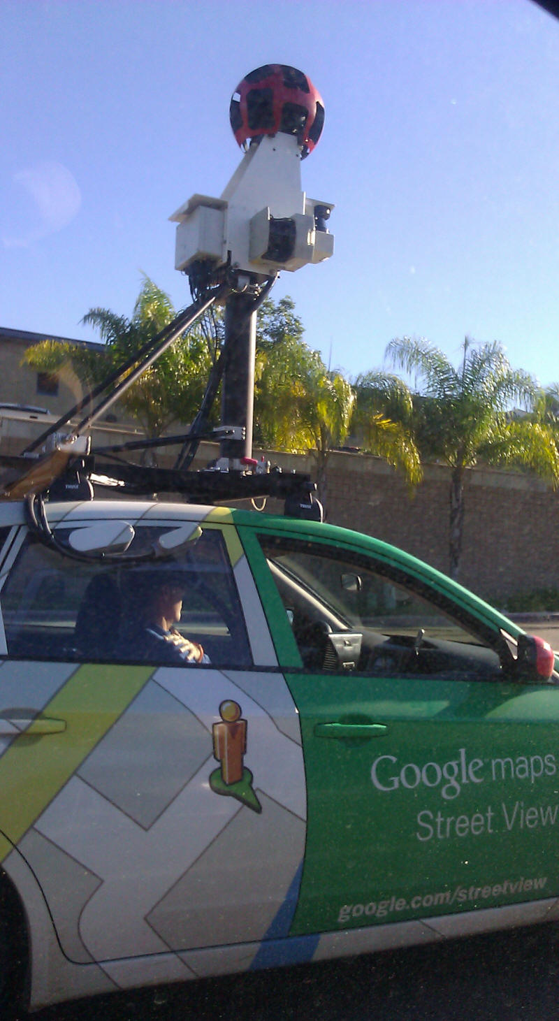
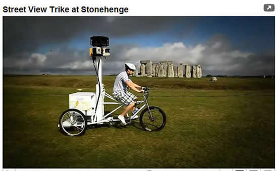
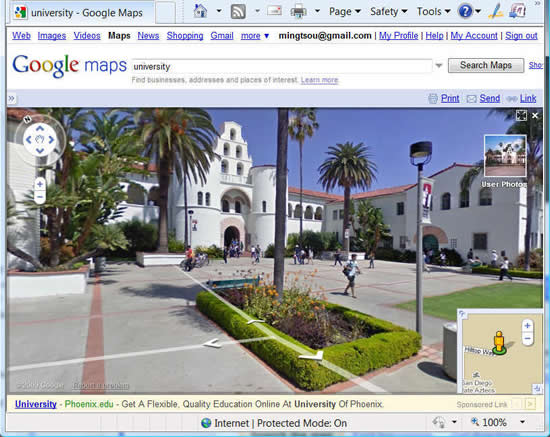
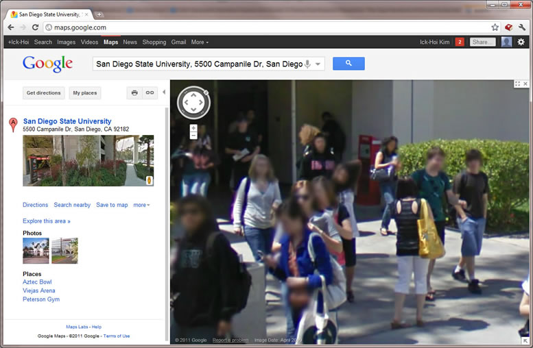
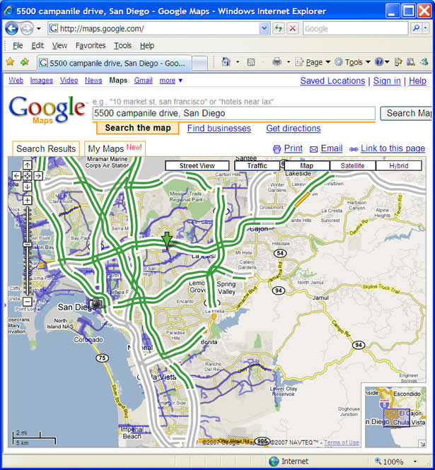
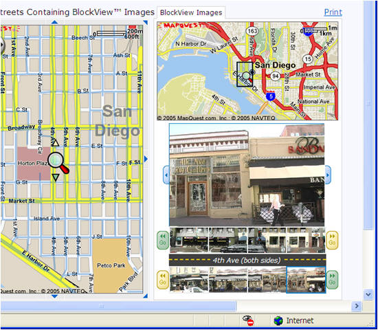
Google Street View
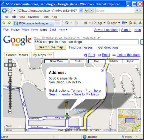
Google Partners With SDSU for 'Street View'. SDSU is the first university in the world to be included in the widely popular Google Maps feature.
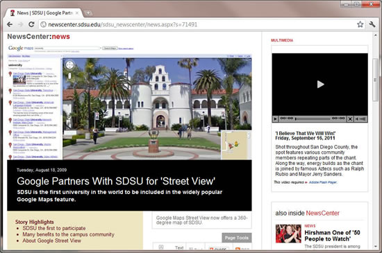
http://newscenter.sdsu.edu/sdsu_newscenter/news.aspx?s=71491
Show the SDSU campus on the Google Street.
Google Street Car Photo
https://www.facebook.com/wired/videos/10155050568563721/
(Video about Google Street View - Crowd Sourcing)
Why does the Google Maps blur faces?
In 2007, Google Street View (Can you recognize the student?)
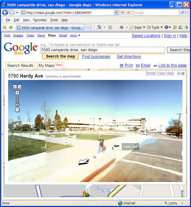
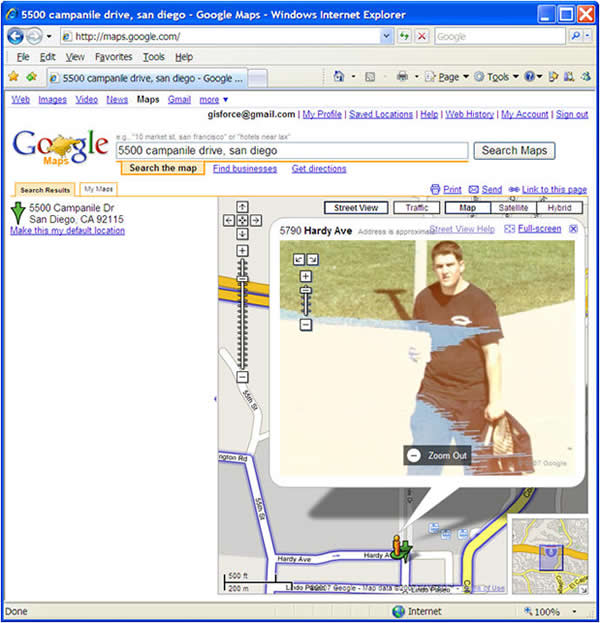
(NOTE: Since 2008, Google Map Street View has reduced the resolution of their images significantly to prevent the privacy problems. You will no longer see this high resolution images in Google Map Street View).
WHO is this Guy?
Take a street view from your home address?
Do you have any concerns about the privacy issues with the Street View?
Big Brother? http://en.wikipedia.org/wiki/Big_Brother_(Nineteen_Eighty-Four)
Enemy of State (Movie): http://www.imdb.com/title/tt0120660/, http://www.youtube.com/watch?v=AoNT6u3mQew&feature=related
http://www.cbc.ca/news/technology/story/2009/11/13/tech-google-street-view-switzerland.html
What kinds of applications or business will be useful for using the Street View? (Finding a new apartment location? Shopping?)
Are these images REAL-Time? or Pre-captured? How long will the Google update these images?
Can people take any pictures from the public space (Streets)?
Why did Google develop the Street View?
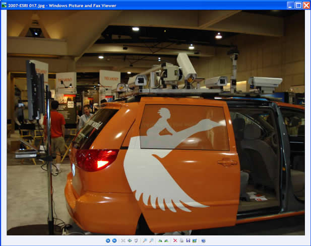
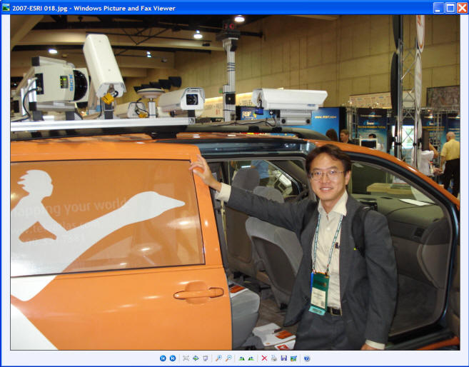
Photos in 2007 ESRI User Conference, San Diego. (Tele Atlas exhibit booth)
Google Map --- Traffic View (Real-time update)
A9 Street View
Before the Google Map Street View, there is a A9 Street View product from Amazon.com.
GIScience also including remote sensing images processing:
Another New Technology for GIScience:
Virtual Reality vs. Augmented Reality
Augmented Reality (AR) is a live direct or indirect view of a physical, real-world environment whose elements are "augmented" by computer-generated perceptual information, ideally across multiple sensory modalities, including visual, auditory, haptic, somatosensory, and olfactory.
https://www.ted.com/talks/blaise_aguera
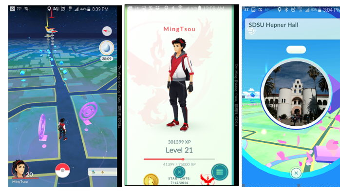
One example of Augmented Reality: Pokemon GO
GIS Application Areas?
http://www.esri.com/industries.html
http://gis.ncsu.edu/research/tourism/GIS_Tourism_Projects.htm
7. Google Earth Bird Flu Example.
A Google Earth Extended (with KML) Map showing the location of the Bird flu (created by Declan Butler(http://declanbutler.info/blog/)
(Note: KML -- Keyhole Markup Language. A computer language for creating customized Google Earth layers.)
Click HERE to open the KML file: http://www.declanbutler.info/Flumaps1/Timeseries.kml
(Note: you need to download the newest version of google earth to see the different color symbols).
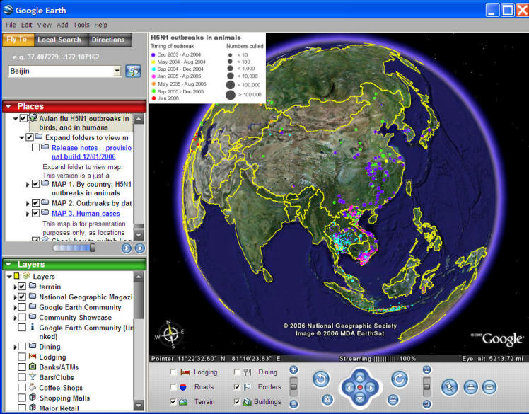
See more information in the following links: http://declanbutler.info/blog/?p=16
8. Discussion: What is Spatial Reasoning?
Do you see any spatial relationships among these human and animal cases?
If there is a hypothetical bird flu outbreak happen in San Diego... What should we do? Do we have enough hospital?
San Diego Wildfire 2007
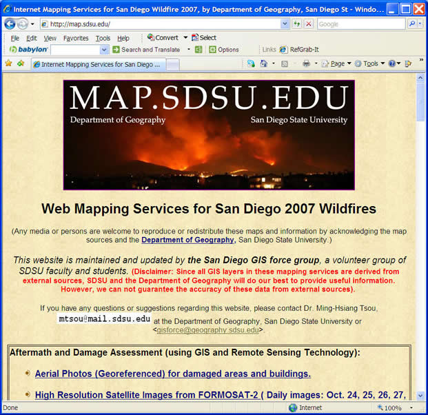
- How could we evacuate people effectively and safely? Which areas? Which routes? When?
- Where should we dispatch firefighters? which areas are needed most?
- What are the impacts of these wildfires for San Diego's ecological environments?
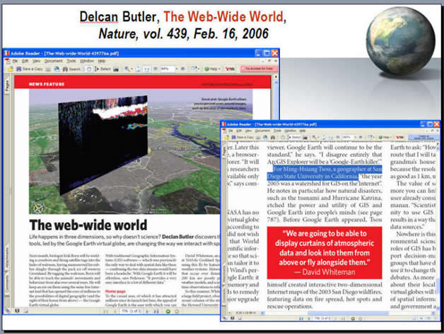
9. The Article from Nature
(Reading Assignment. We will discuss this article next time).
Declan Butler, (2006). The web-wide world. Nature, 439(16). February 2006, pp. 776-778.
This paper is provided on Blackboard under the Readings folder (The web-wide world).
Why GIS Matters?
Almost everything happens somehwere.
Knowing where some things happen is critically important (e.g. Position of country boundaries, location of hospitals, routing delivery vehicles, and management of foreset stands).
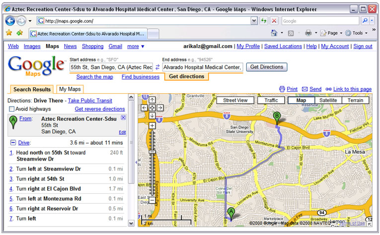
Decide the Route.
Manage Hazards
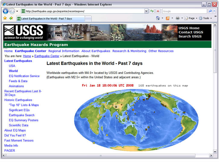
Source: http://earthquake.usgs.gov/eqcenter/recenteqsww/
Plan New Locations
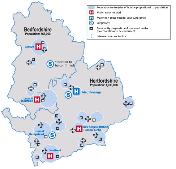
Source: http://www.bhha.nhs.uk/investinginyourhealth/yourhospitals.htm
Geographic problems can be addressed by
- Scale or level of geographic detail (Scale Depenence)
- The intent of Science (solving both scientific questions and practical application problems).
- Decision-Making with different timescales
- Scale Dependence: Geographic features at different scales will have different behaviors, different details, and different relationships
Definition of [Scale]: "The concept of scale is applicable if a system is represented proportionally by another system". (quoted from the Wikipedia http://en.wikipedia.org/wiki/Scale_%28ratio%29) Map Scale: Map items --> Real world items. (1: 1,000).
Map Scale: http://en.wikipedia.org/wiki/Scale_%28map%29 (from the Wikipedia).
In a paper map, the scale is FIXED.
In a computer-based map or a web-based map, the scale is DYNAMIC and changeable.
Different Scale --> Different details: Scale or level of geographic detail is an essential property of any GIS project (textbook, p. 4). (What is "scale" on a map? 1: 10,000)
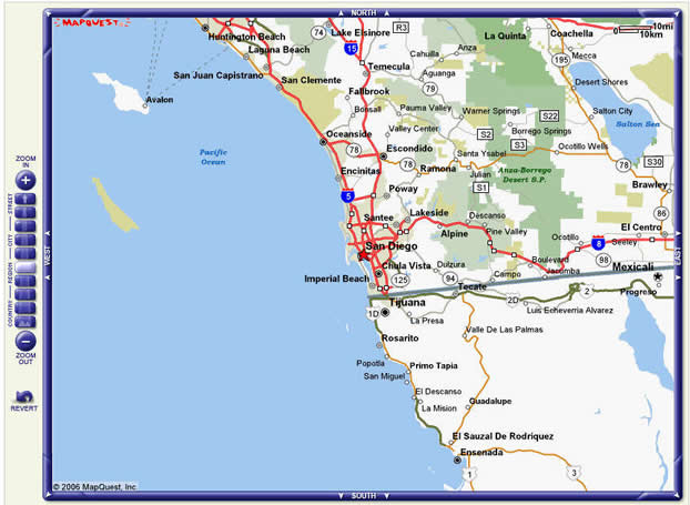
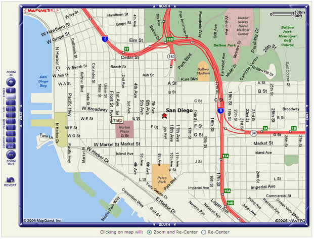
What are the differences between the three map examples? Different [Scale]? The level of geographic details? What kinds of items are more visible in alarger scale (1:5000)? What kinds of items are more prominent in a smaller scale (1:250,000)?
(Why the 1:5000 is a larger scale comparing to 1:250,000?)
Scale dependence in Relationship? (e.g. population density, housing prices, etc)
- Housing prices: San Diego Zipcodes vs. California Counties vs. 50 States in U.S.
- Geographic information can be used to solve both scientific questions and practical application problems. With a single collection of tools, GIS is able to bridge the gap between curiosity-driven science and practical problem-solving. (what is the purpose of science?)
- Science problem: How does the Earthquakes happen? (Scientific theories and methods).
- Practical Problem: Where ? How to reduce the damaged of the Earthquakes in San Diego?
- Timescale: The solution methods of geographic problem can be categorized as operational, tactical, and strategic decisions(What are the differences between operational, tactical, and strategic decisions?)
- Operational Decisions: What do you want to eat tonight? (Daily)
- Tactical Decisions: Weekly or Monthly dinning-out cost should not exceed $300. (short-term).
- Strategic Decisions: Become more healthy by eating "good" food for the next 10 years. (long-term)
The Intent of science: The intent for the advancement of human understanding of the world.
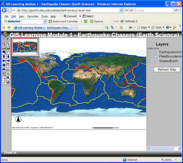
http://geoinfo.sdsu.edu/website/SanFrancisco/viewer.htm
e.g. Wildfires in San Diego. What are the operational, tactical and strategic decisions?
Unit #1.2
Unit 1: Questions: Blackboard URL: https://blackboard.sdsu.edu/
1. Terminology #1:
Spatial is Special
Geographic refers to the Earth’s surface and near-surface (p.11)
Spatial refers to any space --- other planets, human body, DNA, atoms, galaxy, etc. (Google SKY view demo).
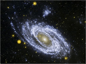
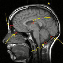
(image source: http://www.jpl.nasa.gov/wallpaper/index.cfm
& http://code.ucsd.edu/Images/brain-1.jpg )
Geographic + Spatial = Geospatial (?) implying a subset of spatial applied specifically to the Earth’s surface and near-surface.
Discussion: (Why use the new term?) What's the advantages and disadvantages of using the new term "Geospatial"? Which term do you like? "geography" or "geospatial"?
2 Data-Information-Knowledge transformation (text book)
- Data: Raw facts, context-free, database
- Information: digitized, intepretative facts, can be used for analysis
- Evidence: multiplicity of information (facts)
- Knowledge: understand the reason/logistics by the "knower"
- Wisdom: impossible to share with others, top level of a hierarchy of decision-making framework.
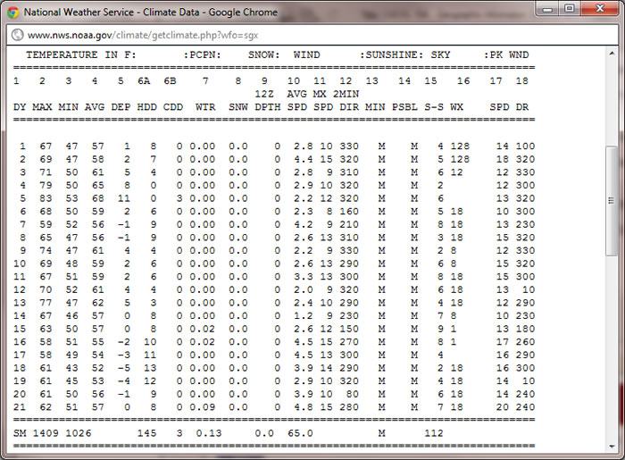
Examples: Global Warming Effect (note: Pseudo data used in this example)
Data: collect annual temperature at San Diego from 1990 to 2006 (create a databases) (54, 55, 53, 56 …… 57)
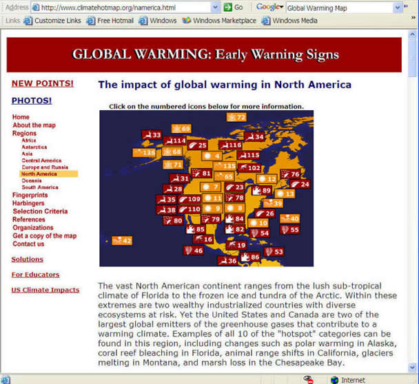
Information: convert the raw data into a Graphic bar chart from 1990 to 2004
Evidence: collect other city’s annual temperature (New York, Chicago, Dallas, Tokyo, London, etc.) All cities indicate an increase of annual temperature.
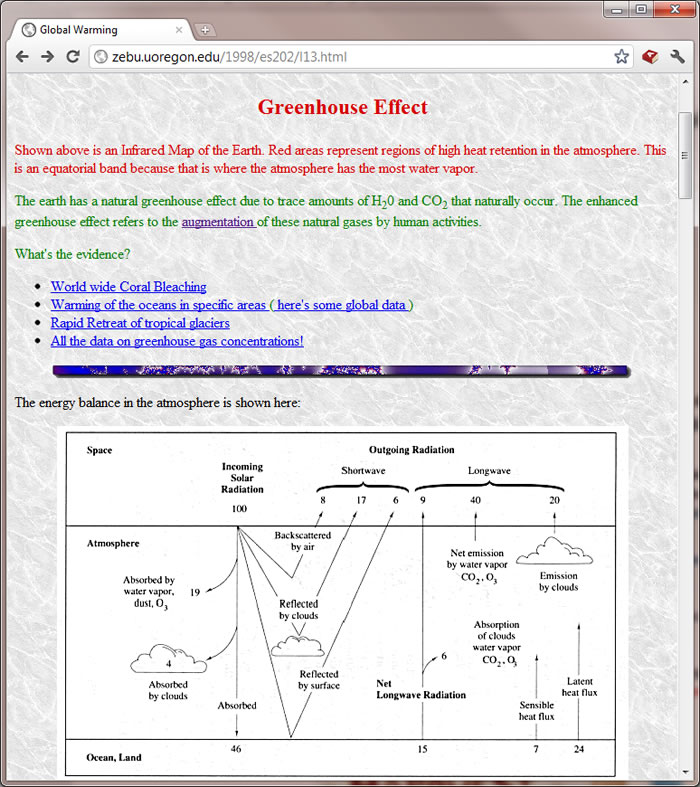
Knowledge: Why did the temperature increase? The increase of CO2, the balance of solar energy, etc.
Wisdom:Decision makers can make laws to reduce the production of CO2 and also balance the economic growth.
Data
http://www.nws.noaa.gov/climate/index.php?wfo=sgx
Information
http://www.climatehotmap.org/index.html
Knowledge
http://zebu.uoregon.edu/1998/es202/l13.html (Greenhouse Effect )
3. Terminology #2:
GIS or GISystems: Geographic Information Systems (tools, software, hardware).
- Emphasis on technology and tools
GIScience: Geographic Information Science (Scientific research domain).
- Used by Michael Goodchild in 1990.
- Fundamental issues raised by the use of GIS and related technologies (e.g. Spatial Representation, Spatial Modeling, Spatial Analysis, Map Projections, Accuracy, and Scientific Visualization). I am a GI Scientist. http://en.wikipedia.org/wiki/STEM_fields
GIStudies: Geographic Information Studies
- Systematic study of the use of geographic information
GIServices: Geographic Information Services (Web-based services).
Geographic Information Systems (GIS)
GIS solves the problem of combining general scientific knowledge (classification, rule sets, modeling) with specific information (local GIS databases) and gives practical value to both.
Many geographic problems involve multiple goals and objectives, which often cannot be expressed in commensurate terms. (Longley, et al. p. 16).
Everyone has their own favorite definition of a GIS.
- Container of maps (general public)
- Computerized tools for solving geographic problems
- Spatial decision support system
- Mechanized inventory of geographically distributed features and facilities
- Methods for revealing patterns and processes in geographic information
- Tool to atuomate time-consuming tasks.
The six component parts of a GIS: (from a community perspective)
- Network (link)
- Data (contents)
- Software (tools)
- Hardware (tools)
- People (key elements)
- Procedures (project managements)
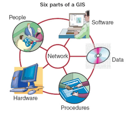
Which component is most expensive?
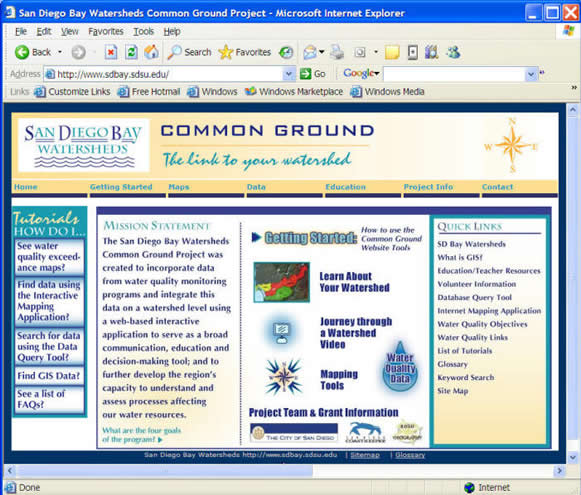
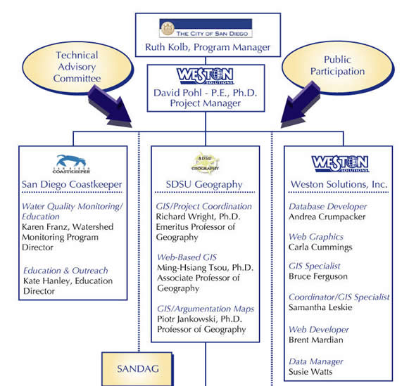
A GIS project Example (San Diego Bay Watershed Common Ground Project)
GIS Functional Perspective (GIS has five elements):
- Data Input
- Dagtabase/Information Storage
- Information Analysis
- Data/Information Sharing
- Information Output

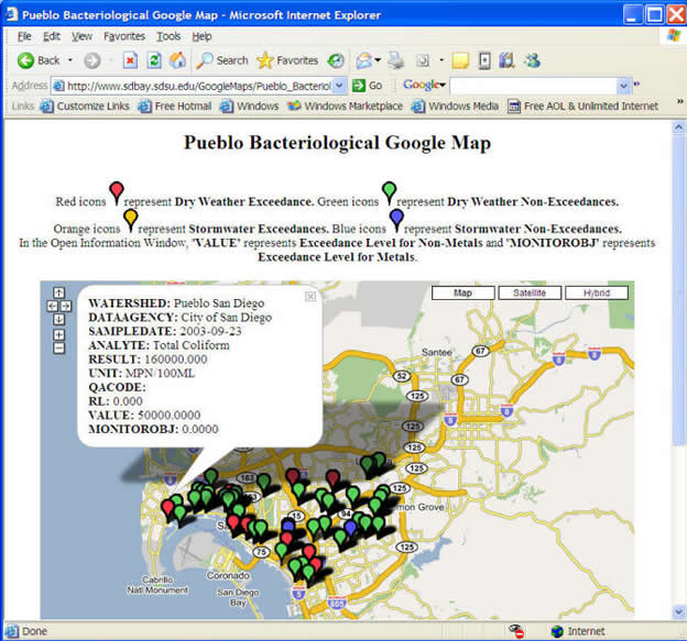
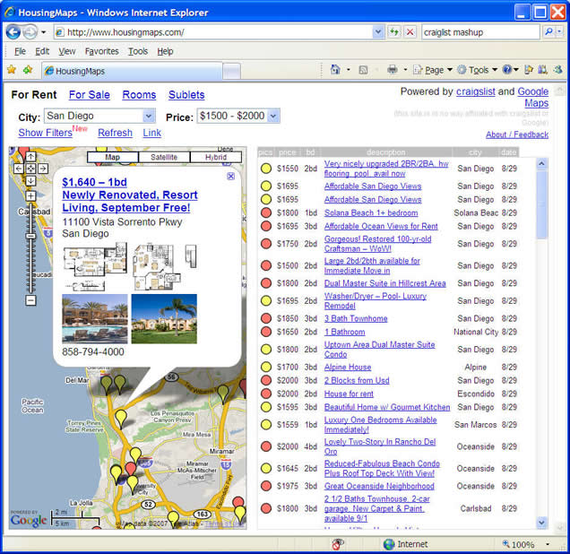
Information Output examples: Google Mash-up Maps:
http://www.sdbay.sdsu.edu/maps/exceedance.php
CraigList example: Housing Maps: http://www.housingmaps.com/
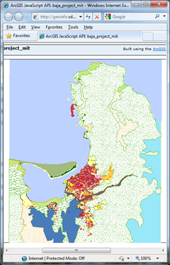
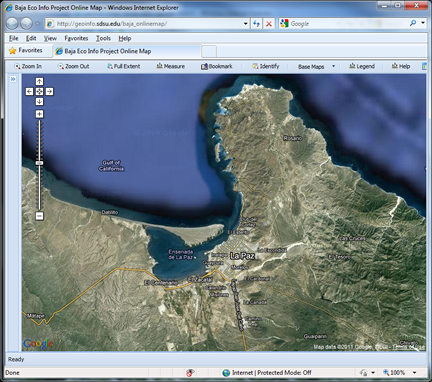
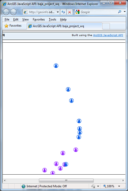
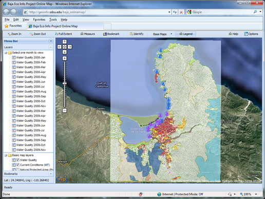
Baja Eco Info Project http://geoinfo.sdsu.edu/baja/
4. What is Geographic Information? Why is it important?
GI is Special.
- Almost all human activities and decisions involve a geographic component
- Working with geographic information involves unique, complex and difficult choices
- Multidimensional
- Different levels of spatial resolution (scale)
- Requires projection to flat surface
- Unique analysis methods
- Analysis are require data integration
- Data updates are expensive and time consuming
- Map displays require fast data retrieval
Geographic Information is a special class of information: Comparing to tabular information, graphic information, numbers, texts, etc.
Over 50% of information contains "geographic" or "spatial" meanings:
Your home address: 888## Lake Murray Blvd, San Diego, CA 92142.
Your phone number: (619) 123-4567. ---> Where? (Try to use Google (www.google.com) to search for your home phone number...)
Your tuition fee (In-state vs. out-of-state status).
Any more?
Your IP Address: http://map.sdsu.edu (http://130.191.118.251)
When and where did you use your credit card? (Why?) (If you spend $5000 tomorrow at a New York Shopping Mall with your local address at San Diego, you might get a warning phone call from the Credit Card Company.) --- Geographic Information can be explicit or inexplicit!
"Almost everything that happens, happens somewhere. Knowing where something happens can be critically important". (Longley, etc., p. 4)
(Why Important?)
- Geographic Information can SAVE MONEY!
- Geographic Information can SAVE TIME!
- Geographic Information can SAVE LIVES!
Geographic Information can SAVE MONEY!
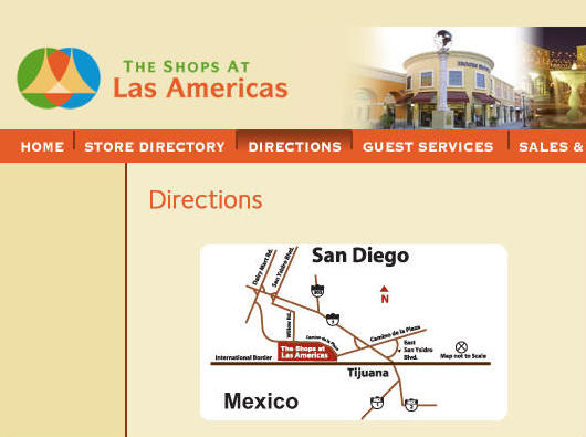
Example 1: Building a BIG shopping center.
"A definitive design for big shopping centers is never carved in stone prior to completion—and even after completion, there is no standard design. Each project has a life of its own, evolving and being shaped as each new retailer signs a lease, purchases property to build or seeks space for expansion. ....
......
If a GIS is built at the onset of the project, however, it can provide a wealth of intelligence to owners and managers. Armed with this valuable data, developers can pinpoint solutions scientifically, communicate more effectively with suppliers, save money and improve overall efficiency." by Bill Dougherty http://www.woolpert.com/asp/articles/Endless_Possibilities.asp (this link is no longer valid).
The location of the [Las Americas] Outlet (Shopping Mall)
Geographic Information can SAVE TIME!
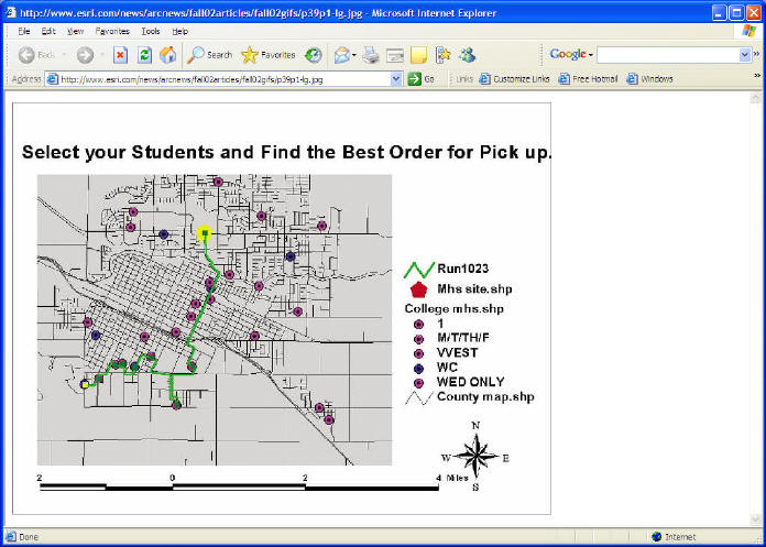
Example 2: Create a Shortest School Bus Routing.
"We wanted a program where we could have 'hands-on' in setting up the routing for several reasons," "For one, medically fragile children need to go home first, even if they are the last person on the route. We needed to be able to interact with the program and do our own 'connecting dot to dot' or setting the order of students." -- Merle Jewett, California, School District Uses GIS for Special Education School Bus Routing. (from On-line ArcNews).
http://www.esri.com/news/arcnews/fall02articles/merced-school.html
Geographic Information can SAVE LIVES!!!
Example 3: The First Few Minutes – GIS Can Help Save Lives (By Vicki Schmidt)
http://www.state.me.us/newsletter/oct2004/first_few_minutes_.htm
(E-911: Enhanced 911 Services)
https://www.fcc.gov/general/enhanced-9-1-1-wireless-services
The wireless E911 program is divided into two parts - Phase I and Phase II. Phase I requires carriers, upon valid request by a local Public Safety Answering Point (PSAP), to report the telephone number of a wireless 911 caller and the location of the antenna that received the call. Phase II requires wireless carriers to provide far more precise location information, within 50 to 300 meters in most cases.
Discussion: The REVERSE 911 Service during San Diego 2007 Wildfire...
Does it work? REVERSE 911? http://www.cassidiancommunications.com/reverse-911
REVERSE 911® is a communications solution that uses a patented combination of database and GIS mapping technologies to deliver outbound notifications. http://www.cassidiancommunications.com/reverse-911
Problems: IP phones and cellular phones... (So ? You need to register your cellular phone with your LOCATION!)
AlertSanDiego: http://www.readysandiego.org/alertsandiego/
What is WEA? Wireless Emergency Alerts(provided by National Weather Services)
Wireless Emergency Alerts (WEA), formerly known as the Commercial Mobile Alert System (CMAS), and prior to that as the Personal Localized Alerting Network (PLAN)),[1] is an alerting network in the United States designed to disseminate emergency alerts to mobile devices such as cell phones and pagers. cited from Wikipedia, 2018 https://en.wikipedia.org/wiki/Wireless_Emergency_Alerts
![]()
http://www.readysandiego.org/wea/
https://www.youtube.com/watch?v=gC7pvCIb4-g
5. What is the FIELD of Geographic Information Science?
Geographic Information Science is a big umbrella, which covers many topics....
- GIS (Geographic Information Systems)
- Cartography
- Remote Sensing (and Satellite Imagery)
- GPS (Global Positioning Systems)
- Spatial Statistics and Spatial Modeling
GIS (Geographic Information Systems)
ARJIS (San Diego Crime Mapping Project).
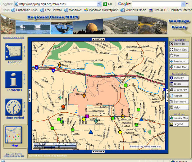
https://www.crimemapping.com/map/location/San%20Diego
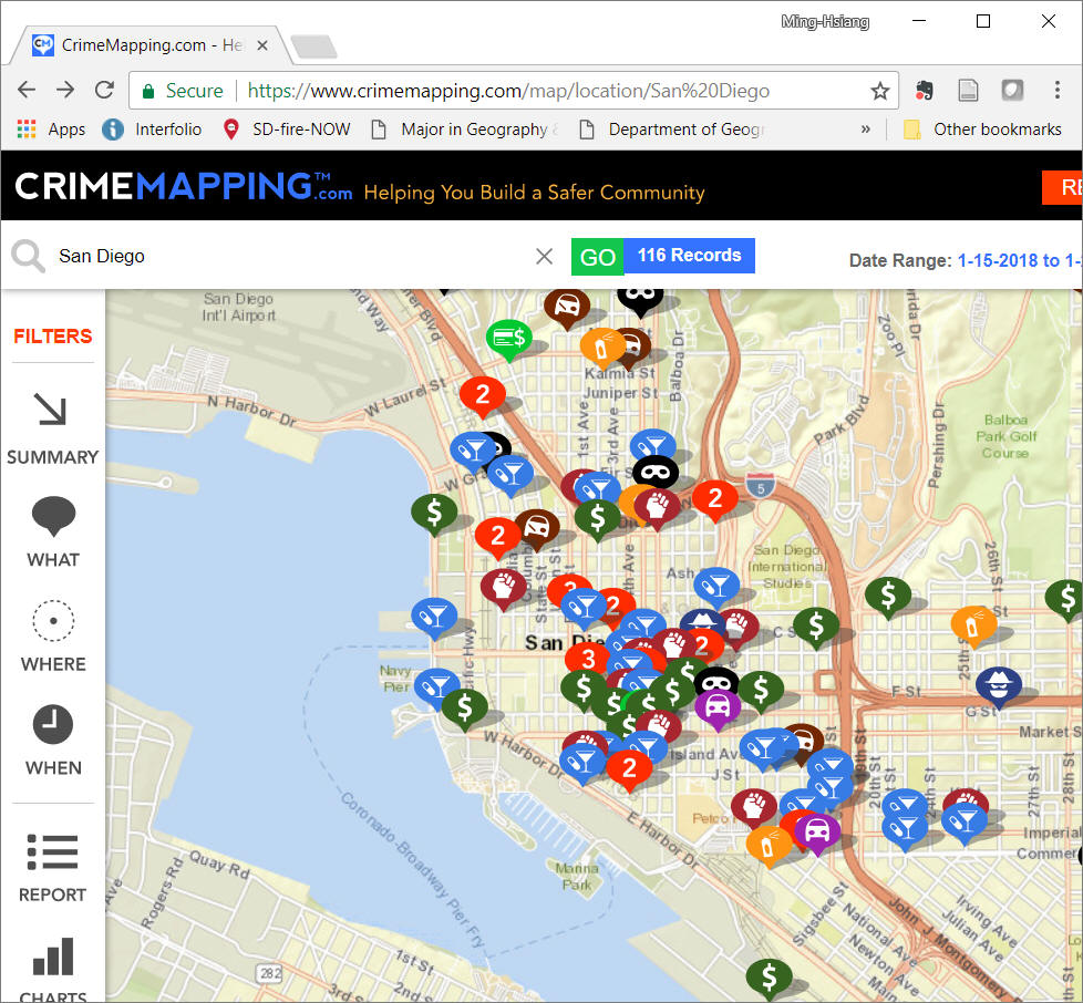
Historical Crime Data in San Diego: San Diego Regional Data Library http://www.sandiegodata.org/
Do you know which street or location has the highest crime records in San Diego?
Cartography (Map Design)
Remote Sensing:
http://rst.gsfc.nasa.gov/Intro/Part2_1a.html (Remote Sensing Tutorial)
 (image source: Nicholas M. Short, Sr., The Remote Sensing Tutorial, http://rst.gsfc.nasa.gov/Intro/Part2_1a.html )
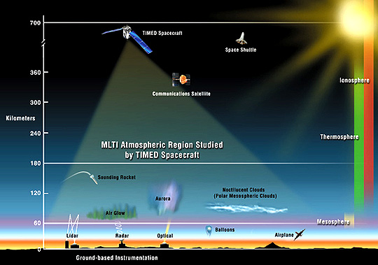 (image source: Nicholas M. Short, Sr., The Remote Sensing Tutorial, http://rst.gsfc.nasa.gov/Intro/Part2_1a.html )
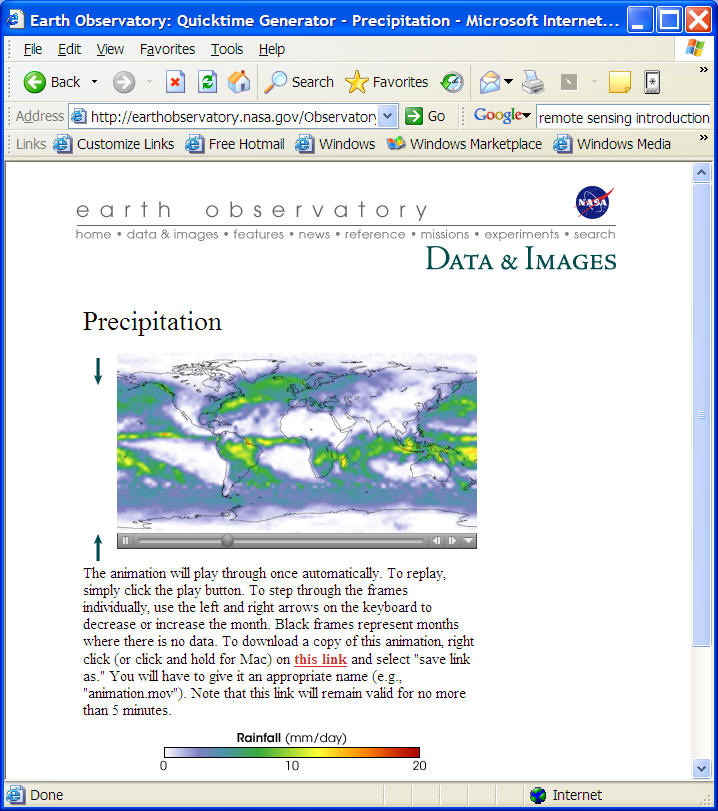
http://earthobservatory.nasa.gov/ (NASA Earth Observatory Systems Website).
http://earthobservatory.nasa.gov/Study/GreenRoof/ (Examples)
http://earthobservatory.nasa.gov/Observatory/Datasets/rainfall.gpcp.html (Create animation for Rainfall). (You need to enter both the months and years info to create a movie).
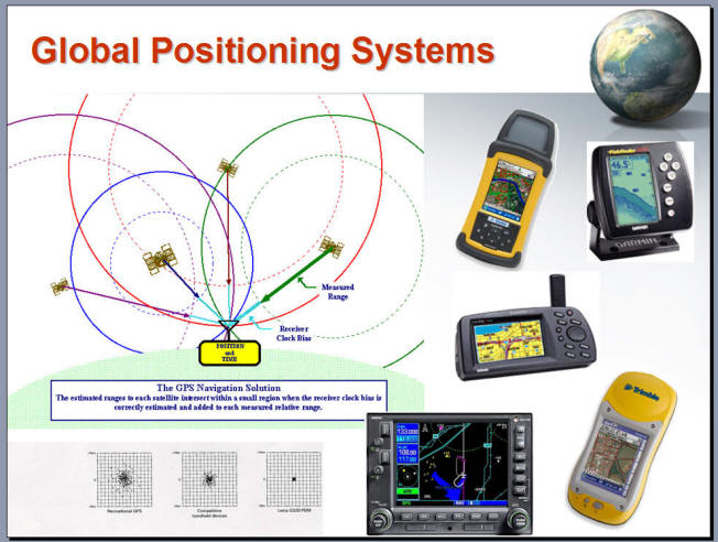
GPS (Global Positioning Systems)
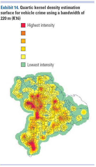
Spatial Statistics and Spatial Modeling
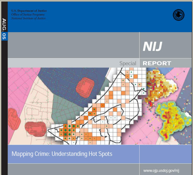
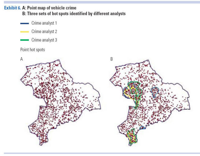
Crime Mapping http://www.ncjrs.gov/pdffiles1/nij/209393.pdf
Geodemography (target marketing)
ESRI Zipcode lookup: http://redlandsbaoapp1.esri.com/ZipCodeLookup/
ESRI Tapestry Segmentation http://www.esri.com/landing-pages/tapestry
Unit 1: Discussion (In Class Exercise #1):
(Paper) Please describe one example of "inexplicit" geographic information from a physical or virtual item (such as phone number, ip address, credit card, a toy box, a TV show, a pen, etc.) used in your daily activities.
Kahoot Exercises (Please use your RED-ID to Enter the Game!) The Red-ID record will be used for your participation records in lecture.
