GEOG 581: Cartography Design
![]()
![]()
![]()
![]()
![]()
![]()
Maplex Labeling Techniques and Functional Maps
![]()
LAB-4, created by Dr. Tsou, 10 points
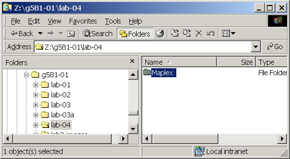
The first step is to create a "lab-04" folder in your Z: g581-## folder.
Copy the maplex folder from the Z:data/ folder into your lab-04 folder.
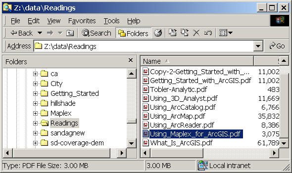
Open the "Using_Maplex_for_ArcGIS.pdf." Start to read the Chapter 1.
Following the Chapter 2 "Quick-start tutorial" and completed the exercise of chapter 2. (from page 7-34).
Save your final maps as "Lastname-parcel.mxd" in the lab-04 folder.
The next step is to create a SDSU campus map by using the techniques you just learn from the maplex tutorial.
Copy the "sdsucampus" folder from the "z:data" into your lab-04 folder.
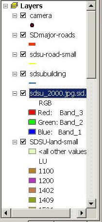
Open a new ArcMap and add the following GIS layers into your ArcMap.
| camera: The location of video camera in our campus. (Add the label of camera | |
| SDmajor-roads: San Diego County's major roads (including name of roads) | |
| sdsu-road-small: more detail roads in SDSU campus. | |
| sdsubuilding: SDSU building's blueprint (lacking building names) | |
| sdsu_2000.jpg.sdi: SDSU aerial photo (taken in 2000). (You need to change the display of RGB to Red: Band 3, Green: Band 2, and Blue: Band_1.) | |
| sdsu-land-small: SDSU landuse (clipped from the SANDAG data, the code of land use (LU) can be found at the SANDAG website: http://www.sandag.org/resources/maps_and_gis/gis_downloads/downloads/codes/Land_Use_Codes.html |
![]()
Designing a Functional Map
Now, let's assume we were in the 1980s (as in the communication paradigm). Your major task is to create a "functional SDSU campus map" to show a readable "sdsu-road-small" labels and the location of campus camera (with TEXT label).
The first step is to describe the purpose of your map. Try to write a paragraph about the purpose of your campus map (it could be a map for a new student orientation, or a map for facilitate management workers, or a map for a campus police). Give a specific description of your campus map and identify their major "functions". (This will be the first question of the on-line forum).
The second step is to start the design of your map. Try to use different techniques from Maplex to improve the labeling of streets at our campus and the labeling of camera location. Also please feel free to change the layers, transparency and other cartographic setting for your map.
The following three layers must be presented in your campus map with appropriate labeling and symbols.
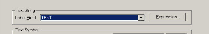
1. Labeling Camera Layer: (Select TEXT for label Field)
2. Labeling sdsu-road-small: (select STREET_NAM).

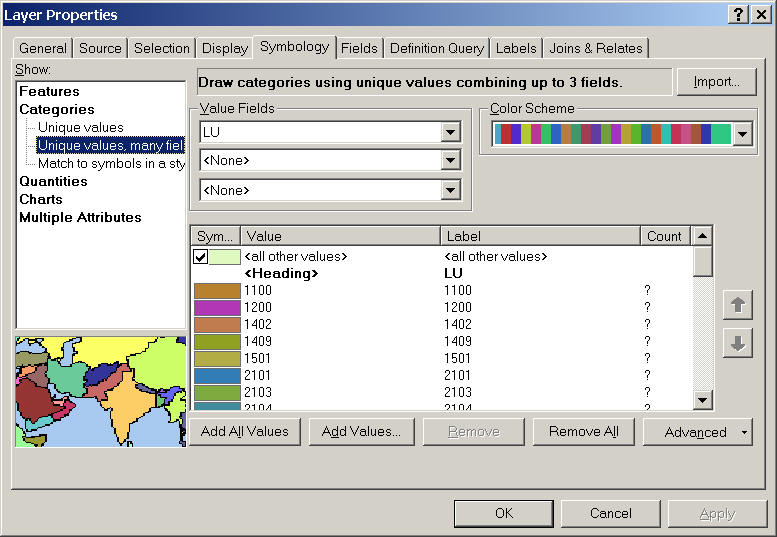
3. For SDSU-land-small, adopt "LU" as the value field for unique values symbols.
Besides the three required layers, please feel free to change or adjust your ArcMap based on your map purpose. You can also add pictures, texts, or explanation about your campus maps. When you finish the design of your map. Save the final map as "lastname-lab04.mxd" into the lab-04 folder, and also export your map to a PDF file "lastname-lab04.pdf". We will show your map to the class members next time. Finally, print out your PDF map from the LittleCesar Laser printer.
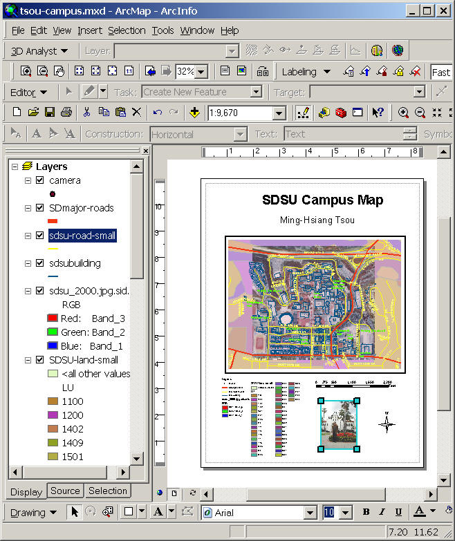
( This is an example of SDSU campus map... but I think it is a bad example... so try to design a better one for your exercises.)
The printed map and the PDF map will have 5 points. The grading will focus on the how well your labeling techniques for the street maps and the camera location. How readable of your street labels? Also, the overall design issue of your map (completing elements? Title, legends, scale....) will be considered.
![]()
Please use on-line forum to answer the following questions (5 points)
|
Write a paragraph about the purpose of your campus map (it could be a map for a new student orientation, or a map for facilitate management workers, or a map for a campus police). Give a specific description of your campus map and identify their major "functions". |
|
Now, let's use a cognitive science aspect to analyze your campus. Write a discussion about How your campus map works? (from an information-processing view. (Using David Marr's four stage of vision). For example, when a police saw this campus map --> stage 1...--> stage 2:....--> stage 3:..... --> stage 4:...... (Describe more details as possible). |
|
Explain what is the "figure" in your campus map? What is the "background" in the map? What kinds of mapping techniques or cartographic variables you applied in the design to make figure/ground effects in your campus map? Do you satisfy the result? WHY or WHY not? |
|
What is "reference scale" in ArcMap setting? Did you use it in your campus map? WHY or WHY not? |
![]()
Web-powered by: MAP.SDSU.EDU