GEOG 581: Cartography Design
![]()
![]()
![]()
![]()
![]()
The Future of Cartography
![]()
Read Slocum's chapter 24 and 25.
(Class evaluation questionnaire at the end)
![]()
Ongoing Development
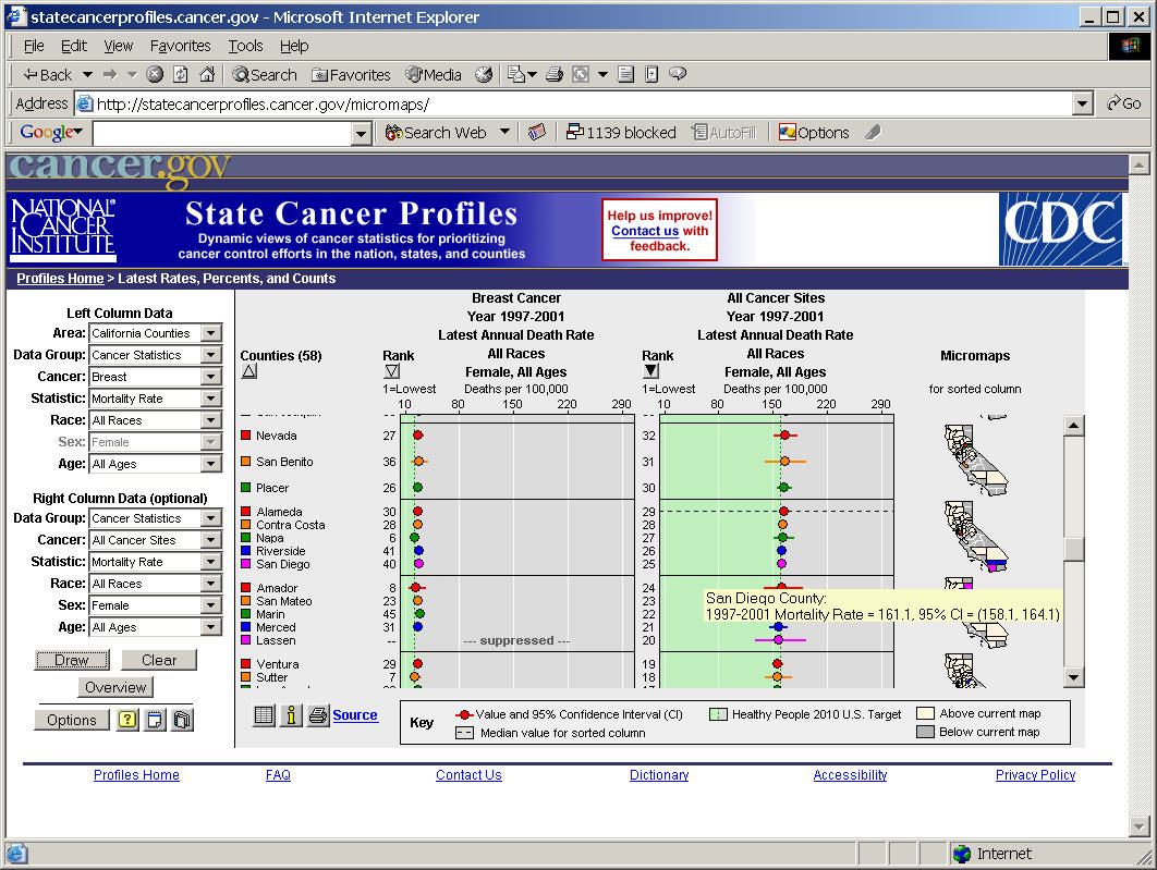
1. Link to statistical plots.
Linked micromap plots (LM plots) -- a series of small maps (micromaps) focus on local pattern perception.
http://statecancerprofiles.cancer.gov/micromaps/
Conditioned choropleth maps (CCmaps): http://www.galaxy.gmu.edu/~dcarr/ccmaps/ ,
more reference: http://www.quantlet.com/mdstat/scripts/csa/html/node84.html
2. Link to Sounds (Abstract or Realistic sounds)
Realistic sounds are like "oceans", "bird sounds", "animal movement"... (use computer games examples).
Abstract sounds are not clear meaning... but provide some feedback to the map readers.
http://soundscapes.geog.ucsb.edu/
Video example: John Ryan's Ph.D. thesis example [Video].
3. Link to Other sensors (touch, smell, or others).
4. Link to multiple users at the same time (collaborative geovisualization).
Nick Hedley with his Augment Reality work. http://www.sfu.ca/geography/people/faculty/Faculty_sites/NickHedley/index.htm
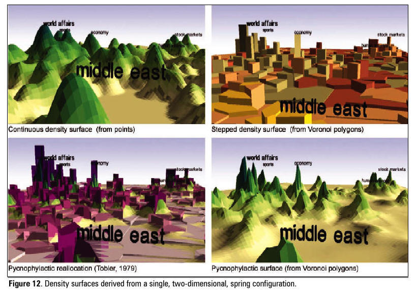
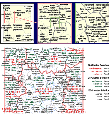
5. Link to Information Landscape (Information Visualization or Spatialization)
Spatialization of articles (using spatial or geographic metaphor). Andrew Skupin and Sara Fabrikant (2003).
Skupin A. and Fabrikant, S.I. (2003). Spatialization Methods: A Cartographic Research Agenda for Non-Geographic Information Visualization. Cartography and Geographic Information Science, vol. 30, no. 2, 95-119.
http://www.geog.uno.edu/~askupin/
Skupin, A. (2004) A Picture from a Thousand Words. Computing in Science and Engineering. 6 (5): 84-88. (PDF - 1.3 MB)
6. Link to Knowledge Discovery and data mining.
| http://www.ccg.leeds.ac.uk/spin/documents/eogeo2000.html | |
| CommonGIS system was created as a result of joint efforts of the
whole CommonGIS consortium (http://commongis.jrc.it/). |
![]()
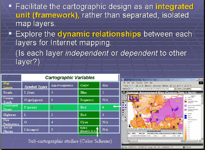
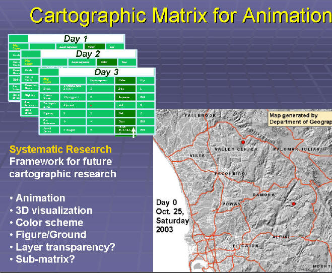
Create a Unified Framework for Cartography?
Cartographic Matrix
AAG abstract 2004
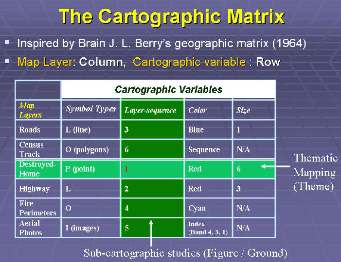
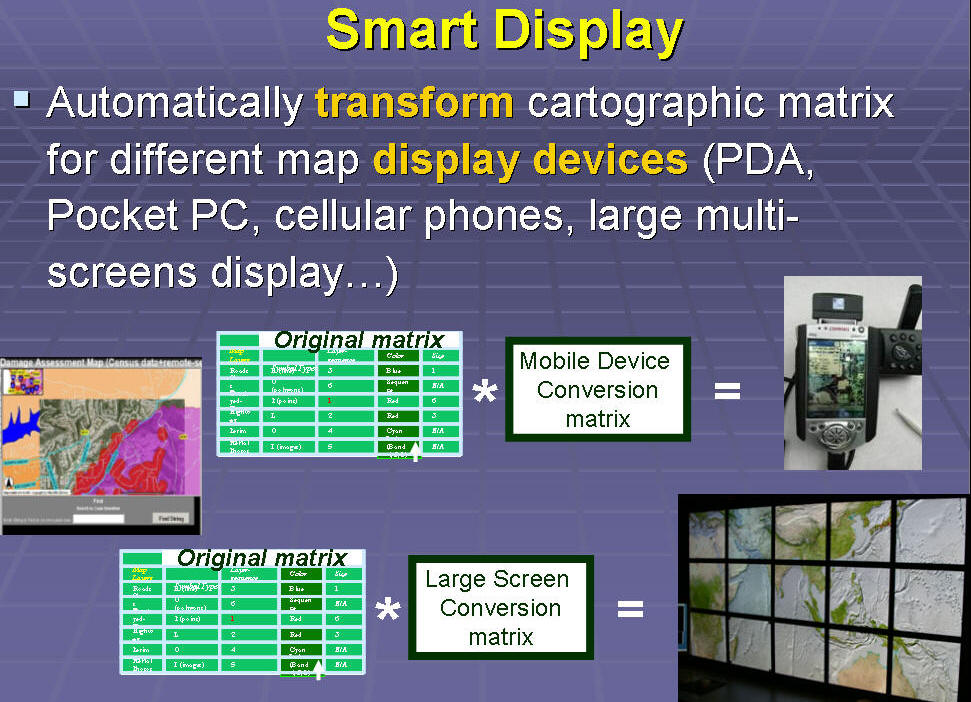
Research Questions:
1. What is the minimum layer unit for cartographic design?
One data object vs. One Layer ?
| Roads + Roads labels (one data object has two layers) | |
| Census Track Population Density (one data object has multiple color layers)Roads (class 1, class 2, class 3). | |
| (What is the “atom” in map layers ?) |
2. How many different cartographic variables should be included for cartographic matrix?
Can we create a universal framework for the study of cartography? (Chemistry with the Periodic Table?)
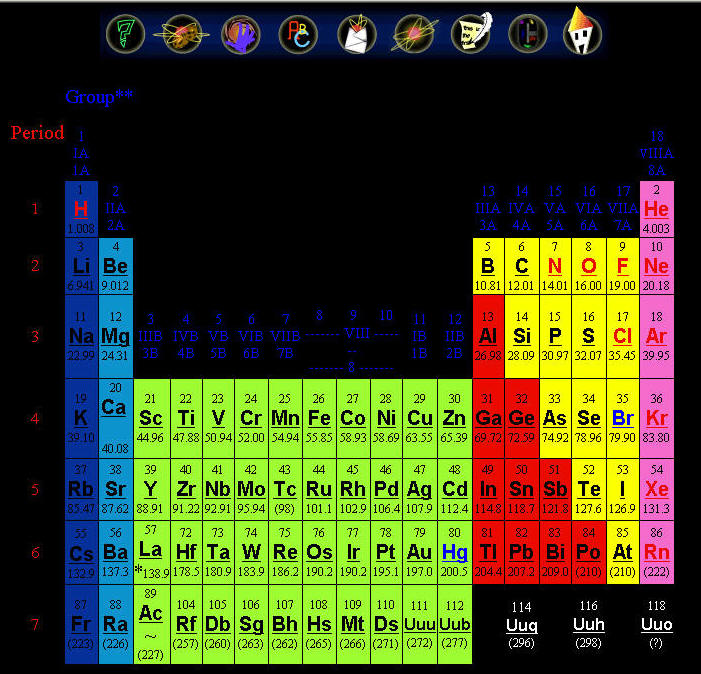
(pictures from the http://pearl1.lanl.gov/periodic/default.htm Los Alamos National Laboratory's Chemistry Division
![]()
Group Project Presentation 2:00pm-4:40pm
![]()
|
2:00-2:20pm: Group 1. Visualization of change of population in San Diego County (Ken, Fred, Tod) | |
|
| |
|
2:20-2:40pm: Group 2. Relocation of the San Diego International Airport (Rosanna, Addie, Lauren, and Pillip) | |
|
| |
|
2:40-3:00pm: Group 3. Misrepresentation in Census Data Mapping (Erica, Ahmed, and Merrilee). | |
(5 minutes break?)
|
3:05pm-3:25pm: Group 4. The El Capitan Reservoir General Reference Site (Jing-Yi, Phillip, and David) | |
|
| |
|
3:25pm-3:45pm: Group 5. Trails of Yosemite National Park (Asia, Andy, and Jennifer) | |
|
| |
|
3:45pm-4:05pm: Group 6. San Diego Trolley (Matt and Alvaro). | |
![]()
Web-powered by: MAP.SDSU.EDU