![]()
Please redirect to our NEW Server for the Most updated informatio
Http://maps.telascience.org
(If you are accessing within SDSU network, you need to use the above URL. If you are accessing outside the SDSU network, just type http://map.sdsu.edu it will automatically reroute you to our new server).
![]()
(OLD VERSION)
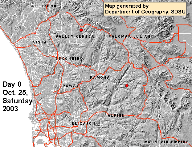
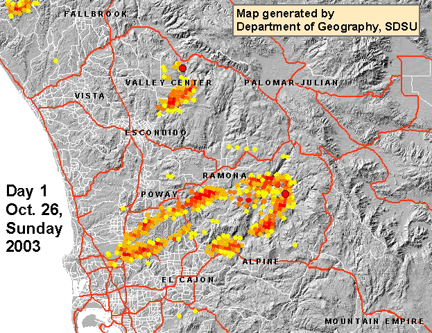
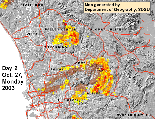
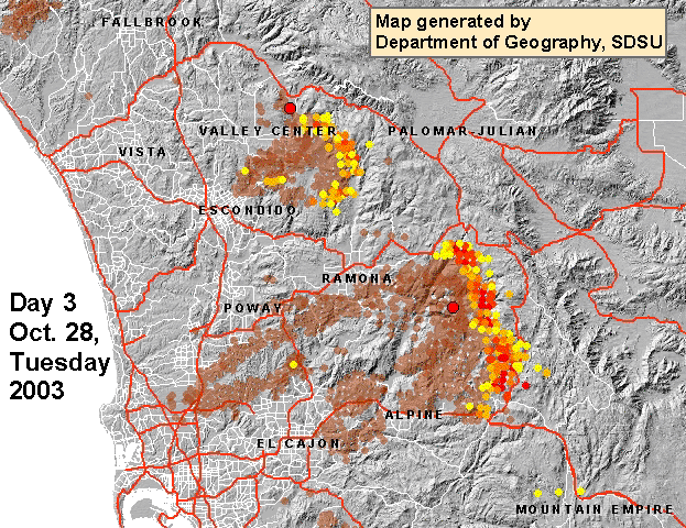
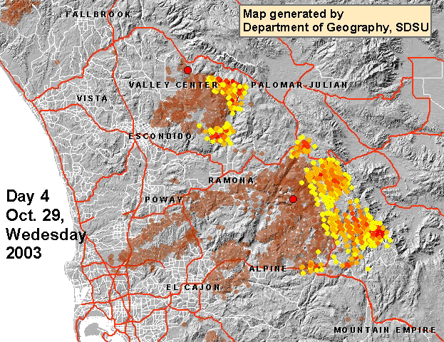
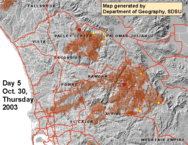
(Any media or persons are welcome to reproduce or redistribute these maps and information by acknowledging the map producers and the Department of Geography, San Diego State University.)
This website is maintained by Dr. Ming-Hsiang Tsou (Ming Tsou). mtsou@mail.sdsu.edu (http://map.sdsu.edu/tsou)
If you have new
wildfire mapping information to share, please contact
"Cristiano Giovando" <giovand@gmail.com>.
Cristiano will update this website tomorrow. --- Ming, Oct.
22, 2007. 11.50pm.