Derived GeoData (SDSU)
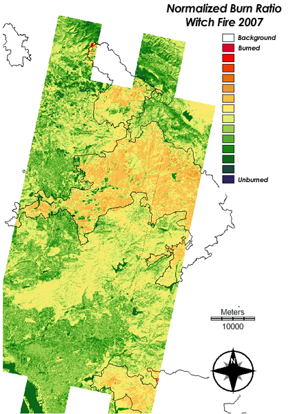
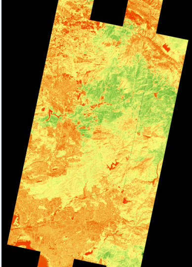
- Normalized Burn Ratio Index from EO-1 ALI
(30m)
 NBR_ALI_10262007.zip
(4mb JPEG)
NBR_ALI_1026.zip
(12mb TIFF) created by
Christopher
Lippitt and Doug Stow.
NBR_ALI_10262007.zip
(4mb JPEG)
NBR_ALI_1026.zip
(12mb TIFF) created by
Christopher
Lippitt and Doug Stow. -
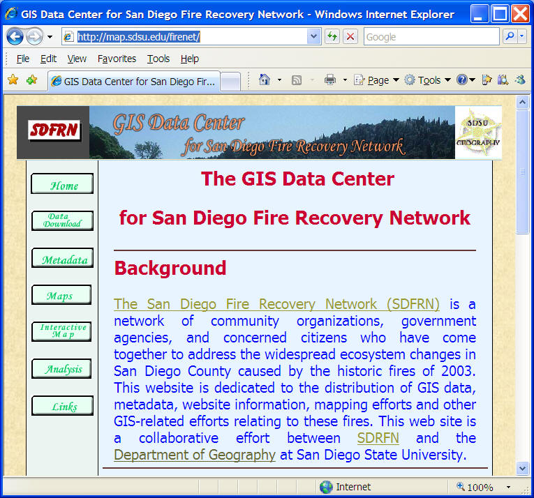
2003 GIS Data
The GIS data portal (2003) for San Diego Fire Recovery Network (SDFRN). SDSU Geography Department was collaborating with San Diego Fire Recovery Network (SDFRN) in 2003 to establish a GIS data center for San Diego Wildfire Recovery and Management. The GIS data center includes downloadble data (shapefiles and coverages and metadata) for San Diego 2003 Wildfires.
Web address: http://map.sdsu.edu/firenet
San Diego Public GIS layers:
- SANDAG GIS Data http://www.sandag.cog.ca.us/index.asp?subclassid=100&fuseaction=home.subclasshome
- SANGIS GIS Data Warehouse http://www.sangis.org/Download_GIS_Data.htm
- California Spatial Information Library CASIL http://gis.ca.gov/index.epl
- San Diego State University, Geography Department Data Collection: http://geography.sdsu.edu/Resources/data.html