All evacuation orders have
been lifted this morning 11:00am in San Diego County (Oct. 31).
Click Here to see the latest and last fire perimeter update and evacuation map
provided by County's EOC.
Official Government Links: (These websites include the most updated fire info and fire maps).
San Diego County Emergency Homepage http://www.sdcounty.ca.gov/dmpr/emer/index.html (This website will have the most updated fire perimeter maps).
City of San Diego Emergency Fire Information. http://www.sannet.gov/newsflash/firealert.shtml
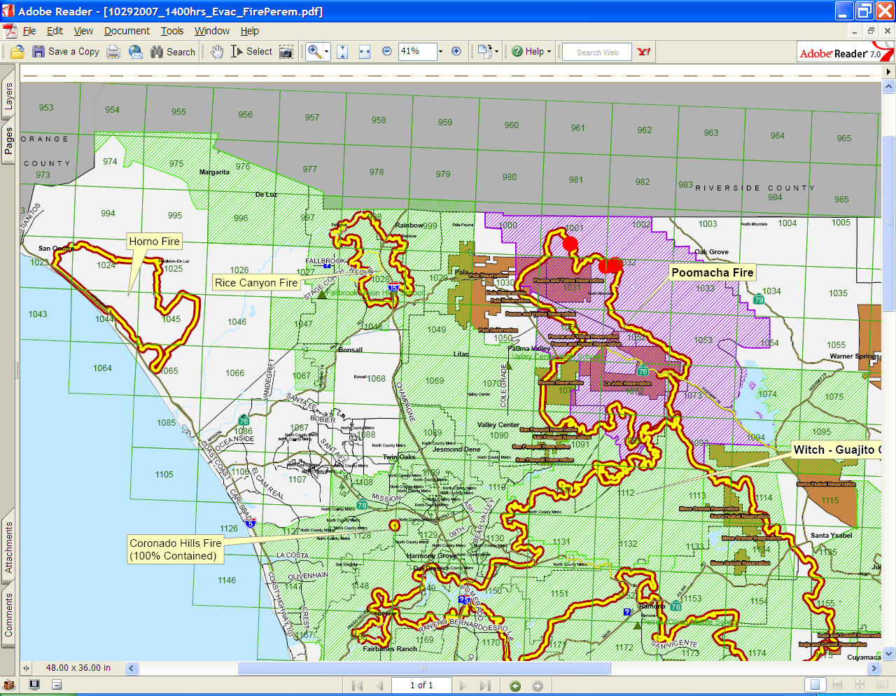
Archived Maps
(PDF download - duplicated copy from the San Diego County Emergency Homepage) created by EOC and SanGIS.
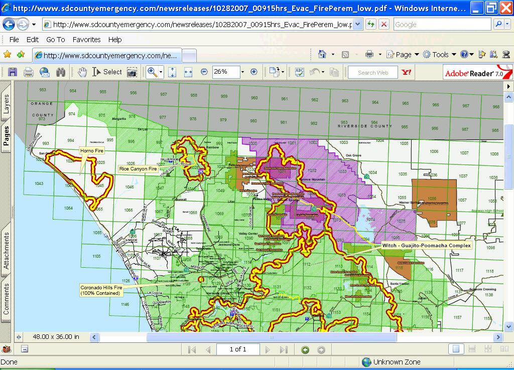
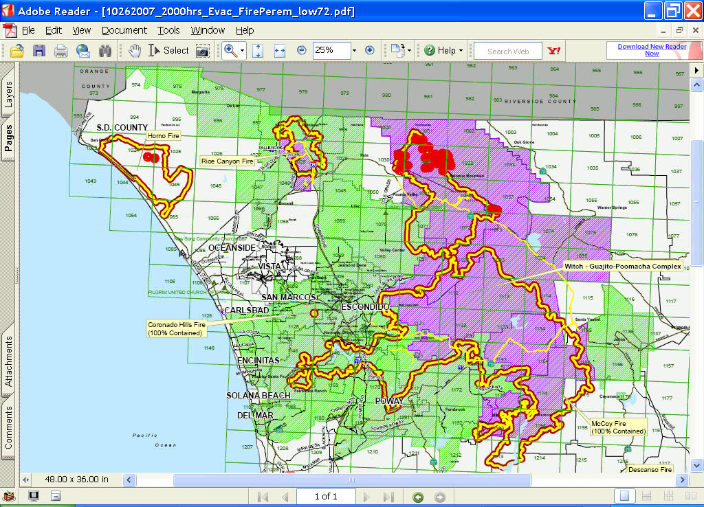
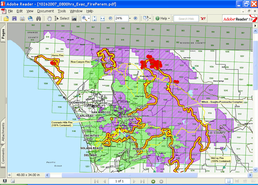
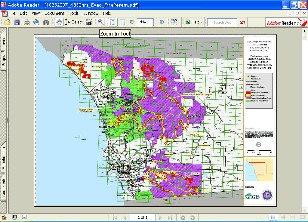
10-25-07 6:30 p.m. Updated Countywide Map Perimeter (created by SanGIS and OES). (PDF download - duplicated copy from the San Diego County Emergency Homepage)
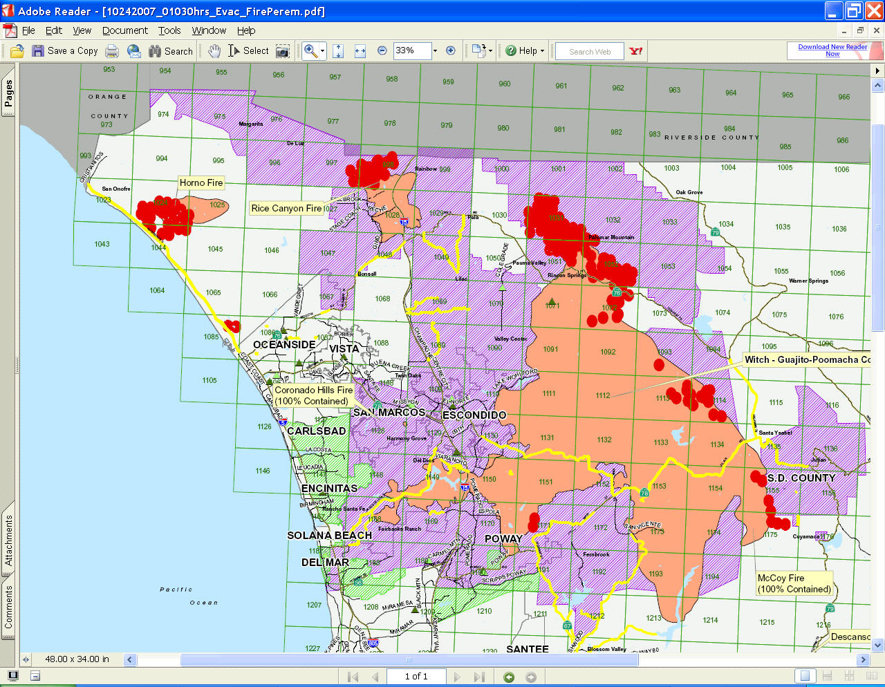
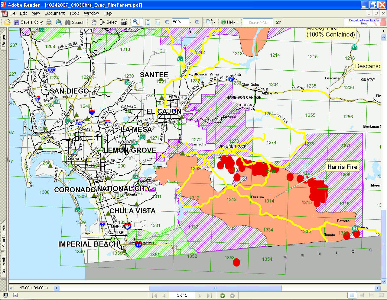
10-24-07 5:40 a.m. Updated Countywide Fire Map Perimeter (PDF download - duplicated copy from the San Diego County Emergency Homepage)
10-23-07, 11:06 p.m. Countywide Fire Map Perimeter (Download PDF maps).
Printable PDF maps
(created by GIS volunteer group)
Printable PDF maps with county-wide overview (1, 2) and active fires on topo sheets (Harris, Horno, Poomacha) (created by Andr'e Skupin).
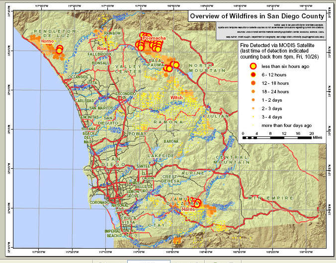
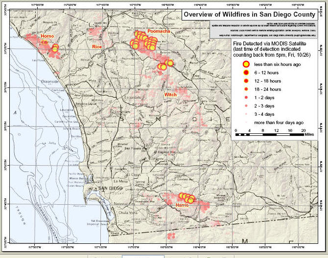
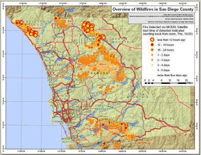
Overview of Wildfires in San Diego County (Printable PDF map) created by Andr'e Skupin.
Oct. 25, 2007
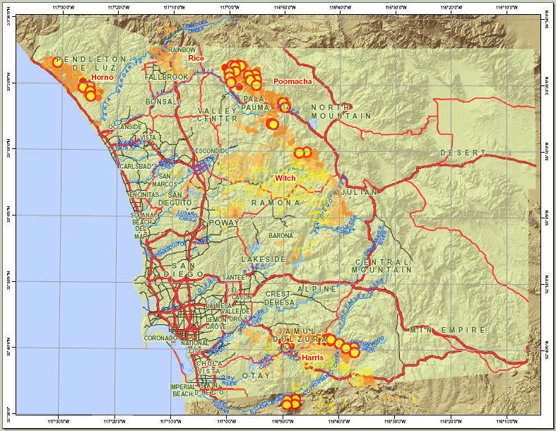
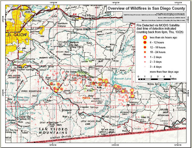
Oct. 24, 2007 - created by Andr'e Skupin.
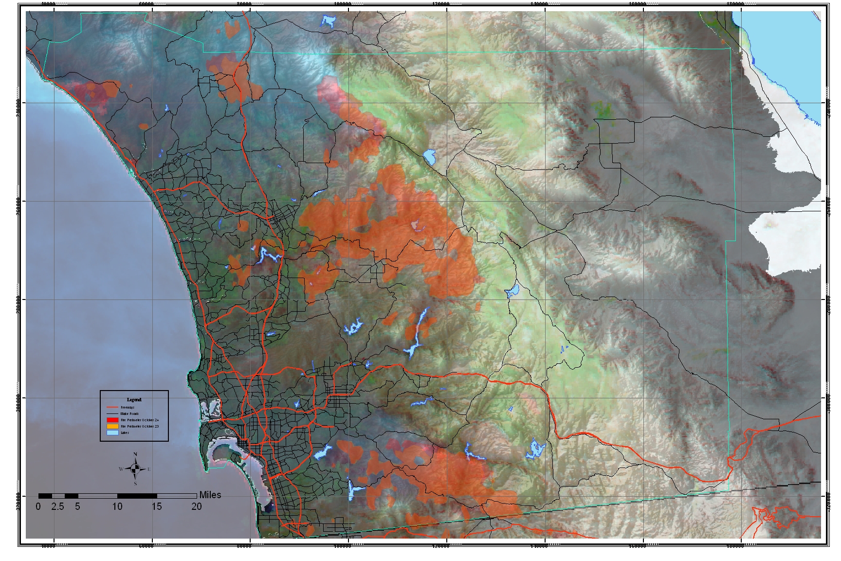
 FireMap_CountyOnTopo_10252007_1800PDT.pdf (as
above, but on topographic map 1:500,000)
created
by Andr'e
Skupin.
FireMap_CountyOnTopo_10252007_1800PDT.pdf (as
above, but on topographic map 1:500,000)
created
by Andr'e
Skupin.

FireMap_HarrisOnTopo_10252007_1800PDT.pdf (detailed
view of Harris fire, on topographic map 1:250,000)
created
by Andr'e
Skupin.
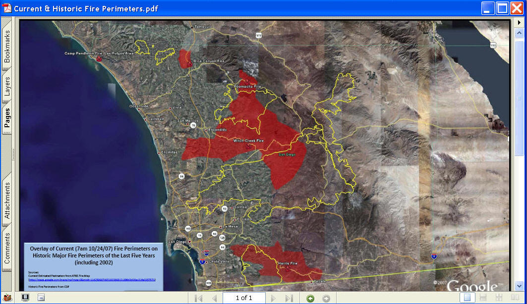
The following map is created by Dave McKinsey.
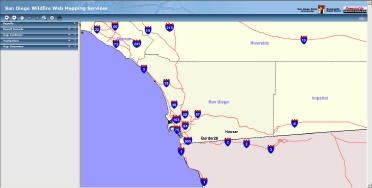
Automatic Wildfire Services for San Diego Region (ArcIMS 9.2 + 24x7 Scheduler) created by SDSU Geography Department. A prototype of automatic wildfire services for San Diego Area. The source of wildfire information is Geospatial Multi-Agency Coordination (GeoMac http://geomac.usgs.gov/) (crated by Tong Zhang)
(Note: The wildfire perimeters are updated daily. However, due to the delay of data integration process, sometime the display of actual wildfire perimeters may be delayed for three days.) The map viewer may take 5-10 minutes to launch at the first time.
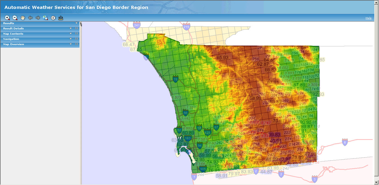
Automatic
Weather Services for San Diego Border Region (ArcIMS 9.2 + 24x7
Scheduler)
A prototype of automatic weather services (maximum/minimum temperatures,
wind direction/speed) for San Diego Area. The weather information is
extracted from National Weather Services National Digital Forecast Database
(http://www.weather.gov/ndfd/).
(crated by Tong Zhang)