GEO 583 Internet Mapping and Distributed GIServices
![]()
![]()
![]()
Unit TEN (Session One):
![]()
Virtual Reality and 3D Cartography
![]()
VISIT the SDSU VITal lab (Virtual Immersive Teaching and Learning) on 4/26 (Thur) at 9:30am.
Group Project Progress Report:
Group Project Progress Report:
Group 1: The SD Camping Guide
Team members: Jesus A. Tamayo, Caleb Bombaci, Richard Caslow.
Group 2: Pups Who Brunch - San Diego
Team member: Melanie Lopez (Coordinator), Haihong Huang, Fali Field
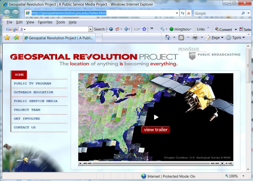
http://geospatialrevolution.psu.edu/
(Episode 1 - chapter 4 )
![]()
Virtual Reality
What is "Virtual Reality (VR)"? (on-line definition by Webopedia http://www.webopedia.com/)
An artificial environment created with computer hardware and software and presented to the user in such a way that it appears and feels like a real environment. To "enter" a virtual reality, a user dons special gloves, earphones, and goggles, all of which receive their input from the computer system. In this way, at least three of the five senses are controlled by the computer. In addition to feeding sensory input to the user, the devices also monitor the user's actions. The goggles, for example, track how the eyes move and respond accordingly by sending new video input.
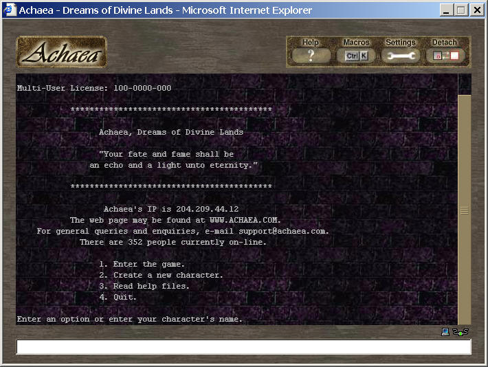
The term virtual reality is sometimes used more generally to refer to any virtual world represented in a computer, even if it's just a text-based or graphical representation. (Example: Multi-user Dungeons (MUD)
Virtual Reality = Multi-sensory experiences (3D view + 3D sounds + Force-feedback + ....)
What is "Cyberspace"? (on-line definition by Webopedia http://www.webopedia.com/)
(1) A metaphor for describing the non-physical terrain created by computer systems. Online systems, for example, create a cyberspace within which people can communicate with one another (via e-mail), do research, or simply window shop. Like physical space, cyberspace contains objects (files, mail messages, graphics, etc.) and different modes of transportation and delivery. Unlike real space, though, exploring cyberspace does not require any physical movement other than pressing keys on a keyboard or moving a mouse.
Some programs, particularly computer games, are designed to create a special cyberspace, one that resembles physical reality in some ways but defies it in others. In its extreme form, called virtual reality, users are presented with visual, auditory, and even tactile feedback that makes cyberspace feel real.
The term was coined by author William Gibson in his sci-fi novel Neuromancer (1984). http://www.williamgibsonbooks.com/books/neuromancer.asp
"A year here and he still dreamed of cyberspace, hope fading nightly. All the speed he took, all the turns he'd taken and the corners he'd cut in Night City, and still he'd see the matrix in his sleep, bright lattices of logic unfolding across that colorless void...."
(Cyberspace has more general meaning, more personal experiences..., users can appear or "enter" into the cyberspace or sit outside as an observer )
On-line Gaming: World of WarCraft http://www.worldofwarcraft.com/
Second Life: http://secondlife.com/
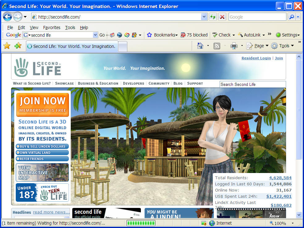
Can GIS be applied in the Cyberspace (Second Life)?
Can we conduct urban planning analysis in Second Life?
Another similar product: Play station 3 [HOME] project:
http://en.wikipedia.org/wiki/PlayStation_Home
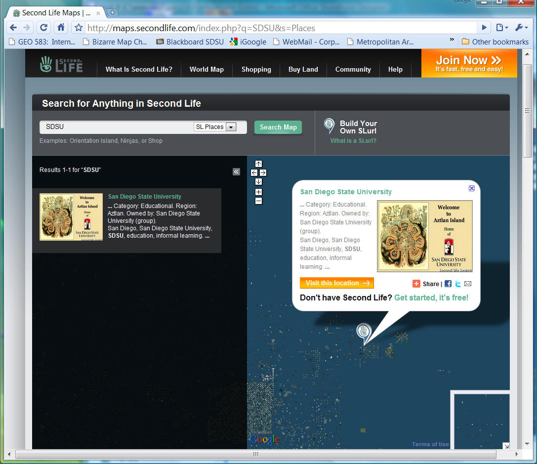
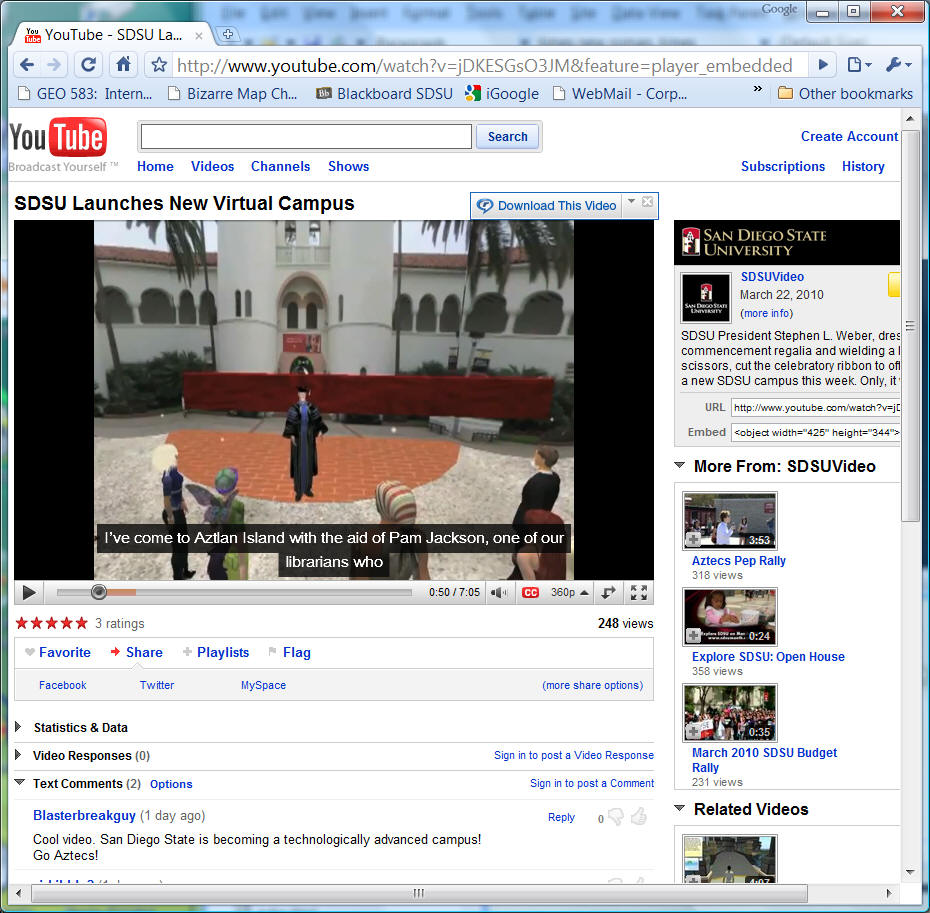
http://sdsu-aztlan.wikispaces.com/
http://www.youtube.com/watch?v=jDKESGsO3JM&feature=player_embedded
![]()
The CAIDA Web Site: the Cooperative Association for Internet Data Analysis, provides tools and analyses promoting the engineering and maintenance of a robust, scalable global Internet infrastructure. http://www.caida.org/home/
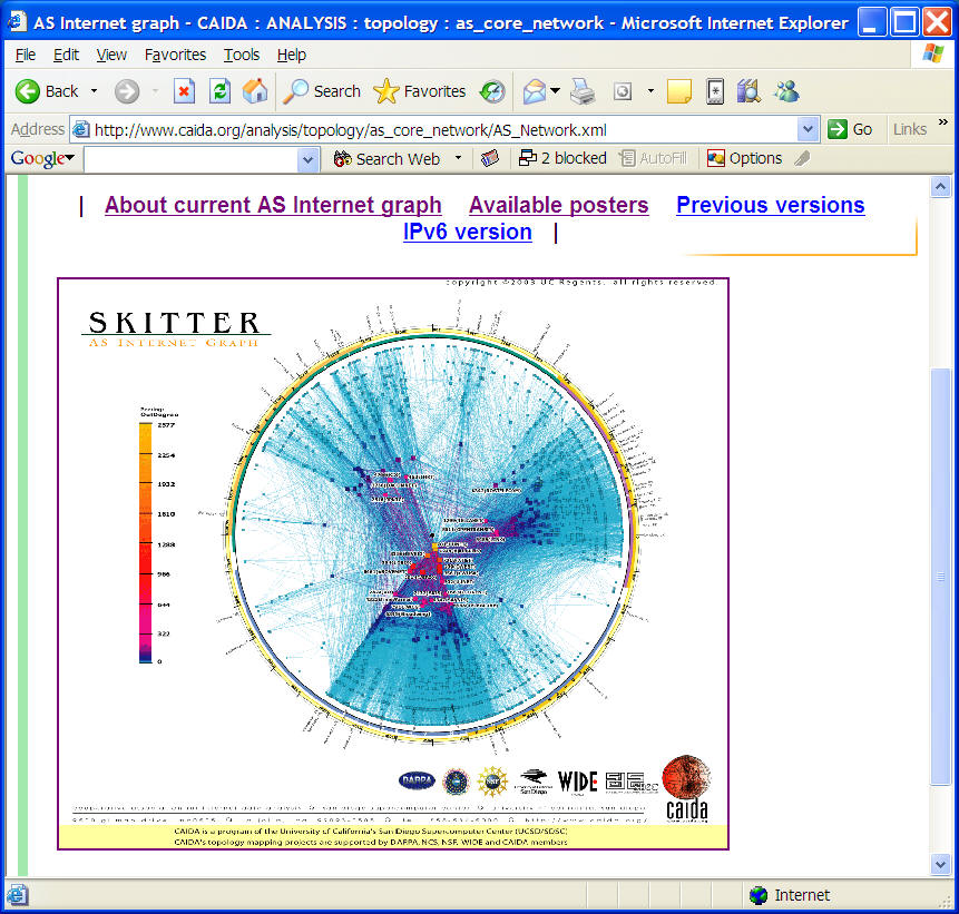
http://www.caida.org/analysis/topology/as_core_network/
View as animated gif (164.5 MB .gif)
Cartographic Applications:
"3D representation stimulate still more neurons; involving a larger portion of the brain in the problem solving process." (James Swanson, 2000, p.184, chapter 18: The Cartographic Possibilities of VRML, in Multimedia Cartography edited by W. Cartwright, M. P. Peterson, and G. Gartner)
When we visualise through the use of external means such as computers, we restructure a problem so that more of it is processed by the preconscious part of our brain -- the visual system that is our silent partner. In this way, consciousness can be devoted to the highest level of analysis and synthesis. (Friedhoff and Benson, 1989).
Discussion:
|
|
What are the differences between "VR" and "Cyberspace"? |
|
|
What are the differences between "VR" and "3D representation"? |
|
|
What are the differences between "space" and "place" on the Internet? |
3D SDSU Campus Map Fly- Through
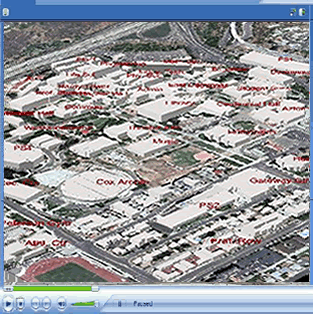
http://geoinfo.sdsu.edu/campusmap/3d.htm (animation created by Jessie Hong).
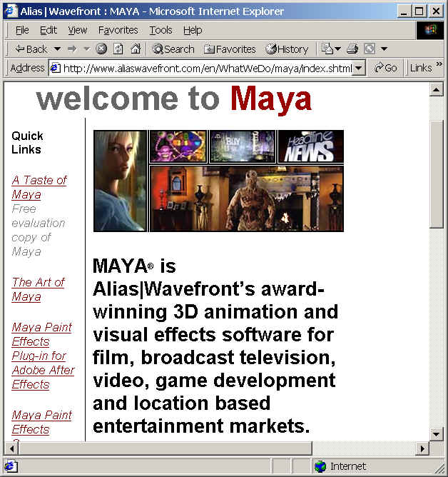
3D Computer Graphics
Animation: Toy Story I and II.
Techniques: Object models, texture patching, lighting, rendering (ray tracing), fog effects, transparency, etc.
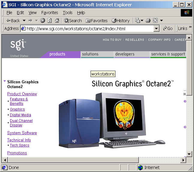
Hardware: High-end graphic workstations. (such as Silicon Graphics Inc. workstations)
Software: Maya (animation software)
Problems for Cartographers:
|
|
Expensive (both Hardware and Software) |
|
|
Difficult to learn |
|
|
Complicated procedures and distribution media. |
"Effective 3D interactive cartography demands that the map maker is an architect. On paper the interplay of positive and negative space is important. The strength of a 3D composition, however, is determined by the interaction of solid and void. Line weight and shading are necessary design considerations in 2D. The cartographer working in 3D must likewise be conscious of volume and lighting. ( James Swanson, 2000, p. 193, chapter 18: The Cartographic Possibilities of VRML, in Multimedia Cartography edited by W. Cartwright, M. P. Peterson, and G. Gartner)
Examples in Geography:
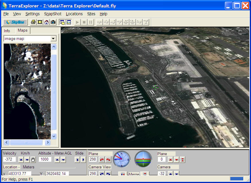
A Remote Sensing Image is draped over a digital elevation model (DEM). Example: Terra Viewer (San Diego region).
VRML
What is VRML? (on-line definition by Webopedia http://www.webopedia.com/)
Pronounced ver-mal, and short for Virtual Reality Mark Up Language (or Modeling Language), VRML is a specification for displaying 3-dimensional objects on the World Wide Web. You can think of it as the 3-D equivalent of HTML. Files written in VRML have a.wrl extension (short for world). To view these files, you need a VRML browser or a VRML plug-in to a Web browser.
VRML produces a hyperspace (or a world), a 3-dimensional space that appears on your display screen. And you can figuratively move within this space. That is, as you press keys to turn left, right, up or down, or go forwards or backwards, the images on your screen will change to give the impression that you are moving through a real space.
The new VRML 2.0 specification was finalized in August, 1996. It is known officially as ISO/IEC 14772.
The Development of VRML
(Souce: http://www.vrml.org/about/historyofvrml.html ) (NOTE: the VRML Consortium is no longer exist).
Stage I: Before VRML
In 1994, Tim Berners-Lee invited Mark Pesce (http://www.hyperreal.com/~mpesce/) to present a paper at the First International Conference on the World Wide Web (http://www.ch.ic.ac.uk./talks/www94_report.html). Pesce and partner Tony Parisi had developed Labyrinth, a prototype three-dimensional interface to the Web. His presentation sparked a consensus: the conference attendees agreed there was a need for a common language to specify 3D scene descriptions.
Work on the VRML specification began immediately following the WWW Conference. Brian Behlendorf (http://www.organic.com/Staff/) set up an electronic mailing list to facilitate discussion of the specification for VRML. Within a month, there were over a thousand members. The list membership quickly agreed upon a set of requirements for VRML: platform independence; extensibility; and the ability to work over low-bandwidth (14.4 kBps modem) connections.
Stage II: VRML 1.0
After much deliberation, the proto-VRML community selected the Open Inventor ASCII File Format from Silicon Graphics, Inc. (http://www.sgi.com/Technology/Inventor/) as the basis of VRML. The Inventor File Format supports complete descriptions of 3D scenes with geometry, lighting, materials, 3D user interface widgets, and viewers. It had all of the features that developers needed to create highly interactive 3D applications, as well as an existing tools base with a wide installed presence. A subset of the Inventor File Format, with extensions to support networking, was the underpinning of VRML 1.0. Rikk Carey and Gavin Bell adapted the Inventor File Format for VRML, with extensive input from the www-vrml mailing list, and the support of Silicon Graphics, Inc.
Stage III: VRML 2.0
Some of the leading technical experts on the VRML mail list formed the VRML Architecture Group (VAG) (http://www.vrml.org/vag) in 1995. The VAG's goal was to foster consensus in the VRML community in order to develop a scalable, fully interactive standard for 3D shared worlds. On August 4,1996, the official VRML 2.0 Specification was released at Siggraph 96 in New Orleans. At the fifth VAG meeting in New Orleans, the VAG finalized the formal announcement of the VRML 2.0 Specification, agreed to issue RFPs for a compressable binary format and an external authoring interface to the VRML 2.0 specification, and initiated the formation of the VRML Consortium.
Stage IV: VRML97
The VRML97 International Standard was developed by the Joint Technical Committee 1 (JTC 1) of ISO and IEC in partnership with the VRML Consortium. The formal processing of VRML97 to become an International Standard began in June 1996 with the Consortium's VRML 2.0 draft specification, when representatives from the VAG and JTC 1 (ISO/IEC JTC 1/SC 24, Computer Graphics and Image Processing) met in Kyoto, Japan and signed a cooperative agreement. VRML set an ISO/IEC record as the first specification to be standardized within 18 months and the first International Standard to be published in HTML.
VRML's Future
The future of VRML is being decided now, in Consortium Working Groups working to provide proposals for the VRML Review Board, in decisions made by the Consortium Board of Directors, and by companies and individuals working daily on VRML technologies. Companies with an interest in VRML's continuing development are urged to join the Consortium and help guide the future of 3D on the web -- and wherever else desktop VR technology can be applied.
(Source: VRML Consortium URL : http://www.vrml.org/about/historyofvrml.html ) (NOTE: the VRML Consortium is no longer exist).
VRML advantages:
|
|
Easy to learn |
|
|
Inexpensive development tools (High-end PC will be good enough). |
|
|
Free browser (Web + VRML plug-in) and easy format to distribution (wrl ascii-based file). |
|
|
Popular adoption than Vendor-based computer graphic software. |
VRML problems:
|
|
Difficult to create a complicated VRML file with multimedia. |
|
|
The navigation controls were not intuitive. |
|
|
Limitation of computer performances and network bandwidth. (slow response) |
|
|
Plug-in required |
NEW Development:
Web 3D Consortium (http://www.web3d.org/)
X3D technology: http://www.web3d.org/x3d/specifications/
Cartography Applications:
"The interactive and dynamic of VR can stimulate the user's engagement and understanding of the real world. VR relates to the multidimensional nature of geographical data such as the urban environment, geological structures and geomorphological processes. Symbolically VR extends the range of components available for visualization and cartography:
|
|
3D shapes and volumes; |
|
|
Other dimensions -- time; |
|
|
Descriptions or simulations of motion and behavior -- dynamics; |
|
|
User interaction; |
|
|
Multi-user worlds; |
|
|
A new colour terminology: emissive colour, diffuse colour, transparency; |
|
|
Other environmental variable: lighting, fog; |
|
|
Alternative viewpoints == both user controlled and predefined. |
The cartographer therefore have a whole new language to use in modelling spatial data...."
(Kate Moore, 2000, p. 206, Chapter 20: VRML and Java for Interactive 3D Cartography in in Multimedia Cartography edited by W. Cartwright, M. P. Peterson, and G. Gartner)
The Problems of VRML (97) in geographical modelling: (Kate Moore, 2000).
|
|
modeling of diverse cartographic coordinate systems, |
|
|
handling large terrain models; |
|
|
precision of coordinate locations |
|
|
modeling to earth time references; and |
|
|
database linking. |
Related Links:
|
|
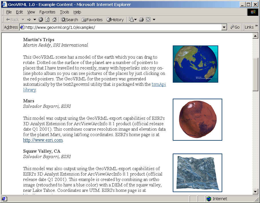
GeoVRML Working Group http://www.ai.sri.com/geovrml |
|
|
The VRML Consortium http://www.vrml.org/ |
Examples:
|
|
CD-ROM demos: | ||||||
|
|
3D PRIMS MAP (James Swanson, chapter 18) | ||||||
|
|
Terran Model: (Kate Moore, chapter 20).
|
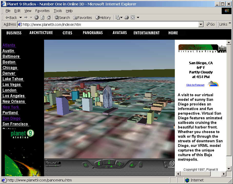
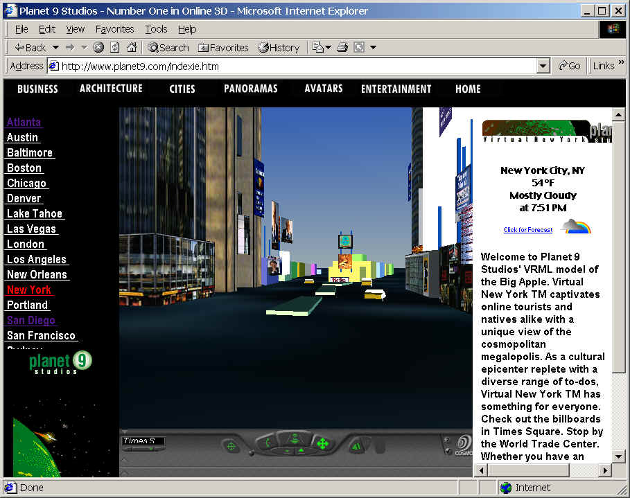
Urban Environment:
San Diego Downtown. (source: Planet9 www.planet9.com )
New York Time Square (source: Planet9 www.planet9.com )
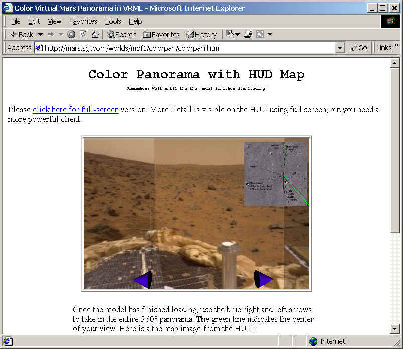
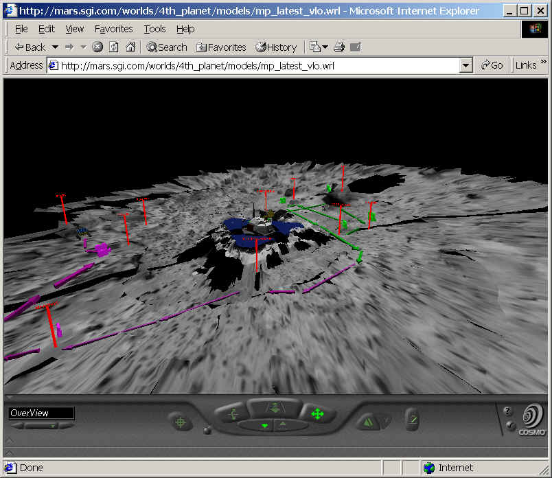
NASA VRML model for the Martian Landscape:
http://www.ksc.nasa.gov/mars/vrml/vrml.html
GeoVRML Examples:
Google Earth Sketch Up 3D model
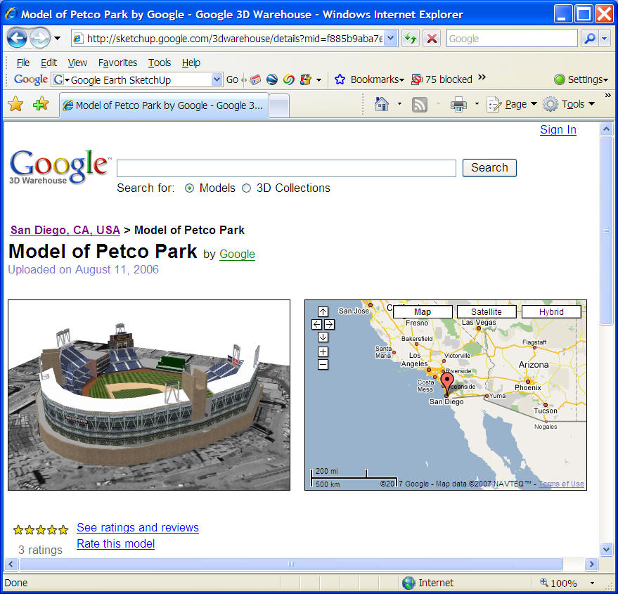
http://sketchup.google.com/3dwarehouse/cldetails?clid=10a083d2915e587c5958d6d0901ff059
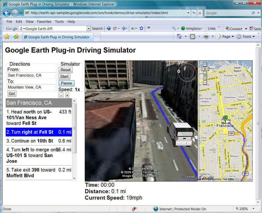
Google Earth API (Google Earth Plug-In for Web browser)
http://code.google.com/apis/earth/
The Google Earth Plug-in and its JavaScript API let you embed Google Earth, a true 3D digital globe, into your web pages. Using the API you can draw markers and lines, drape images over the terrain, add 3D models, or load KML files, allowing you to build sophisticated 3D map applications. (cited from http://code.google.com/apis/earth/)
http://code.google.com/apis/earth/documentation/examples.html
Microsoft Virtual Earth 3D (Bing Map 3D)
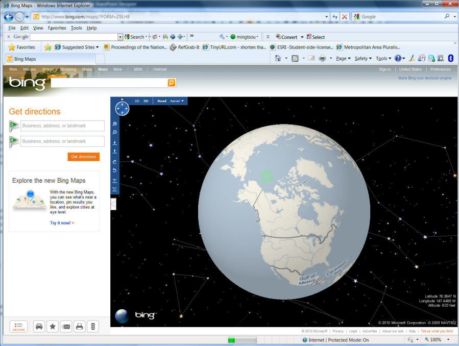
http://www.gearthblog.com/blog/archives/2010/11/bing_maps_is_dropping_their_3d_vers.html
(Microsoft drops 3D maps in Bing Map in 2010) WHY?
![]()
Unit NINE (Session Two):
![]()
On-line Forum Discussion
Blackboard URL: https://blackboard.sdsu.edu/
Individual Website:
HTTP://geoinfo.sdsu.edu/583student
Demo of Group project website: