GEOG 583
Internet Mapping and Distributed GIServices


UNIT THREE (Session One):
Cartography and User
Interface Design

Domain Name Update:
Who
controls the domain names?
(old) Internet Assigned Numbers Authority (IANA)
(US Government contract).
http://www.iana.org/gtld/gtld.htm
(current) The New Administration
Organization: Internet Corporation For Assigned Names and
Numbers (ICANN)http://www.icann.org/
InterNIC site.
http://www.internic.net/ (InterNIC is a registered service mark of the U.S.
Department of Commerce. It is licensed to the
Internet Corporation for Assigned Names and Numbers, which operates this web
site.)
The history of Domain Name System (DNS):
http://www.stormy.ca/technology/dns_history.html
1994: "top-level domain names" (TLDs) were the generic TLDs (EDU,
COM, NET, ORG, GOV, MIL, and INT), and the two letter country codes from
ISO-3166. (Country Codes:
http://www.iana.org/cctld/cctld-whois.htm )
2000: four new TLDs (.biz, .info, .name, and .pro)
"unsponsored" i.e. market supply/demand, and three new TLDs (.aero,
.coop, and .museum) "sponsored" or managed by narrow
professional/business interests.
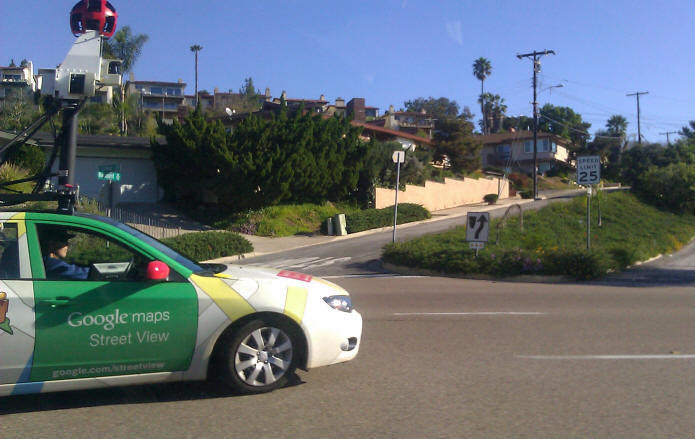
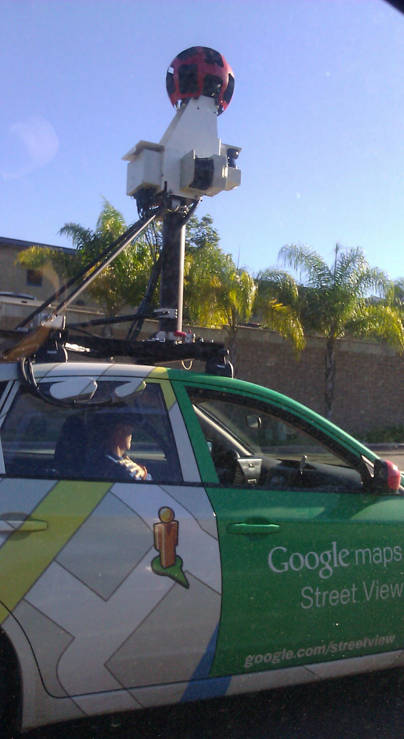
Google Street View Car (with Camera), San Diego, CA (Jan
27, 9:30AM, 2011)
Internet Technology and Distributed GIServices
The Internet is a
modern information relay system that connects
hundreds of thousands of telecommunication networks and creates an
"inter-networking" framework. Peng and Tsou, p. 4,
Internet GIS.
Any "traditional" information relay
systems? (horse, pigeon, telegraph..)
GIS Technology: from a centralized
GISystems to Distributed GIServices
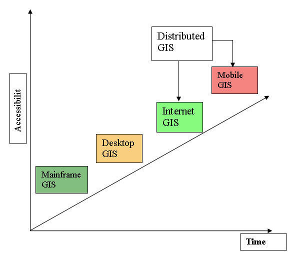
The development of GIS technology has evolved from mainframe GIS, to
desktop GIS, to Distributed GIS, which includes wired Internet GIS and
wireless mobile GIS. The mainframe GIS and the
desktop GIS is also
traditionally called GISystems, while the distributed GIS is referred to
as Distributed GIServices.
Internet2 and NGI
Different from the current Internet,
which was developed originally by the U.S. Department of Defense, the
Internet2 is a university-led effort to develop advanced network
technology and applications. In October 1996, thirty-four of U.S.
universities formed the Internet2 Consortium and created the University
Corporation for Advanced Internet Development (UCAID) to support the
Internet2. Currently more than one hundred and seventy
universities participate the project and work closely with industry and
the federal government. (Susan Fingerman, 1999, Internet2 and Next
Generation Internet: Two for the Future, Information Outlook, Nov.
1999
The Internet2 also created a high-speed network
infrastructure by connecting over 150 Internet2 universities and institutes as
“gigapops” who are connected to high-performance backbone network.
Gigapops are the high-bandwith nodes or hub universities which can serve as
the portal to various Internet2 applications.
There are two kinds of technologies used in
such high-speed backbone. The very high performance Backbond Network
Service (vBNS) was developed and supported by National Science Foundation
and MCI, which can provide 622M-bps to 2.4G-bps bandwidth communication
between two backbone nodes. Another network is the Abliene network (http://abilene.internet2.edu/)
supported by UCAID and its partners. Abilence is developed by Qwest,
Nortel, and Cisco together and utilize high-speed Sonet facilities to provide
connections between Gigapops. The bandwidth of Ablience network is between
2.4G-bps to 9.6G-bps. The two types of backbone infrastructures can be
interconnected by vBNS+ (the next generation of vBNS). (Abilene Project:
http://abilene.internet2.edu/about/ )
The Next Generation Internet (NGI)
Different from the Internet2 as university-led project, the
Next Generation Internet (NGI) is federally-led initiative. (http://www.ngi.gov
) The NGI project was a three year project started in 1997 and ended in 2000
with $300 million commitment. The focus of NGI was the needs of collaboration
among federal governments agencies and to connect existing high-speed networks
projects within the federal governments, including NSF, NASA, the National
Institute of Health, EPA, the National Institute of Standards and Technology,
etc.
In 2001, the NGI was replaced by a new project, Large Scale
Networking (LSN) which also focus on future network technologies. “The goal of LSN R&D is to provide leadership in network communications through advances in
high performance network components; technologies that enable wireless, optical,
mobile, and wireline communications; large scale network engineering,
management, and services; and systems software and program development
environments for network-centric computing” (High Performance Computing and
Communication FY-1999-FY2000 Implementation Plan, p. 2, National Coordination
Office for Computing, Information, and Communications.
http://www.nitrd.gov/pubs/ )
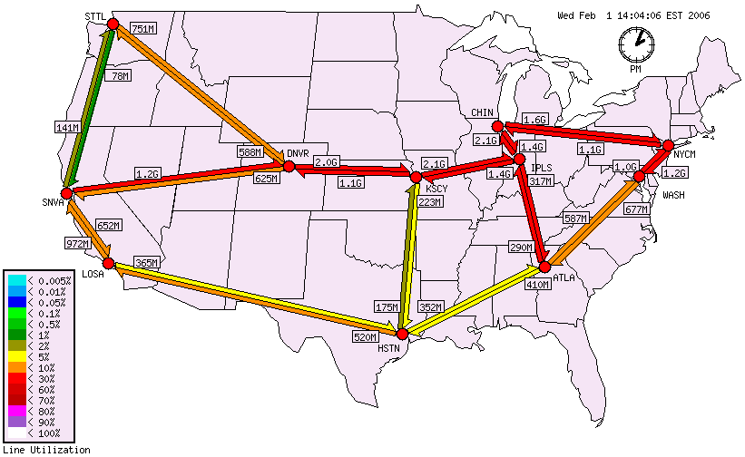
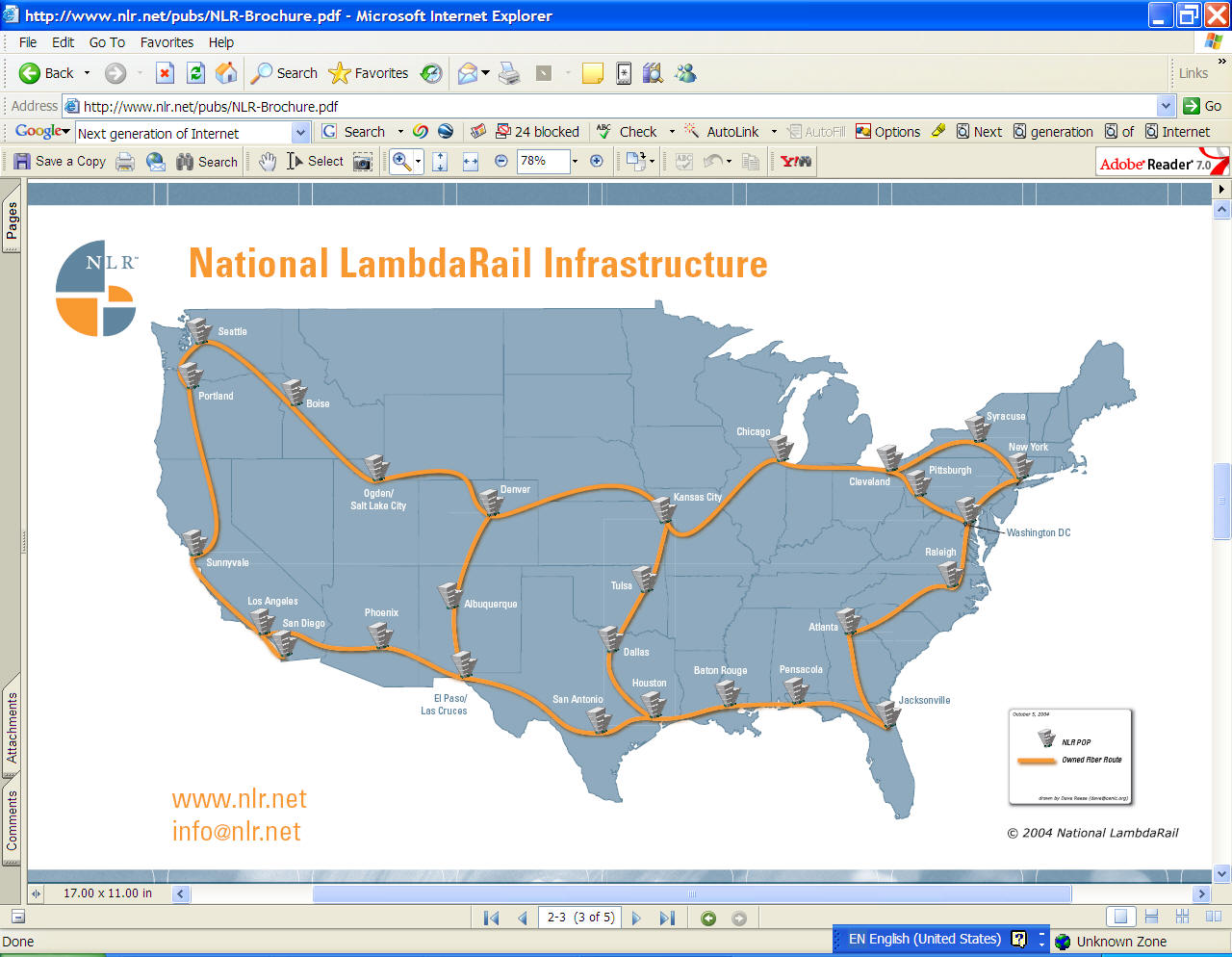
National LambdaRail (http://www.nlr.net/
)
The foundation of the NLR infrastructure is a dense wave division
multiplexing (DWDM)-based national optical footprint using Cisco Systems' 15808
and 15454 optical electronic systems, with a maximum capacity of 40 and 32
wavelengths per fiber pair respectively. Each wavelength can support
transmission at 10 billion bits per second (10 Gbps). This optical system is
being deployed nationwide across roughly 10,000 route-miles of dark fiber that
NLR has obtained through Level 3 Communications and WilTel Communications. Four
NLR wavelengths have been implemented using 10 Gigabit Ethernet LAN PhY
(physical layer), a technology and architecture that had previously been limited
to metro-area networks. NLR can also support the SONET (Synchronous Optical
NETwork) Technology employed in traditional telecommunications networks, (cited
from
http://www.nlr.net/infrastructure/ )
http://en.wikipedia.org/wiki/National_LambdaRail
IPV6
http://www.ipv6.org/
(the following
paragraphs are cited from the website:
http://www.ipv6.org/
IPv6 is short for "Internet
Protocol Version 6". IPv6 is the "next generation" protocol designed
by the IETF to replace the current version
Internet Protocol, IP Version 4 ("IPv4").
Most of today's internet uses IPv4, which is now nearly
twenty years old. IPv4 has been remarkably resilient in spite of its age, but it
is beginning to have problems. Most importantly, there is
a growing shortage of IPv4 addresses, which are
needed by all new machines added to the Internet.
New Challenges for Cartographers
The Paradigms of Cartography
1. Communication
Paradigm (Arthur H. Robinson, 1952)
(Source: Dent, Borden D. 1985. Principles of Thematic
Map Design. Reading, Mass.: Addison- Wesley Publishing Co., p. 13).
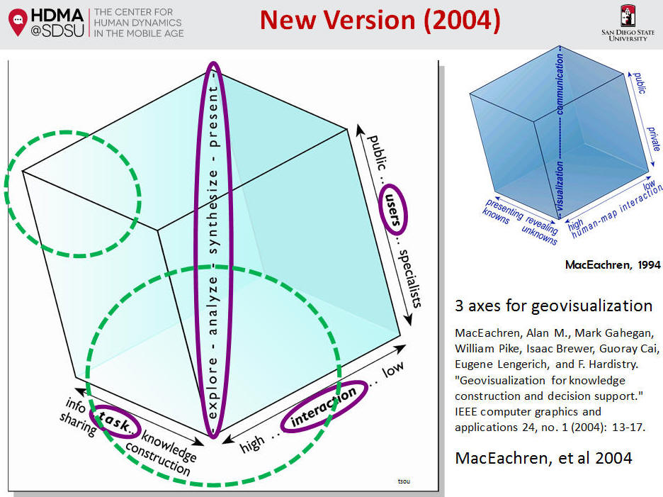
2.
Geographic/Cartographic Visualization (GVIS / CVIS) (DiBiase 1990,
MacEachren 1994)
 | Visualization: The use of graphics
to facilitate thinking, problem solving, and decision making; |
| The domains of GVIS: data
exploration, visual thinking, revealing unknown spatial patterns.
|
(Source: Alan MacEachren, "Visualization in Modern
Cartography: Setting the Agenda," in A.M MacEachren and D. R. F.
Taylor (eds.). Visualization in Modern Cartography. Oxford, England:
Elsevier, 1994. p. 6.)
Visualization: (visual thinking)
|
-revealing
unknowns
|
|
-high
human-map interaction
|
|
-focus
on private information
|
Communication: (visual communication)
|
-presenting
knowns
|
|
-low
human-map interaction
|
|
-focus
on public information
|
3. New Direction: Web-based maps? , Map-on-demand? ,
Interactive and Dynamic mapping? , Multimedia Cartography?
The unique features of Internet mapping:
1. Map users become both map authors and map
readers. The role of traditional map authors (cartographers) become
invisible or replaced by computer programs (such as automatically labeling,
symbolizations, and the
design of color schemes) and map users themselves. The learning curve
and map making experiences from the map users will become the major feedback
for improving the design of maps.
2. The use of maps could be applied in both
public domains and private domains via the Internet and the World Wide
Web. People can use on-line mapping tools to conduct their own
private research (maps) and, at the same time, they can save/publish their
results back to the public web site and allow other people to access their
private research findings. A Web-based map can be used both privately
and publicly.
3. Who is the audience? It is more
difficult to know who are accessing your Web-based maps now and how much time
they are willing to spend on your web maps. Internet users are much more
diversified than traditional map readers. Creating user feedback pages
and analyzing Web page logs may help us to describe targeted user profiles.
4. Copy maps electronically. The
duplication of electronic maps becomes easier and cheaper than traditional
paper maps. Map users can download either statistic map pictures or a
complete GIS data set for further use. Copyright issue will need to be
reconsidered. How to put a "signature" on the electronic maps?
How to protect the contents of electronic maps? These questions need to be
answered.
5. Others?
New Approaches
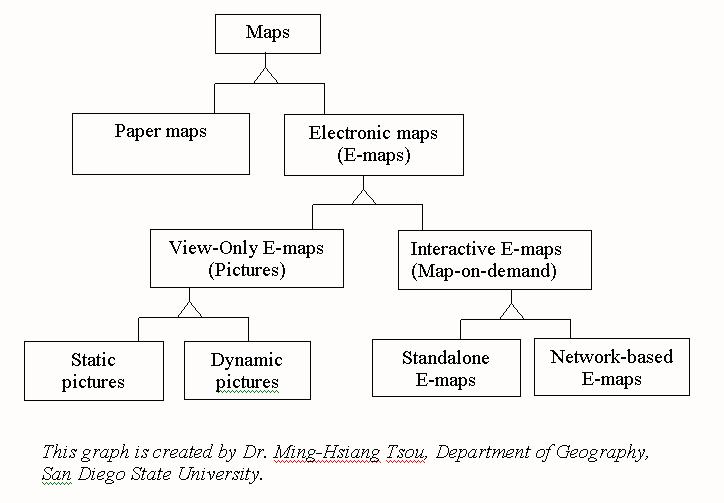
What are the differences between paper
maps and electronic maps (E-maps)?
Paper maps:
|
Format: paper or transparencies, page size (30cm X 35 cm),
Colors or B/W, |
|
Fixed scale (1: 200,000). |
|
Easy to carry. |
|
Expensive procedures for map production and reproduction.
|
|
Statistic representation |
| High resolution (1200 dpi) (dpi: dots per inch) = 0.021
mm per dot |
|
? |
|
? |
|
? |
E-maps:
|
Format: (much more complicated than paper maps)
 |
Storage Format: digital media: Disks, CD-ROM, Hard
Drive, Tapes. |
|
Graphic Format: GIF, JPEG, PNG, BMP
|
|
GIS databases: Vector (Coverages, shapefiles, DLG) and
Raster (GRID, GRASS). |
|
|
Dynamic scale, fixed data accuracy (data
uncertainty). |
|
Require computer to display maps. Desktop / Notebook
/ Pocket-size PC |
|
Easy and inexpensive procedure for map reproduction.
(Electronic copy). But the original cost of creating new GIS databases are
very high. |
|
Interactive and dynamic representation
|
|
Low resolution (LCD or CRT)
|
Example: 19' CRT: 0.25 mm aperture grille pitch. Resolution:
1800 x 1440 |
|
|
? |
|
? |
What are the differences between
view-only
E-maps and interactive E-maps?
View-only E-maps (Pictures):
|
Map users have no controls on the change of map design and
formats. (Picture presentation) |
|
Static pictures and dynamic pictures:
|
|
PDF map
example:
http://map.sdsu.edu/group2001/group5/ibap-8.pdf
(map created by Adrienne Perry
and Kate Wells). |
|
? |
|
? |

Interactive E-maps (Map-on-demand):
|
Map users can change map design and formats.
|
change map scale -- zoom-in, zoom-out,
|
|
change map symbols,
|
|
change map elements: add new themes and graphic
items, |
|
change colors, ..
|
|
identify or highlight map objects,
|
|
query on the map
|
|
generate new data sets (Map Notes)
|
|
|
Google Map
http://maps.google.com |
|
?
|
|
?
|
What are the differences between standalone
E-maps (CD-ROM, Standalone computer software) and network-based E-maps (WWW)?
Standalone E-maps (CD-ROM, GIS packages):
|
High speed data process and transfer rates (Faster
responses)
|
SCSI Hard drive: 40/80MB per second.
|
|
|
Centralized Database management
|
|
Stable
|
|
Platform dependent. (UNIX, Windows, Mac)
|
| Expensive to distribute results or update information.
|
|
Comprehensive GIS functions and tools.
|
|
?
|
|
?
|
|
?
|
Network-based E-maps (WWW):
| Slower data transfer rate (Ethernet: 10 MB per second;
Modern: 56K)
|
future: Gigabits Ethernet. Internet 2. |
|
|
Distributed Database management. |
|
Platform independent. |
|
Easier update and disseminate results? |
|
Limited GIS functions, mainly for map display |
|
? |
|
? |
|
|
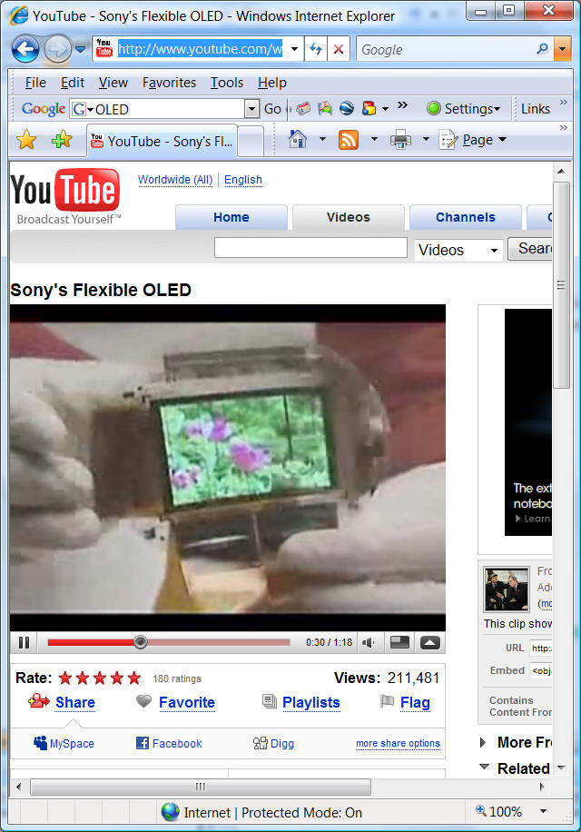
OLED:
organic light-emitting
diode, a
display device that
sandwiches carbon-based films between two charged electrodes, one a metallic
cathode and one a transparent anode, usually being glass.
http://en.wikipedia.org/wiki/Organic_light-emitting_diode
| Increased brightness
|
| Faster response time for full motion video
|
| Lighter weight |
| Greater durability |
| Broader operating temperature ranges
|
http://www.youtube.com/watch?v=NcAm3KihFho
Important Design Issues for Interactive
Mapping
(Suzzette Miller, (1999), Chapter 5: Design of
Multimedia Mapping Products, Multimedia Cartography edited by Cartwright
W., Peterson, M. P. & GArter, G. Springer. p. 51)
1. Setting scale thresholds for map themes. (Simplify map
display) not too complicated.(problems in Google Mashup).
Example: California DUI program
site maps:
http://vision.sdsu.edu/DUI/
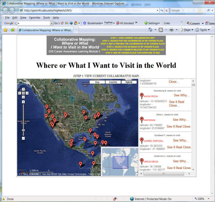
2. The use of index maps to provide a synoptic map
"view" for map "coverage".
Map View: refers to the portion of the map coverage displayed
at a point in time
Map Coverage: refers to the extent of the spatial information
contained in a map.
Example: http://geoinfo.sdsu.edu/hightech/LM3/
3. Create a hierarchy of map symbols:
First Order Symbols
(Foreground):
Second Order Symbol
(Background)
Each first order symbol object has associated multimedia
content. (identify function, query, hyperlinks) Symbols in multimedia
cartography will be used for the access of multimedia content.
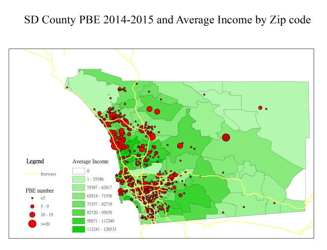
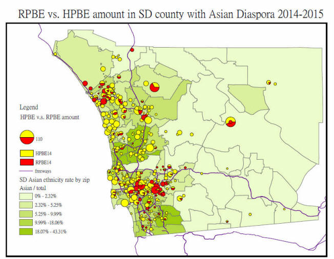
Example: http://geoinfo.sdsu.edu/hightech/LM3/
The following GIS maps were created by Joey Ying Lee at the HDMA Center.
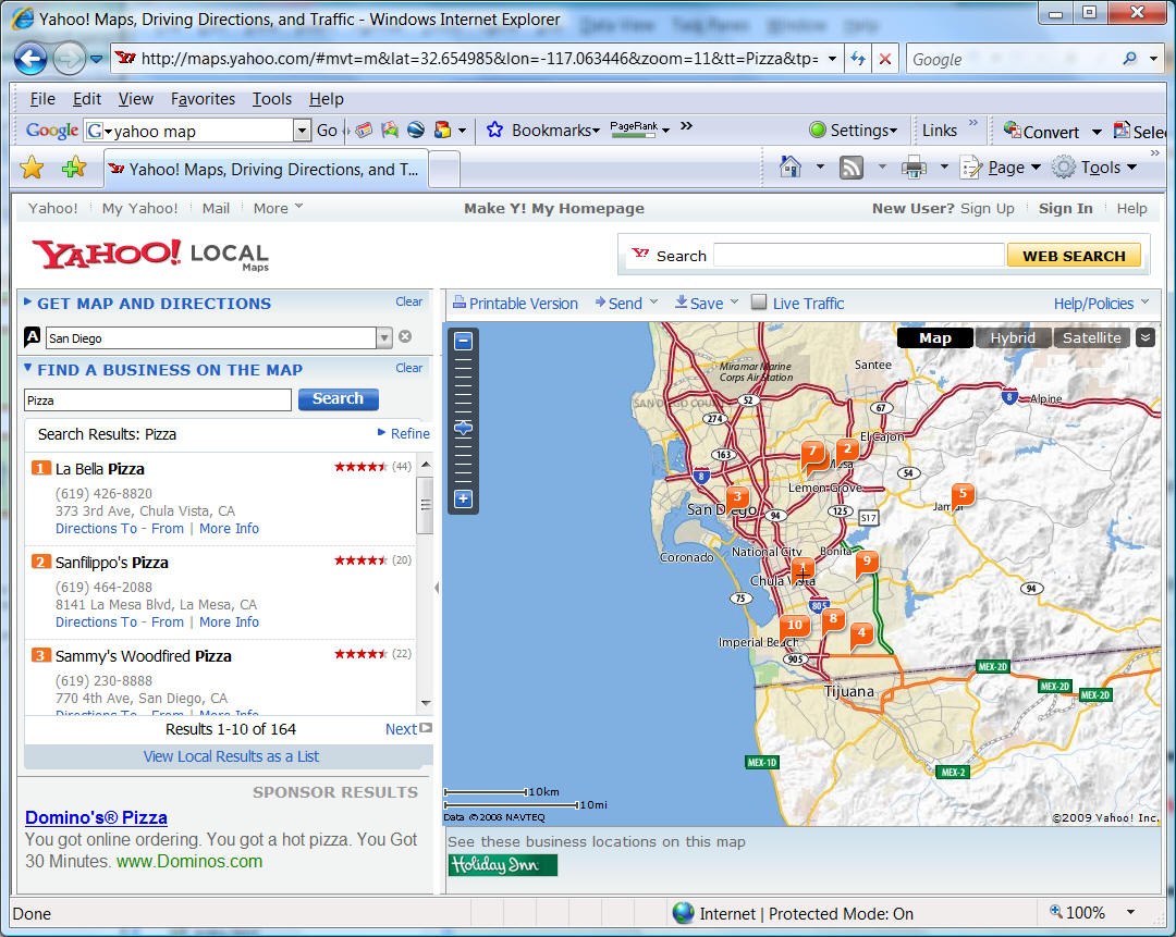
4. Self-describing symbols and dynamic presentation of
content. (Flashing symbols, sound effects)
http://maps.yahoo.com/
Unit THREE (Session
Two):
The "data" folder in the Z: drive.
(Readings in PDF format are located in the new
"data" folder on the Z: drive.)
On-line Forum Discussion
Blackboard URL:
https://blackboard.sdsu.edu/
Show your own web page and explain your HTML codes.
HTTP://mappingideas.sdsu.edu/583student
User Interface Design
The major difference between traditional
cartographic communication and interactive mapping is USER INTERFACE, which
bridges the gap between map users and spatial databases.
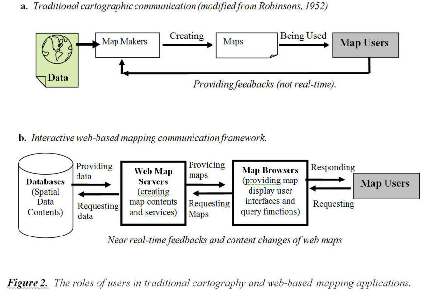
The role of the map user in the development of maps becomes
significantly more important in web-based mapping applications (Figure 2b).
The map user can change map content immediately by manipulating a map
browser (user interface). An
example of this type of manipulation is zooming in and zooming out.
The role of the map maker has been transformed into a collaboration of
efforts between spatial databases, web map servers, and map browsers.
Maps within a web-based mapping application are dynamic objects (pictures
or data streams) that can be transferred and requested between web map servers
and map browsers.
Therefore, to create a successful web mapping application, all
major system components (Databases, Web map servers, and map browsers) need to
adopt a UCD approach to ensure that maps generated by these systems are
effective in meeting the needs of the map user.
User centered design is one of the major research areas in
computer science and human computer interaction (HCI).
Many GIS research projects have emphasized the importance of
Human-Computer Interaction (HCI), user interfaces, and user-centered design
approaches (Gould, 1989; Mark and Gould, 1991; Medyckyj-Scott and Hearnshaw,
1993 ; Nyerges et. al, 1995; Peterson, 1999).
One major focus area of UCD approaches is design of the user interface.
The user interface plays an important role in bridging communication
between users and web mapping systems.
Similar to the development of computer software, user interface design
evolved from command line scripting, macro languages, menu-driven interfaces,
and graphical user interfaces (GUIs), to direct manipulation interfaces (Tsou
and Buttenfield, 1997; Shneiderman, 1998).
The UCD approach can improve the design of user interfaces and provide
user-friendly and effective tools for information access and manipulation.
The 1999 ISO
Standard 13407, “Human Centered Design for Interactive Systems”, outlines
detailed UCD procedures and the importance of UCD methods.
http://www.iso.org/iso/iso_catalogue/catalogue_tc/catalogue_detail.htm?csnumber=21197
These procedures and methods focus
on the interactive process of system development with user participation and
evaluation. This standard
illustrates five major steps for the implementation of UCD applications.
The first step is the development of a plan with a user-centered focus.
The second step is to understand and determine the context of use.
The third step is to specify the user and organizational requirements.
The fourth step is to produce design solutions.
The fifth step is to evaluate the design using established requirements.
One important aspect of the ISO 13407 Standard is that each step is part
of an iterative loop. For example,
the results of the fifth step can be applied to the second step creating an
iterative loop of user feedback and revision (ISO, 1999).
The
iterative process will continue until the objectives are satisfied.
For web-based
mapping applications, UCD can be used as a set of practical guidelines for
design and software implementation processes.
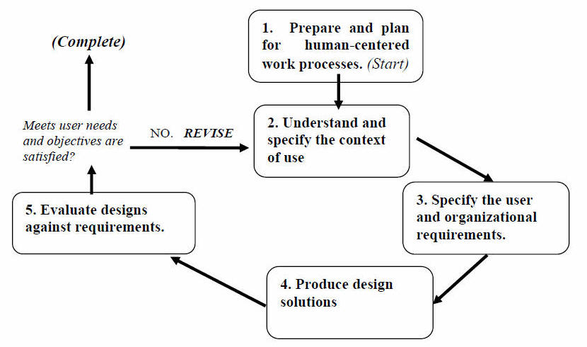
(Modified from the ISO 13407 Model Overview Figure).
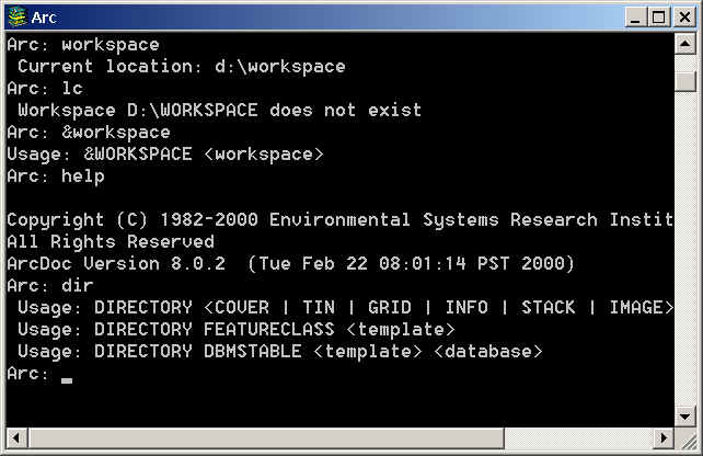
Examples of User Interface
1. Command Mode: (ARC/INFO workstation)
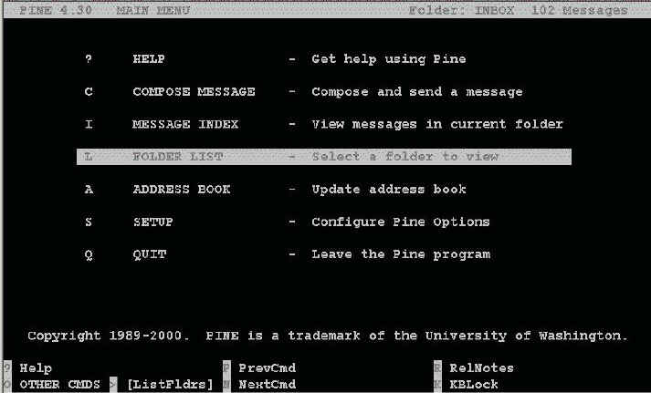
2. Menu and Lists (PINE - email browser)
3. Graphic User Interface (GUI) (Macintosh and the
"desktop" metaphor)
4. Voice Command:
Voice Command for Windows Mobile
http://www.microsoft.com/windowsmobile/downloads/voicecommand/default.mspx (see high resolution Flash demo).
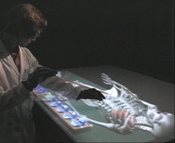
5. Direct Manipulation and Virtual Reality (Stanford
Computer Graphics Laboratory)
http://graphics.stanford.edu/papers/twohanded/twohandrwb.mov
This example allows users to naturally manipulate virtual
3D models with both hands on the Responsive Workbench, a tabletop VR
device.
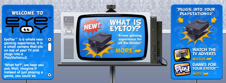
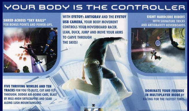
6. SONY Play Station Eye Toy: http://www.eyetoy.com/language.html
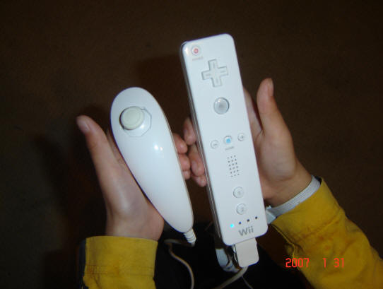
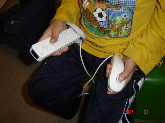
7. The Nintendo Wii
Remote controller:
http://en.wikipedia.org/wiki/Wii_Remote
Microsoft Kinect with XBOX system.
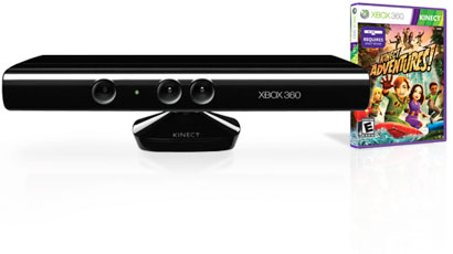

The device features an "RGB camera, depth
sensor and multi-array microphone running proprietary software",[25] which
provide full-body 3D motion capture, facial recognition and voice recognition
capabilities (from Wikipedia:
http://en.wikipedia.org/wiki/Kinect )
You are the "controller".
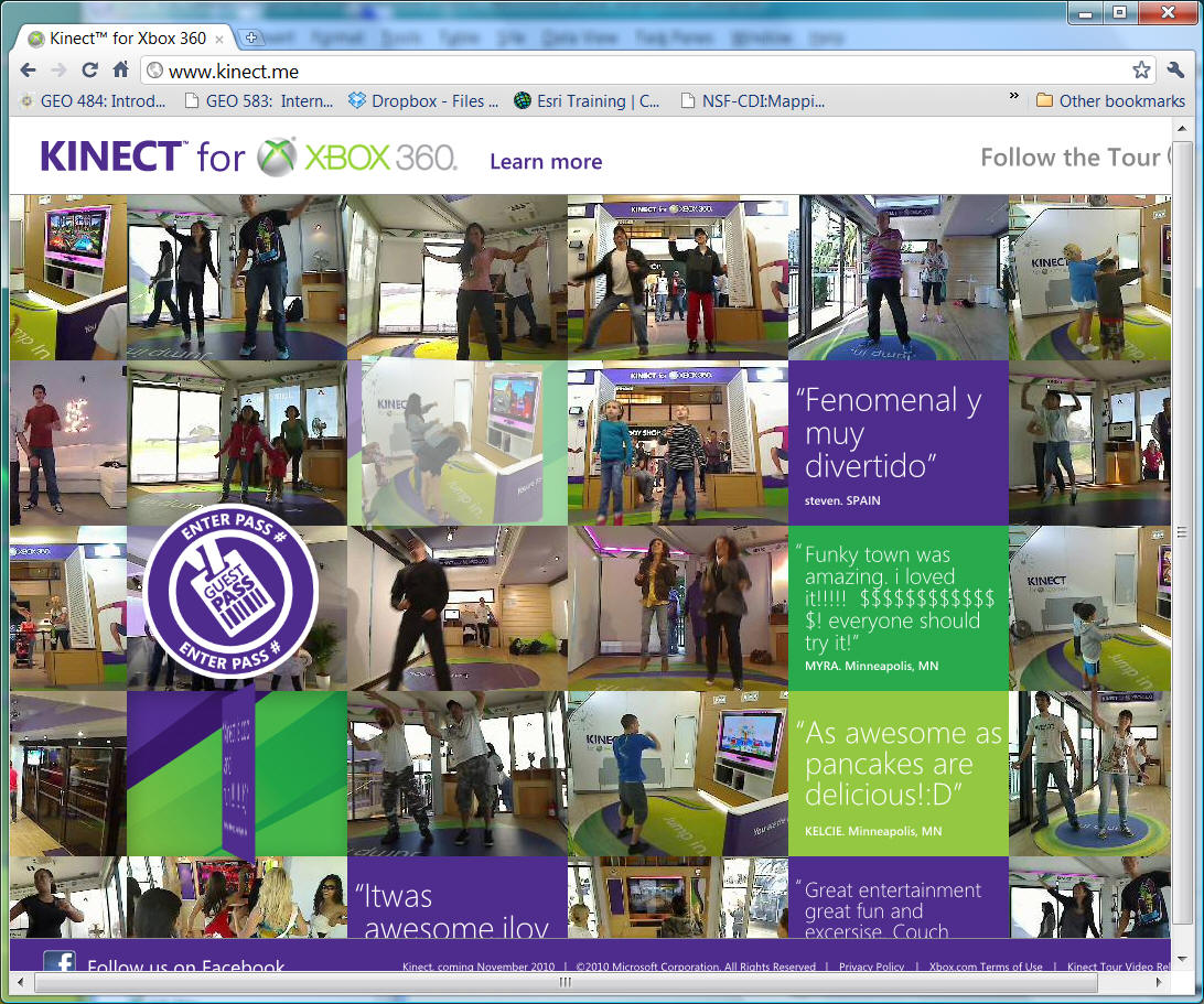
http://www.xbox.com/en-US/kinect
http://www.kinect.me/
User Interface
for Mapping:
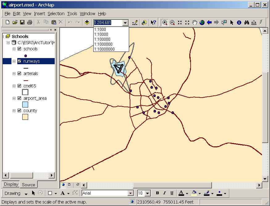
1. ARC/INFO 8 ArcMap
2. ArcView 3.2

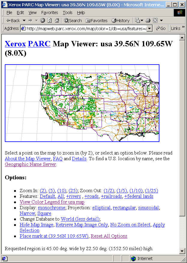
3. The Xerox PARC Map Viewer
(http://mapweb.parc.xerox.com/map/)
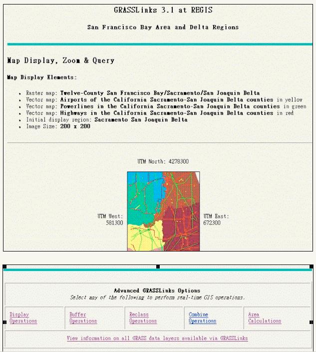
4. GRASSLinks (http://www.regis.berkeley.edu/grasslinks/)
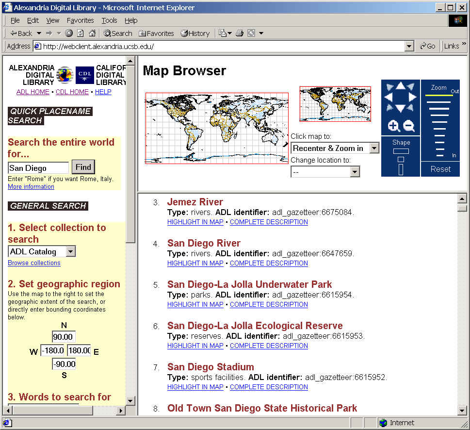
5. Alexandria
Digital Library Project (http://alexandria.sdc.ucsb.edu/)
6. The TIGER Map Service, a project
sponsored by the U.S. Bureau of the Census. (http://tiger.census.gov/)

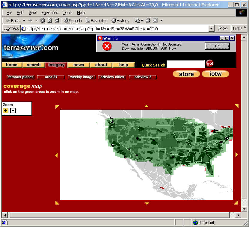
7. TerraServer.com
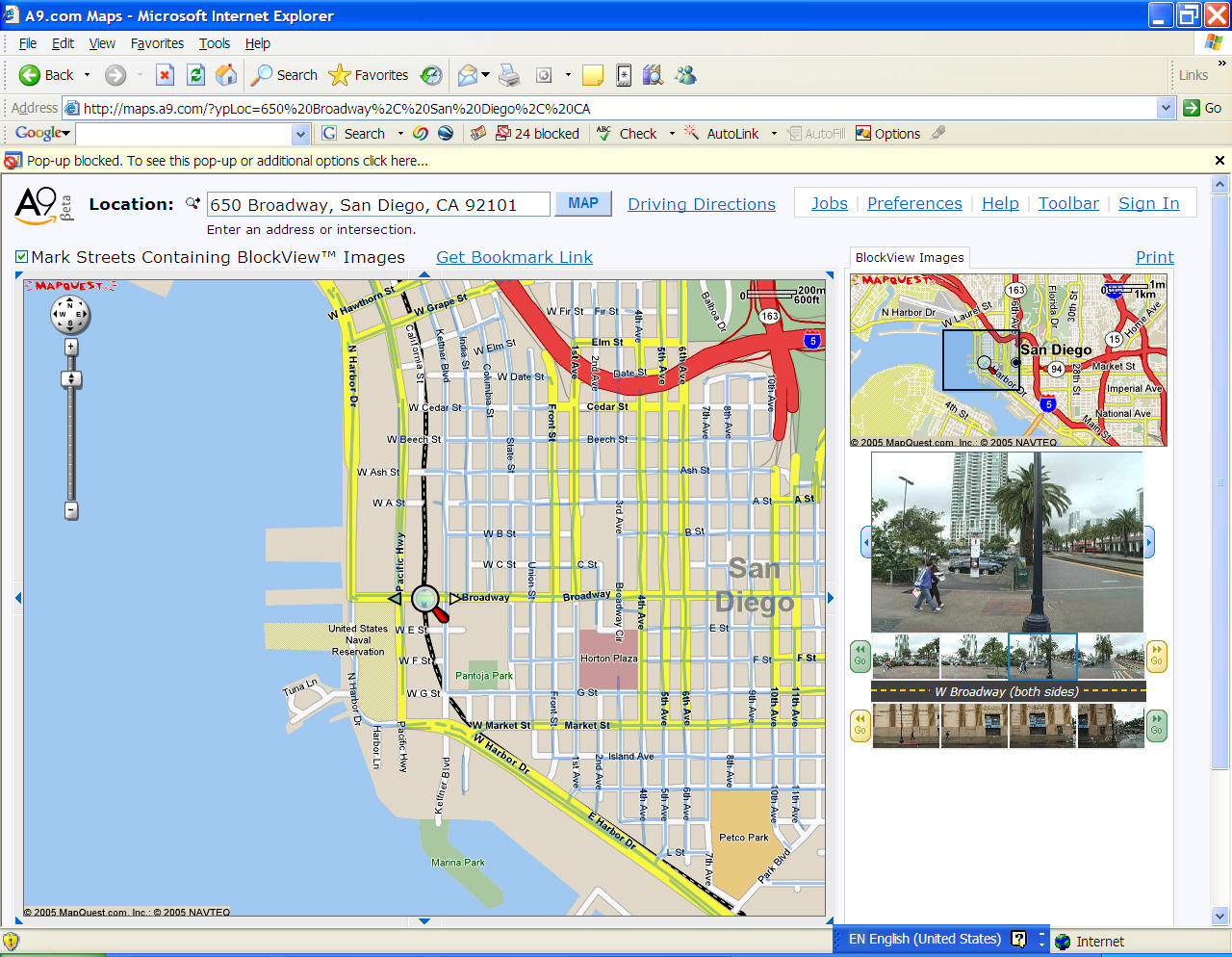
8. Amazon's
http://maps.a9.com/ (This server is no longer
available).
San Diego:
Think about the following questions:
What are the differences among these
examples?
What kinds of "metaphors" do they
use in their interface design?
Who are their users?
What kinds of "services" do they
provide on-line?

MAP.SDSU.EDU