![]()

Geographic Information Science and Spatial Reasoning
(GEOG 104) (A General Education [GE] Course) Spring 2018
![]()
![]()
![]()
|
Geographic Information Science and Spatial Reasoning (GEOG 104) (A General Education [GE] Course) Spring 2018
|
|
| |
|
Geographic Information Science and Spatial Reasoning (GEOG 104) (A General Education [GE] Course) Fall 2015
|
Unit 3.1
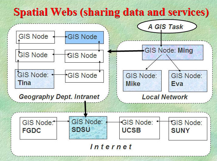
The Network of Geospatial Information
Spatial Webs (or Geospatial Cyberinfrastructure):
What is [Spatial Webs] ?
Spatial webs are geographically dispersed
information communities actively sharing geospatial data. (NCGIA, Specialist
Meeting report:
http://www.ncgia.ucsb.edu/projects/nga/docs/final_report.pdf )
The topics of spatial webs include data and service interoperability, distributed data sources, distributed services, data integration, spatial support, etc.
Discussion:
What are the differences between "Spatial Web" and the "World Wide Web"?
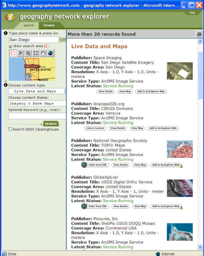
GeoData Network: ESRI Geography Network: http://www.geographynetwork.com/ (Retired in 2010). Replaced by the ArcGIS online.
Search for [San Diego], [New York] or [Tokyo].
New Version:
One State Data Portal in this web page (Geoplatform)( https://www.geoplatform.gov/resources
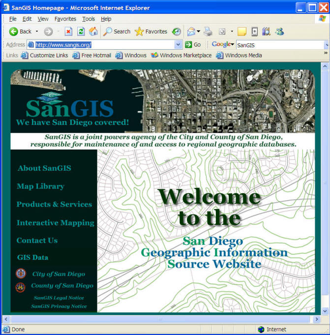
GIS Service Network:
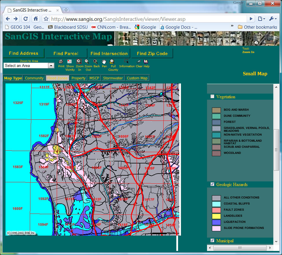
SANGIS http://www.sangis.org/
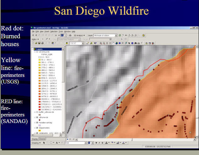
Buying a house in San Diego? Make sure to check if the house location is within any potential natural hazard zones.
Internet has dramatically changed GIS.
What kinds of new media are available on the Internet today?
Web Blogs (http://www.blogger.com/start .
YouTube (http://www.youtube.com/ .
Podcasting (http://en.wikipedia.org/wiki/Podcasting )
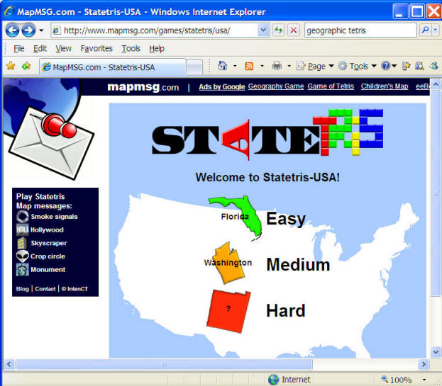
MAPMSG.com StateTRIS Game.
http://www.mapmsg.com/games/statetris/usa/
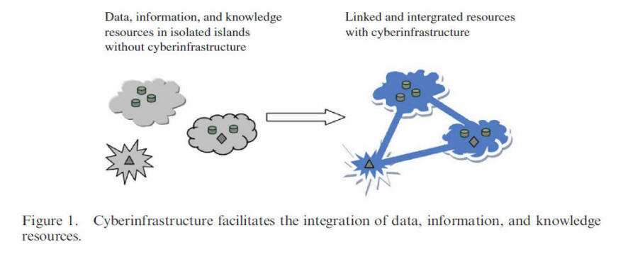
What is the term, "cyber-infrastructure"? http://en.wikipedia.org/wiki/Cyberinfrastructure
The term describes the new research environments that support advanced data acquisition, data storage, data management, data integration, data mining, data visualization and other computing and information processing services over the Internet. (definition from the Wikipedia).
Cyberinfrastructure is the coordinated aggregate of software, hardware and other technologies, as well as human expertise, required to support current and future discoveries in science and engineering. (Fran Berman, San Diego Supercomputer Center and UC San Diego, 2005. http://vis.sdsc.edu/sbe/ )
Geospatial cyberinfrastructure is a combination of distributed geographic information processing technology, high-performance computing (HPC) resources, interoperable Web services, and sharable geographic knowledge to facilitate th
e advancement of geographic information science (GIScience), geospatial technology, and geographic education.(Zhang, Tong and Tsou, Ming-Hsiang(2009)'Developing a grid-enabled spatial Web portal for Internet GIServices and geospatial cyberinfrastructure',International Journal of Geographical Information Science,23:5,605 — 630).
What is a Mash-up Web applications?
http://en.wikipedia.org/wiki/Mashup_(web_application_hybrid)
Mash-up is a key concept for Web 2.0. (What is Web 2.0?)
Web 2.0: Dynamic contents, user-generated contents, mashup, crowd-sourcing, service-oriented, web services, semantic web...
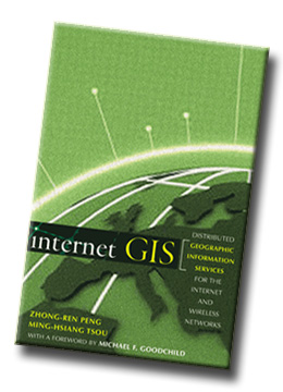
More information can be found at the book: Internet GIS.
"Internet GIS" Book Web site: Http://map.sdsu.edu/gisbook
Internet GIS: Distributed Geographic Information Services for the Internet and Wireless Networks, authored by Dr. Zhong-Ren Peng and Dr. Ming-Hsiang Tsou, introduces basic Internet GIS issues--such as the state of the art of technology and state of the practice of implementation, applications, and data, as well as the future trend of the Internet GIS--in preparation for using and getting the most out of newly available, off-the-shelf Internet GIS software packages.
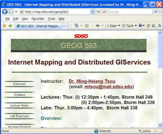
Link to GEOG 583 Internet Mapping and Distributed GIServices (every Spring semester, except 2008 Spring - sabbatical leave).
Internet GIS Applications
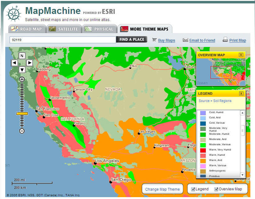
National Geographic Map Machine (http://www.nationalgeographic.com/maps/)
(old version here)
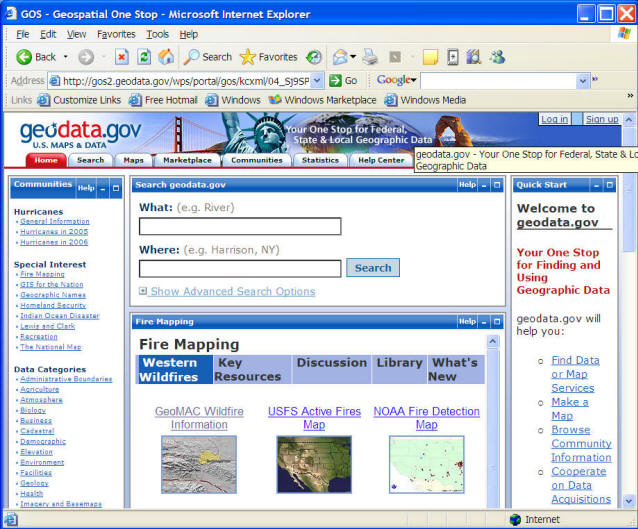
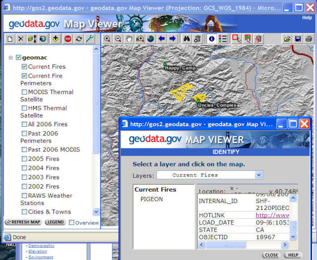
U.S. Federal Government GIS data portal (www.geodata.gov )
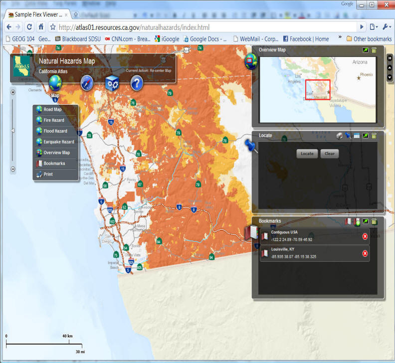
Web Mapping (The Cal-Atlas site )
(Nature Hazard Map). Flex Viewer with ArcGIS Server.
Unit 3.2
Georeference and Map Projection
(Show NASA video: The vision of future).
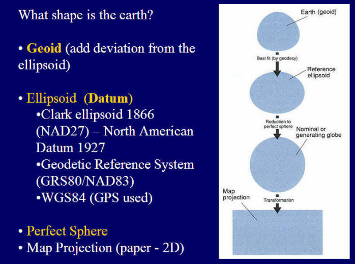
What is Georeferencing ?
Georeferencing is the process of specifying locations of objects on the Earth's surface by one or multiple reference methods. (This definition is modified from the textbook).
(example: locating your position now in this classroom. rows, columns)
Keywords: Locations, Objects, Reference methods.
Location information is very unique.
Objects refers to the natural or human phenomena.
Reference methods refer to a systematic framework of connecting two different systems (real world systems vs. mapping systems)
The requirements of a good geoferencing system:
Be unique. only one location associated with one given georeference. (example:.. Is [placename] a good georeference system? (WHY?). ... Try to type [Paris] in the Yahoo Maps. (old version)
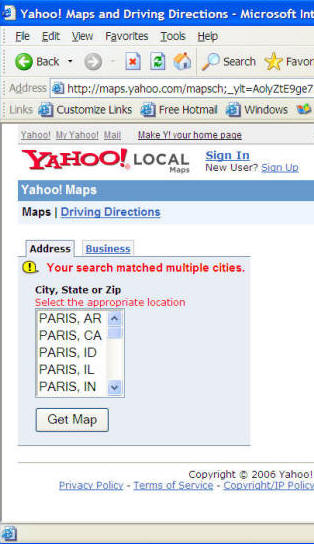
Or to the Wikipedia: http://en.wikipedia.org/wiki/Paris_(disambiguation)
Can be shared with others. (WHO? specific community? or everyone?) Examples: mailing address.
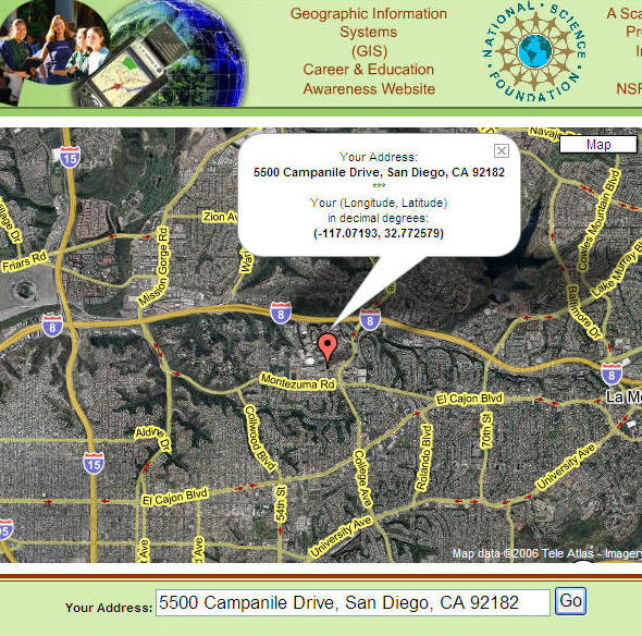
U.S. Mailing Address: 5500 Campanile Drive, San Diego, CA 92182-4493 (San Diego State University).
Chinese (Taiwan) Mailing Address: National Taiwan University. (Zip Code first, then City name, then Street name, then the numbers.)
(Taiwan).
Should not be changed frequently -- persistent through time. (School Districts, Zip Code, Telephone area code?)
Poway Unified School District Boundary might need to be changed .
Should rely on specific measurement frameworks;
(Lat/Long: degrees, minutes, seconds, UTM: meters, Postal Addresses: street blocks, building numbers).
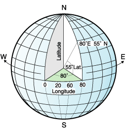
The Latitude/Longitude coordinate system
(image source: IBM on-line documents: http://publib.boulder.ibm.com/infocenter/db2luw/v8/index.jsp?topic=/com.ibm.db2.udb.doc/opt/csb3022a.htm)
Better to be metric. (Universal Transverse Mercator).
Different Systems of Georeferencing
Placename (fuzzy concepts)
Discussion: How can you tell a new friend where do you live? Where is your home town?
The postal system (more precise than “Placenames” system)
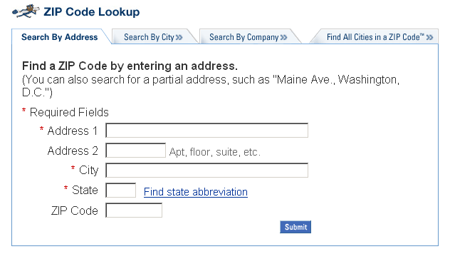
USPS ZIP Code Lookup (http://zip4.usps.com/zip4/welcome.jsp)
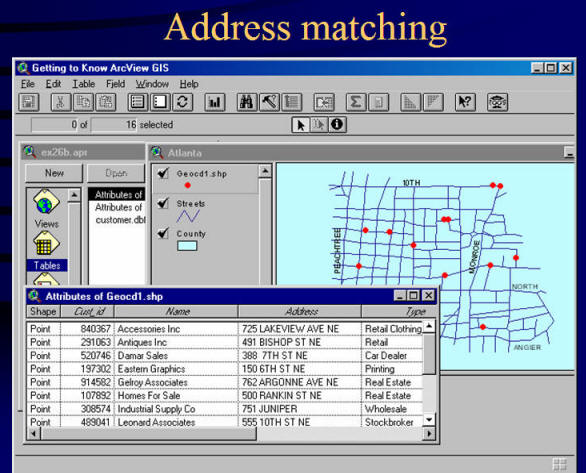
Linear referencing systems (used in the Address Matching functions)
e.g. AAA (American Automobile Association) maps with street numbers marked in the intersections.
Additional Info for Address Matching: http://www.uiowa.edu/~geog/health/address/locate.html (from the Geography Department, University of Iowa).
Latitude and Longitude
Advantages: high spatial resolutions
Several concepts:
l North/South pole;
l Equator;
l Prime Meridian;
l Latitude and Longitude;
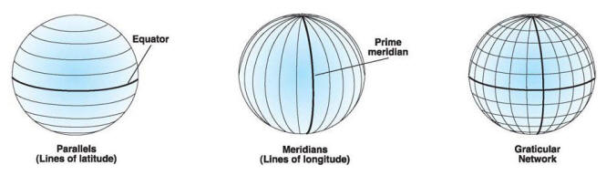
(image source: ESRI Documentation, Understanding Map Projections page 8.)
http://store.esri.com/esri/showdetl.cfm?SID=2&Product_ID=99&Category_ID=28
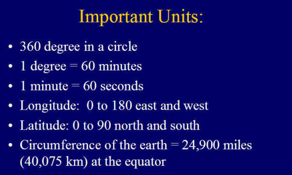
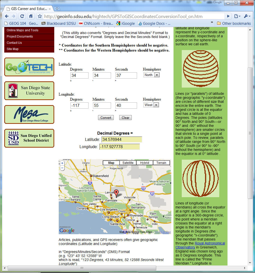
How to convert from a degree/minutes/second format to a decimal degree format?
130° 42' 30 '' W (West). = - 130.70833.
1. Convert the [seconds] to minutes: 30'' (seconds) = 30 / 60 = 0.5' (minute)
2. Add the value (0.5) back to the minutes (42). 42 + 0.5 = 42.5 (minutes)
3. Convert the [minutes] to [degree]: 42.5' (minutes) = 42.5 / 60 = 0.70833 (degree).
4. Add the result (0.70833) to the degree number (130): 130 + 0.70833 = 130.70833 (degree).
5. Since the longitude is West. The value of the decimal degree will be negative -->
130° 42' 30 '' W (West). = - 130.70833
Latitude: N (+), S (-), Longitude: E (+), W (-)
http://geoinfo.sdsu.edu/hightech/GPSToGISCoordinatesConversionTool_on.htm
(More map projection info can be found from the following link: http://www.colorado.edu/geography/gcraft/notes/mapproj/mapproj_f.html from the Geographer's Craft Project, Department of Geography, The University of Colorado at Boulder)
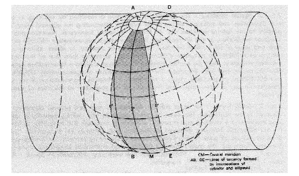
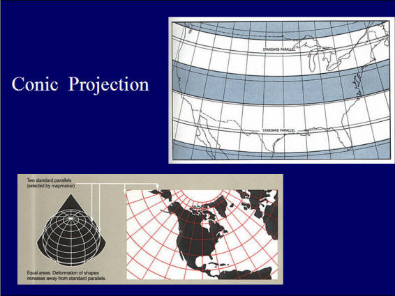
Three classes of projections in terms of the analogous physical models:
Cylindrical projections;
Conic projections;
Azimuthal/plannar projections;
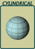


Examples:
Cylindrical Projection for the
Universal Transverse Mercator Grid (UTM) Coordinate system.
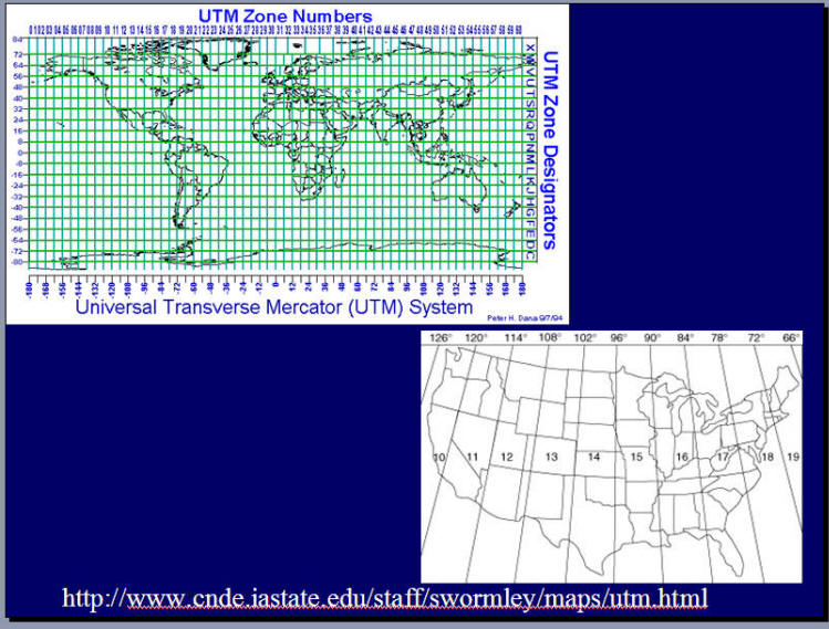
State Plane Coordinate System (SPCS).
"This coordinate system that divides all fifty states of the United States, Puerto Rico and the U.S. Virgin Islands into over 120 numbered zones. Each zone has an assigned code number that defines the projection parameters for the region." (source: http://gislounge.com/features/aa032700.shtml)
More information regarding the State Plane Coordinate System:
http://www.warnercnr.colostate.edu/class_info/nr502/lg3/datums_coordinates/spcs.html
Converting Georeference systems.
l Coordinate systems conversion:
From your local street address to Latitude/Longitude:
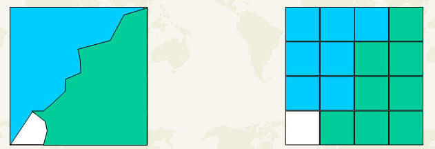
Data Uncertainty
What is Data Uncertainty? What is Data Accuracy?
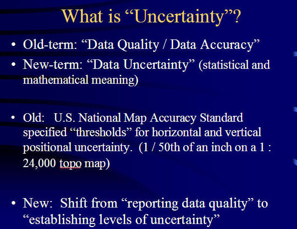
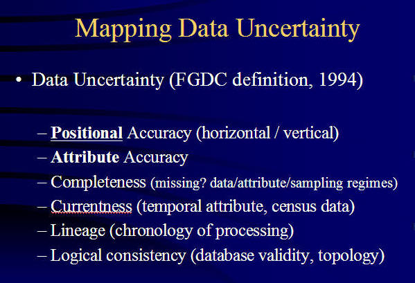
Measurement and representation uncertainty
l “Mixed” problem (What kinds of data formats? In these pictures?)
How to represent [Uncertainty]? Probability
Probability: (from statistics explanation)
Gambling (Throw a Dice --- How likely to get #6 ?)
Weather (Raining or not?)
On-line Tools: http://www.shodor.org/interactivate/activities/ExpProbability/?version=1.4.2_06&browser=MSIE&vendor=Sun_Microsystems_Inc.
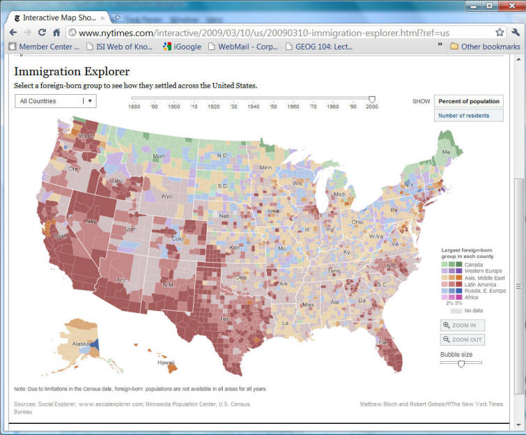
Web Mapping Example: NY Times Immigration maps. (Temporal and Spatial Chainges).
http://www.nytimes.com/interactive/2009/03/10/us/20090310-immigration-explorer.html?ref=us
Unit-3 Discussion:
1. Please find out one downloadable GIS DATA from One State Data Portal in this web page (Geoplatform)( https://www.geoplatform.gov/resources ) and tell us the URL of the data link. Why this downloadable GIS DATA link become one part of [Spatial Web]? Who will be interested in using this data?
2. Please choose ONE map projection from the following websites or other resources, and then explain the characteristics of your selected projection (equal area? conformal? or equal distance). (Please also post the URL link to the selected projection map).
![]()
![]()
![]()
This web site is hosted on MAP.SDSU.EDU
and Geography Department.
|
|