|
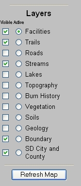
Legend/Layer List |
Toggles between
display of map legend or map layer list. |
 |
Overview Map |
Toggles overview map
display on or off. |
 |
Zoom In |
Click on a location
or click and drag the mouse to draw a box to zoom in. |
 |
Zoom Out |
Click on a location
or click and drag the mouse to draw a box to zoom out. |
 |
Zoom to Full Extent |
Reverts back to
display initial map extent. |
 |
Zoom to Active Layer |
Zooms to full extent
of the active map layer. |
 |
Back to Last Extent |
Reverts back to
display the previously selected map extent. |
 |
Pan |
Pan the map display
in any direction by dragging it. |
 |
Pan North |
Pans the map display
north. |
 |
Pan South |
Pans the map display
south. |
 |
Pan West |
Pans the map display
west. |
 |
Pan East |
Pans the map display
east. |
 |
Identify |
Click on a feature to
get attribute information. |
 |
Query |
Opens a popup dialog
box to enable boolean queries to be run on the map data. |
 |
Find |
Opens a dialog box to
enable searching of names or attributes in the active map
layer. |
 |
Measure |
Use the mouse to draw
a line or series of lines. The length of each segment and
the total distance are displayed in dialog boxes in the map
window. |
 |
Set Units |
Opens a dialog box to
allow changing of map units and display units. |
 |
Buffer |
Enables buffering of
a selected line or polygon. |
 |
Select by Rectangle |
Select map area or
feature by rectangle. |
 |
Select by
Line/Polygon |
Select map area or
feature by using the mouse to draw a line or polygon. |
 |
Clear Selection |
Clears any previous
selection. |
 |
Locate Address |
Opens a popup window
with a dialog boxes to enable location of addresses by
street, zipcode or cross streets. This function is only
available for mapservices with geocoded street files. |
 |
Print |
The print button creates a map for printing or saving to
disk which opens in a new browser window and can be printed
or saved using the browser's File menu. |