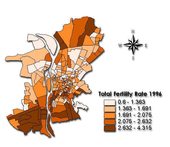


ArcView is one of the widely used tools by Geographic Information Systems(GIS) to support the management of spatial Information and various mapping facilities. One such activity is thematic mapping, which shows below, presenting spatially referenced demographic data on maps. While the maps build by this system are not confined to the static pictures, this system offers interactive tools to manipulate the presentations in order to make them more impressive and to create more beneficial conditions for revealing significant relationships and demographic patterns, the example showing above features the 3D dynamic model, representing the spatially referenced 2D mapping.