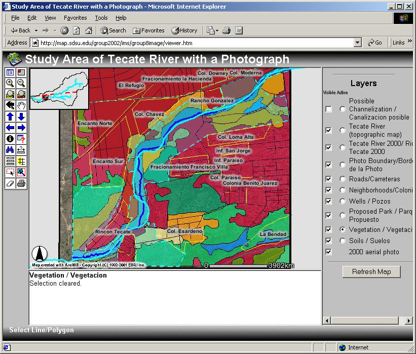
Help for the Image Server
On the right side of the viewer are layers which can be turned on or off by clicking in the square box. Then click on "Refresh Map".
The circle box turns the layer "active" which means you can play in the "tool bar"
The first button on the left displays all visible legend classes
The second through 5th rows allow you to move around on the map
The "I" button lets you identify active layers contents
The "?" button lets you ask for specific items in a Boolean way (ie roads=boulevard, add to query, excecute)
The ruler tool lets you measure distances (in meters)
The printer button creates a nice "layout"