|
|
|
|
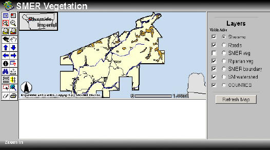
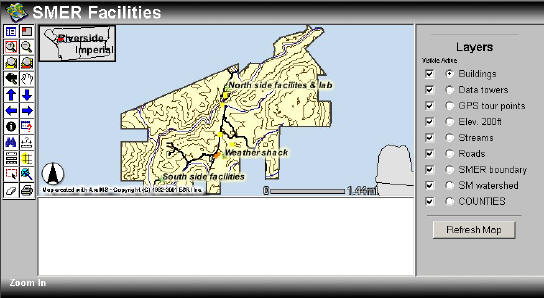
Santa Margarita Ecological Reserve Internet Maps
Select image to open interactive HTML viewer.
Data sources: County of Riverside GIS, Harvard University, SANDAG, San GIS, SDSU Field Stations, UC Santa Barbara
Select image to open interactive HTML viewer.
Data sources: County of Riverside GIS, Harvard University, SANDAG, San GIS, SDSU Field Stations, SDSU Geography Department, UC Santa Barbara, USGS
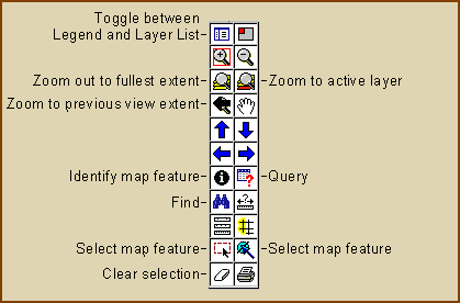
EXPLANATIONS of Commonly Used Button Tools
Try the Identify tool: make a map layer "Active" then click on a map feature to get information on that feature. When making map layers visible or invisible, please click "Refresh Map" to view changes. |
|
Send mail to
jiles@rohan.sdsu.edu with
questions or comments about this web site.
|