
Internet Mapping and Distributed GIServices (GEOG 583)
![]()
![]()
![]()
|
Internet Mapping and Distributed GIServices (GEOG 583)
|
|
|
2001, 2002 Student Group Project Showcase �@
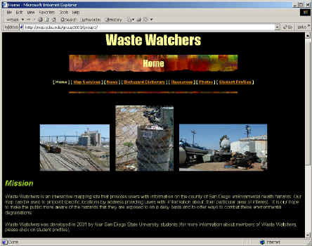
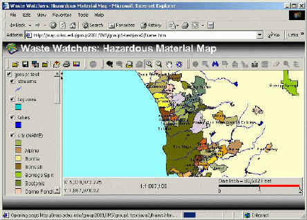
2001 Spring Student Group Projects: �@ Group One: Jason Thacker, Jason Casta�eda, Carina Garret, Brian Weller. http://map.sdsu.edu/group2001/group1/ Waste Watchers is an environmental health Web site that contains information on hazardous materials and their adverse effects on human health. The site focuses on San Diego County and includes photos, definitions, links, news, and three ArcIMS interactive maps displaying hazardous material sites within San Diego County.
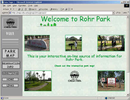
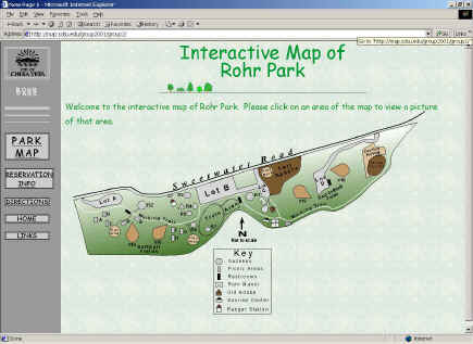
�@ Group Two: Reed Thornberry, Chad Cronk, Keirsten Hess. http://map.sdsu.edu/group2001/group2/ Rohr Park is located in the City of Chula Vista, California. It is owned, operated, and maintained by the Parks and Recreation Department of the City. This project created a visual format that would encompass all the many recreational activities offered there, as well as gives residents the information they need to plan their next event or outing. �@
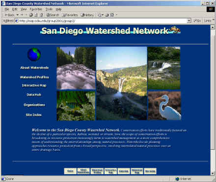
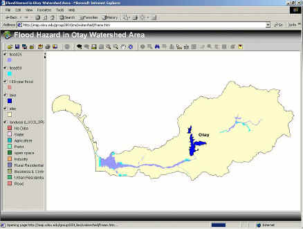
�@ Group Three: Mettja Hong, Liang Guo http://map.sdsu.edu/group2001/group3/ San Diego Watershed Network was designed to be a comprehensive and informative San Diego County Watershed website. This project create a one-stop information network where the users could not only locate geospatial data about all of the watersheds within SD county, but also information about the various organization involved with these watersheds.
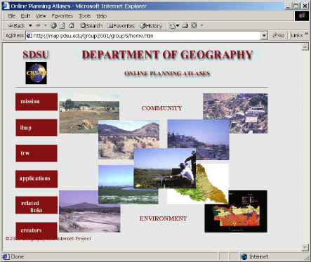
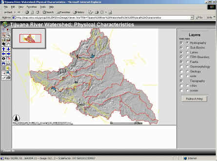
�@ Group Five: Adrienne Perry and Kate Wells http://map.sdsu.edu/group2001/group5/home.htm Online Planning Atlases: The International Border Area Planning Atlas (IBAP) and The Tijuana River Watershed (TRW) Atlas. The San Diego State University Department of Geography participates in many projects related to the transborder region shared between San Diego County, California and Baja California, Mexico. Two of these projects involve publishing atlases that focus on this region. These atlas projects are carried out in cooperation with other departments at SDSU as well as other universities and government agencies on both sides of the border.
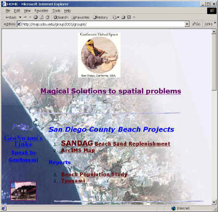
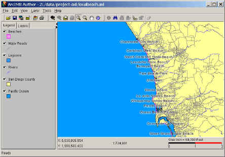
�@ Group Six: John Ryan, Bonny Hinshaw, Abdur Shoyeb http://map.sdsu.edu/group2001/group6/ Beaches of San Diego County: A pilot study for the Near Shore Environment. This project seeks to explore the functionality of using Internet mapping, in conjunction with standard web design, to enhance the user understanding of the near shore environment.
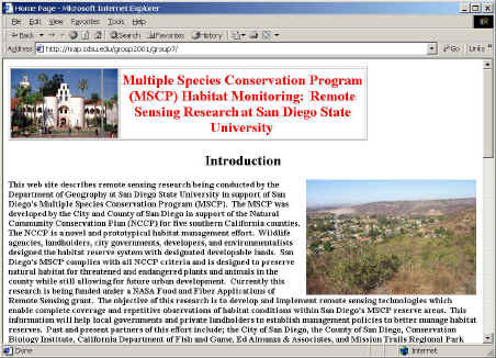
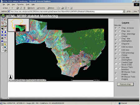
�@ Group Seven: http://map.sdsu.edu/group2001/group7/ MSCP Habitat Monitoring. This goal of this project is to create the Internet mapping facilities for remote sensing data and describes remote sensing research being conducted by the Department of Geography at San Diego State University in support of San Diego's Multiple Species Conservation Program (MSCP). The MSCP was developed by the City and County of San Diego in support of the Natural Community Conservation Plan (NCCP) for five southern California counties. This information will help local governments and private landholders to establish management policies to better manage habitat reserves.
�@
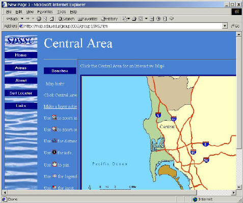
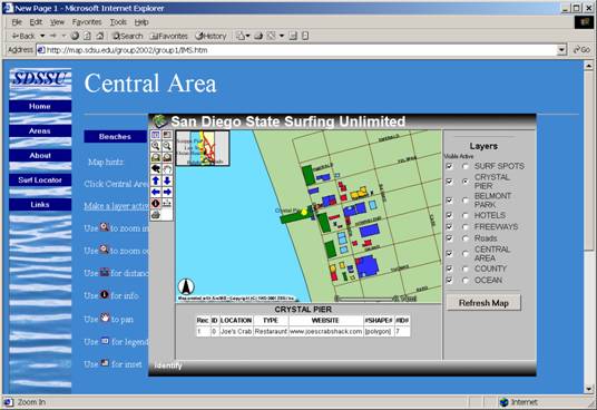
2002 Spring Student Group Projects: �@ Group One: Chad Kane, Tim Huntley, Matthias Monreal, Kevin Wilson http://map.sdsu.edu/group2002/group1/ San Diego State Surfing Unlimited (SDSSU). This page is devoted to helping surfers and tourists find information about beaches and surf spots in San Diego County.
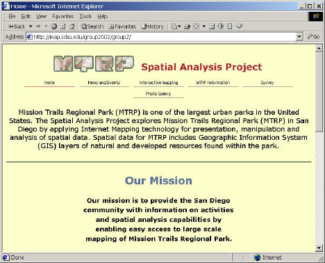
�@ Group Two: Elena Gantcheva, Rasmus Larsen, Jennifer Paluch http://map.sdsu.edu/group2002/group2/ MTRP Spatial Analysis Project. Mission Trails Regional Park (MTRP) is one of the largest urban parks in the United States. The Spatial Analysis Project explores Mission Trails Regional Park (MTRP) in San Diego by applying Internet Mapping technology for presentation, manipulation and analysis of spatial data. Spatial data for MTRP includes Geographic Information System (GIS) layers of natural and developed resources found within the park. �@
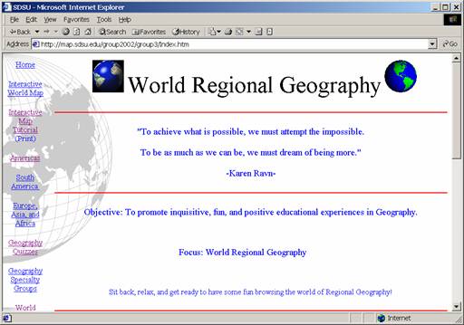
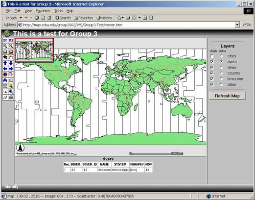
�@ Group Three: L. Makey, K. Hennequin, S. Robb, D. Ward http://map.sdsu.edu/group2002/group3/ World Regional Geography: To promote inquisitive, fun, and positive educational experiences in Geography. Focus: World Regional Geography.
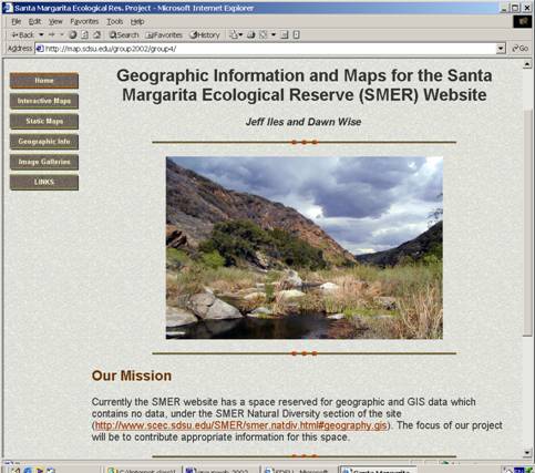
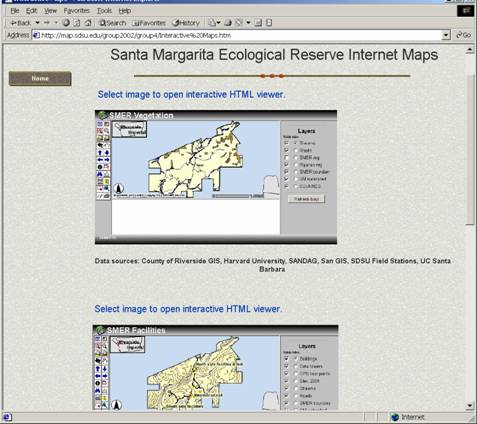
�@ Group Four: Jeff Iles, Dawn Wise http://map.sdsu.edu/group2002/group4/ SMER Website: Currently the SMER website has a space reserved for geographic and GIS data which contains no data, under the SMER Natural Diversity section of the site (http://www.scec.sdsu.edu/SMER/smer.natdiv.html#geography.gis). The focus of our project will be to contribute appropriate information for this space.
�@ Group Five: Maider Veschembes, Amy Slater http://map.sdsu.edu/group2002/group5/ SD Open Space Preserves: The Open Space Management and Park Program Services Division manages open space preserves, including their natural and cultural resources, with protection as a first priority, while providing opportunities for positive environmental education and outdoor recreational experiences for the citizens of San Diego County.
�@ Group Six: Hiram Fowler, Susmita Panchal, Tohru Nakaya, Yuying Li http://map.sdsu.edu/group2002/group6/ Storm Water Monitor: This website is dedicated to involving citizens in the prevention of sediment pollution from San Diego's construction sites. To achieve this, our site demonstrates the potential utility of web-based mapping in the monitoring of erosion and erosion control plans at construction sites around San Diego
�@ Group Seven: Rob Bergstrom, Lael Hoff http://map.sdsu.edu/group2002/group7/ A Surf's Health and Environmental Service (ASHES) aims to provide valuable information regarding water quality data, surf and weather conditions, as well as general information about San Diego's coastal region. A.S.H.E.S also provides an interactive map with water quality data for San Diego's beaches, as well as a static map which will link you to beach information such as location, parking, and hours of operation. Visit our site for quick info about the San Diego beach you wish to visit.
�@ Group Eight: Katie Comer, Susie Pike Humphrey, Alyssa Tugend http://map.sdsu.edu/group2002/group8/ Urban River Planning Tools Using Internet Mapping: A Case Study with the Tecate River This website was developed to provide information and planning tools for a small section of land along the Tecate River (Tecate Creek) in Mexico. The study area is located within the Tijuana River Watershed along the U.S. - Mexico border and is part of a larger proposed urban river project. Other plans call for channelization of the creek to decrease flooding. This website includes interactive maps, static maps and relevant information about the region that you can use to explore alternative land-use options.
|
|
hosted at MAP.SDSU.EDU ,
Department of Geography, SDSU.
|